MyTopo
Readfield Maine US Topo Map
Couldn't load pickup availability
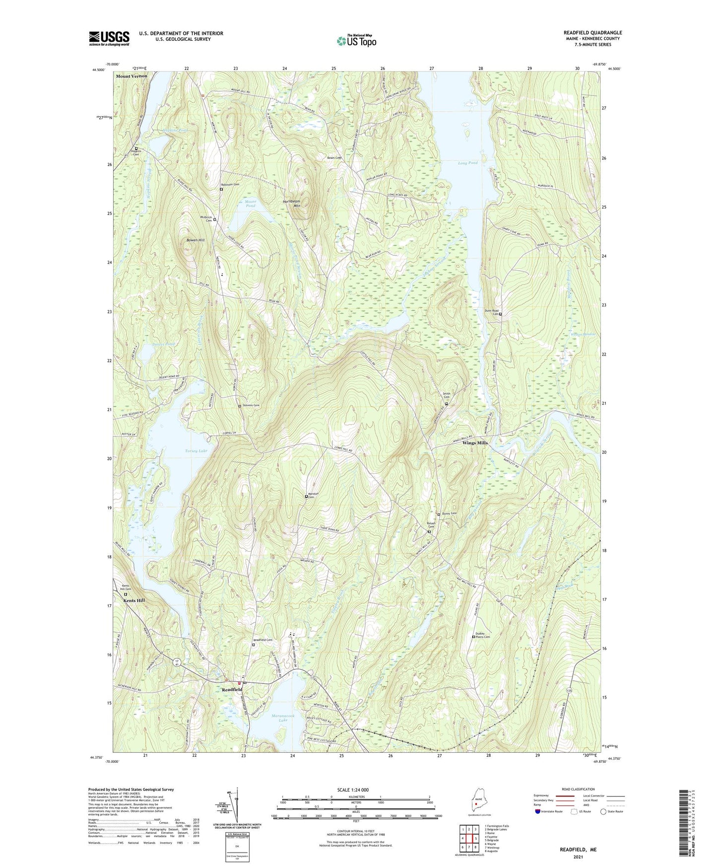
2024 topographic map quadrangle Readfield in the state of Maine. Scale: 1:24000. Based on the newly updated USGS 7.5' US Topo map series, this map is in the following counties: Kennebec. The map contains contour data, water features, and other items you are used to seeing on USGS maps, but also has updated roads and other features. This is the next generation of topographic maps. Printed on high-quality waterproof paper with UV fade-resistant inks.
Quads adjacent to this one:
West: Fayette
Northwest: Farmington Falls
North: Belgrade Lakes
Northeast: Rome
East: Belgrade
Southeast: Augusta
South: Winthrop
Southwest: Wayne
This map covers the same area as the classic USGS quad with code o44069d8.
Contains the following named places: Beam Cemetery, Bog Stream, Bowen Hill, Desert Pond, Dudley Plains Cemetery, Dunns Cemetery, Dunns Corners, Green Island, Grist Mill Pond, Grist Mill Pond Dam, Hopkins Cemetery, Hopkins Pond, Hornbeam Mountain, Ingham Stream, Inghan Pond, Intervale Brook, Kents Hill Cemetery, Locks Corner, Long Pond Storage Dam, Maranacook Community High School, Maranacook Community Middle School, Marston Cemetery, Meadow Brook, Minnehonk Lake, Moose Pond, Moose Pond Stream, Mount Vernon Elementary School, Philbrick Cemetery, Potash Cemetery, Readfield, Readfield Cemetery, Readfield Community Library, Readfield Depot, Readfield Fire Department, Readfield Post Office, Robinson Cemetery, Seven G's Seaplane Base, Smith Cemetery, Stevens Cemetery, Tingley Brook, Torsey Lake, Torsey Lake Dam, Town of Mount Vernon, Town of Readfield, WABK-FM (Gardiner), Weston Meadow, Wings Mills, ZIP Codes: 04352, 04355