MyTopo
Vassalboro Maine US Topo Map
Couldn't load pickup availability
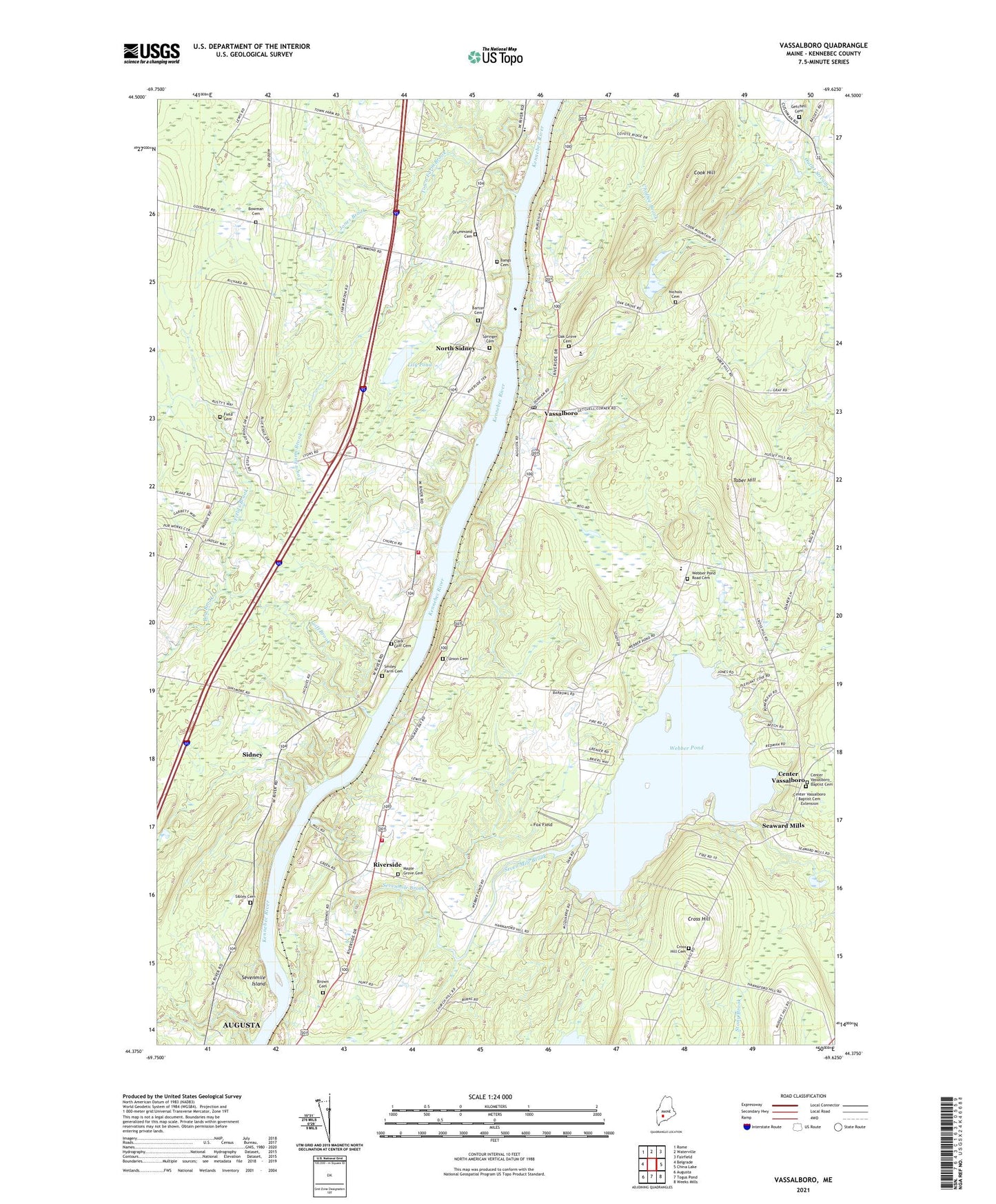
2024 topographic map quadrangle Vassalboro in the state of Maine. Scale: 1:24000. Based on the newly updated USGS 7.5' US Topo map series, this map is in the following counties: Kennebec. The map contains contour data, water features, and other items you are used to seeing on USGS maps, but also has updated roads and other features. This is the next generation of topographic maps. Printed on high-quality waterproof paper with UV fade-resistant inks.
Quads adjacent to this one:
West: Belgrade
Northwest: Rome
North: Waterville
Northeast: Fairfield
East: China Lake
Southeast: Weeks Mills
South: Togus Pond
Southwest: Augusta
This map covers the same area as the classic USGS quad with code o44069d6.
Contains the following named places: Bog Brook, Bowman Cemetery, Brown Cemetery, Center Vassalboro, Center Vassalboro Baptist Cemetery, Center Vassalboro Baptist Cemetery Extension, Clark - Goff Cemetery, Cook Hill, Cross Hill, Cross Hill Cemetery, Field Cemetery, Fields Brook, Fox Field, Getchell Cemetery, Getchell Corner, Goff Brook, Green Valley Park, James H Bean Elementary School, Jones Brook, Lily Pond, Longfellow School, Maine Criminal Justice Academy, Maple Grove Cemetery, McCoy Crossing, NFI Sidney River Bend School, Nichols Cemetery, North Sidney, Oak Grove Cemetery, Oak Grove-Coburn School, Riverside, Seaward Mills, Seven Mile Brook, Seven Mile Brook Dam, Sevenmile Brook, Sevenmile Island, Sibley Cemetery, Sidney, Sidney Center, Sidney Fire Department, Sidney Fire Department Engine Company 6, Springer Cemetery, Taber Hill, Thayer Corner School, Town Farm Brook, Town of Vassalboro, Union Cemetery, Vassalboro, Vassalboro Community School, Vassalboro Fire Department Riverside Station, Webber Pond, Webber Pond Dam, Webber Pond Road Cemetery, WJBI-FM (Winslow), WMEW-FM (Waterville), ZIP Codes: 04962, 04989