MyTopo
Schoodic Head Maine US Topo Map
Couldn't load pickup availability
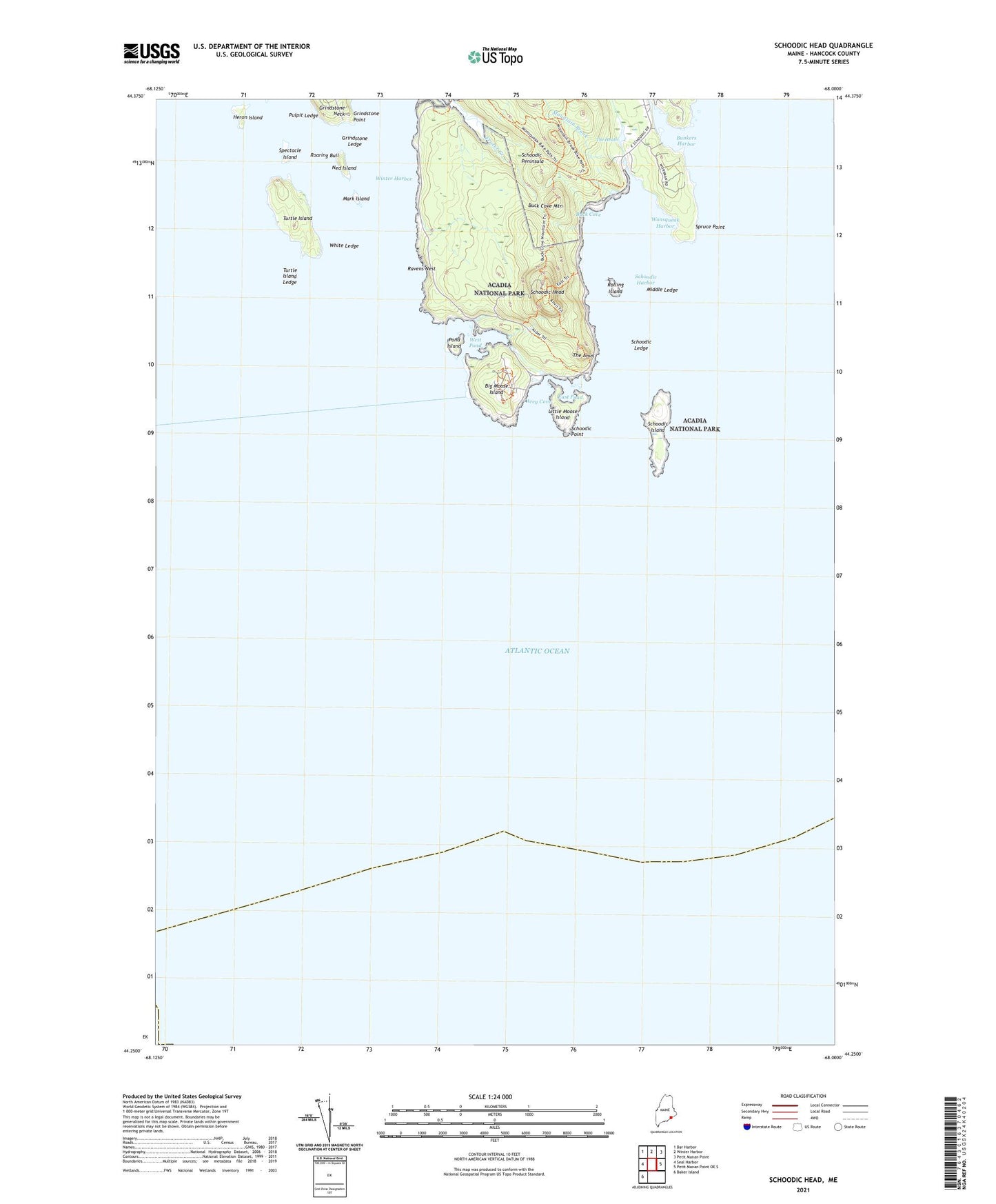
2024 topographic map quadrangle Schoodic Head in the state of Maine. Scale: 1:24000. Based on the newly updated USGS 7.5' US Topo map series, this map is in the following counties: Hancock. The map contains contour data, water features, and other items you are used to seeing on USGS maps, but also has updated roads and other features. This is the next generation of topographic maps. Printed on high-quality waterproof paper with UV fade-resistant inks.
Quads adjacent to this one:
West: Seal Harbor
Northwest: Bar Harbor
North: Winter Harbor
Northeast: Petit Manan Point
East: Petit Manan Point OE S
Southwest: Baker Island
This map covers the same area as the classic USGS quad with code o44068c1.
Contains the following named places: Alder Path Trail, Arey Cove, Big Moose Island, Buck Cove, Buck Cove Mountain, Bunkers Harbor, East Pond, Frazer Creek, Grindstone Ledge, Grindstone Point, Heron Island, Little Moose Island, Mark Island, Middle Ledge, Mountain Brook, Ned Island, Old Woman, Pond Island, Pulpit Ledge, Ravens Nest, Roaring Bull, Rolling Island, Schoodic Harbor, Schoodic Head, Schoodic Head Trail, Schoodic Island, Schoodic Ledge, Schoodic Peninsula, Schoodic Point, Spectacle Island, Spruce Point, The Anvil, The Anvil Trail, The Heath, Town of Winter Harbor, Turtle Island, Turtle Island Ledge, West Pond, White Ledge, Winter Harbor, Winter Harbor Light, Wonsqueak Harbor