MyTopo
Winter Harbor Maine US Topo Map
Couldn't load pickup availability
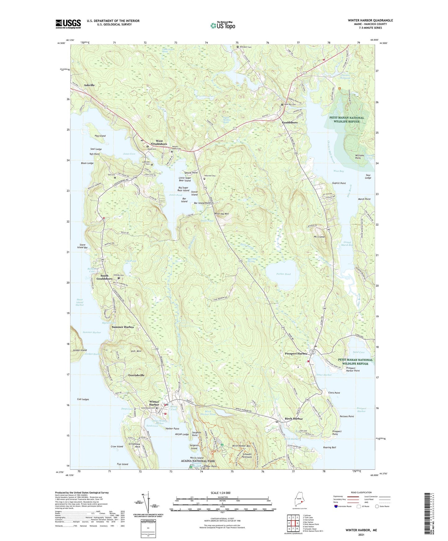
2024 topographic map quadrangle Winter Harbor in the state of Maine. Scale: 1:24000. Based on the newly updated USGS 7.5' US Topo map series, this map is in the following counties: Hancock. The map contains contour data, water features, and other items you are used to seeing on USGS maps, but also has updated roads and other features. This is the next generation of topographic maps. Printed on high-quality waterproof paper with UV fade-resistant inks.
Quads adjacent to this one:
West: Bar Harbor
Northwest: Sullivan
North: Tunk Lake
Northeast: Cherryfield
East: Petit Manan Point
Southeast: Petit Manan Point OE S
South: Schoodic Head
Southwest: Seal Harbor
This map covers the same area as the classic USGS quad with code o44068d1.
Contains the following named places: Abijah Ledge, Ash Mountain, Ashville, Bar Island, Bar Island Point, Bartlett Maine Estate Winery, Big Chief Spring, Big Sugar Bear Island, Birch Harbor, Birch Harbor Mountain, Birch Harbor Pond, Birch Harbor Post Office, Black Ledge, Bunkers Cove, Chicken Mill Stream, Chicken Millpond, Clark Point, Cod Ledges, Crow Island, Deep Cove, Dike Brook, Dingle Meadow Heath, Dorcas Library, Flat Island, Forbes Pond, Frazer Point, Frazer Point Picnic Area, Gerrishville, Gouldsboro, Gouldsboro Fire Department Station 1, Gouldsboro Fire Department Station 2, Gouldsboro Fire Department Station 3, Gouldsboro Grammar School, Gouldsboro Police Department, Gouldsboro Post Office, Gouldsboro United Methodist Church, Grand Marsh Bay, Grindstone Neck, Grindstone Neck Golf Course, Guptill Point, Harbor Point, Henry Cove, Hillcrest Cemetery, Hillside Cemetery, Hog Island, Inner Harbor, Inner Winter Harbor, Jones Cove, Jones Pond, Jones Pond Dam, Jordan Harbor, Lakeview Cemetery, Libby Brook, Lily Pond, Little Pond, Little Sugar Bear Island, Lower West Bay Pond, Lower West Bay Pond Dam, Marsh Point, Mill Stream, Mosquito Harbor, Mount Cromer, Myrick Cove, Nahum Jones Cemetery, Nails Brook, Norris Island, Peninsula School, Pettees Point, Prospect Harbor, Prospect Harbor Light Station, Prospect Harbor Point, Prospect Harbor Post Office, Prospect Harbor United Methodist Church, Prospect Point, Roaring Bull, Sand Cove, Sargents Island, Sargents Point, Seal Ledge, South Gouldsboro, Spruce Point, Stave Island Bar, Stover Island, Summer Harbor, Taft Cemetery, Taft Point, Timber Cove, Town of Gouldsboro, West Bay Cemetery, West Gouldsboro, West Gouldsboro Union Church, Whitaker Cemetery, Willisms Point, Winn Joy Mountain, Winter Harbor, Winter Harbor Census Designated Place, Winter Harbor Fire Department, Winter Harbor Grammar School, Winter Harbor Historical Society Building, Winter Harbor Marina, Winter Harbor Police Department, Winter Harbor Post Office, Winter Harbor Public Library, Winter Harbor Yacht Club, Wood Cemetery, ZIP Codes: 04607, 04613, 04669, 04693