MyTopo
Sebec Lake West Maine US Topo Map
Couldn't load pickup availability
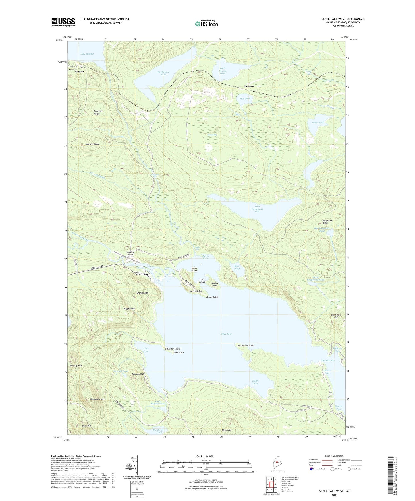
2021 topographic map quadrangle Sebec Lake West in the state of Maine. Scale: 1:24000. Based on the newly updated USGS 7.5' US Topo map series, this map is in the following counties: Piscataquis. The map contains contour data, water features, and other items you are used to seeing on USGS maps, but also has updated roads and other features. This is the next generation of topographic maps. Printed on high-quality waterproof paper with UV fade-resistant inks.
Quads adjacent to this one:
West: Monson East
Northwest: Barren Mountain West
North: Barren Mountain East
Northeast: Silver Lake
East: Sebec Lake East
Southeast: Dover-Foxcroft
South: Sangerville
Southwest: Guilford
Contains the following named places: Bear Pond, Ben Chase Hill, Bennett Brook, Benson, Benson Brook, Big Bennett Pond, Big Bennett Pond Outlet, Big Bennett Pond Outlet Dam, Big Benson Pond, Big Grapevine Pond, Big Wilson Stream, Bucks Cove, Bucks Falls, Buttermilk Brook, Chicken Cove, Cowyard Falls, Crockett Brook, Crockett Ridge, Deer Hill, Deer Point, Duck Pond, Earley Landing, First Buttermilk Pond, Garcock Hill, Garcock Pond, Gibralter Ledge, Granite Mountain, Grapevine Ridge, Grapevine Stream, Green Point, Grindstone Brook, Hampshire Mountain, Hedgehog Mountain, House Bog, Ice Cave Brook, Johnson Brook, Johnson Ridge, Jordan Island, Little Bennett Pond, Little Benson Pond, Little Grapevine Pond, Mud Pond, Norton Cove, Onawa, Packard Landing, Peaks-Kenny State Park, Ragged Mountain, Salmon Stream, Sebec Lake, Second Buttermilk Pond, Seymour Cove, Ship Pond Stream, South Cove, South Cove Point, Stork Island, Stubb Island, The Narrows, Tims Cove, Town of Bowerbank, Two Falls Airport