MyTopo
Barren Mountain West Maine US Topo Map
Couldn't load pickup availability
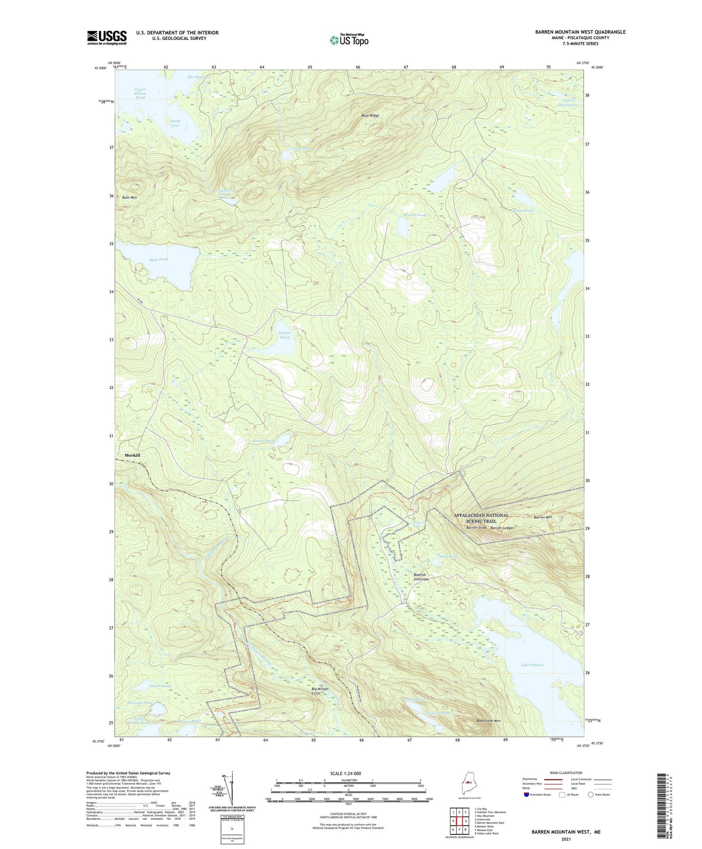
2024 topographic map quadrangle Barren Mountain West in the state of Maine. Scale: 1:24000. Based on the newly updated USGS 7.5' US Topo map series, this map is in the following counties: Piscataquis. The map contains contour data, water features, and other items you are used to seeing on USGS maps, but also has updated roads and other features. This is the next generation of topographic maps. Printed on high-quality waterproof paper with UV fade-resistant inks.
Quads adjacent to this one:
West: Greenville
Northwest: Lily Bay
North: Number Four Mountain
Northeast: Hay Mountain
East: Barren Mountain East
Southeast: Sebec Lake West
South: Monson East
Southwest: Monson West
This map covers the same area as the classic USGS quad with code o45069d4.
Contains the following named places: Barren Ledges, Barren Slide, Big Wilson Cliffs, Blue Ridge, Boarstone Mountain, Bodfish Intervale, Brown Pond, Camp Twelve, Cranberry Brook, Cranberry Pond, Hedgehog Pond, Indian Pond, Indian Stream, Little Wilson Pond, Little Wilson Stream, Long Pond, Long Pond Stream, Midday Pond, Mink Brook, Moose Pond, Morkill, Notch Pond, Otter Pond, Plantation of Elliottsville, Prescott Pond, Rum Pond, Saint Regis Depot Camp, Secret Brook, Secret Pond, Slugundy Falls, Smith Pond, South Cove, Sunrise Pond, Sunset Pond, The Narrows, Thompson Brook, Trout Brook, Trout Pond, Upper Deadwater, Vaughn Stream, West Branch Thompson Brook, Wilber Brook, Wilder Brook