MyTopo
Silver Lake Maine US Topo Map
Couldn't load pickup availability
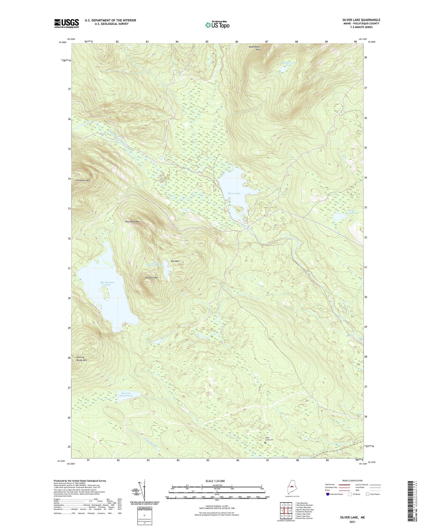
2021 topographic map quadrangle Silver Lake in the state of Maine. Scale: 1:24000. Based on the newly updated USGS 7.5' US Topo map series, this map is in the following counties: Piscataquis. The map contains contour data, water features, and other items you are used to seeing on USGS maps, but also has updated roads and other features. This is the next generation of topographic maps. Printed on high-quality waterproof paper with UV fade-resistant inks.
Quads adjacent to this one:
West: Barren Mountain East
Northwest: Hay Mountain
North: Big Shanty Mountain
Northeast: Jo-Mary Mountain
East: Ebeemee Mountain
Southeast: Brownville Junction
South: Sebec Lake East
Southwest: Sebec Lake West
Contains the following named places: Arnold Camps, Auburn Log Hauling Road, Big Houston Pond, Big White Brook, Houston Brook, Houston Mountain, Indian Stream, Katahdin Iron Works, Katahdin Iron Works Historic Site, Katahdin Iron Works Township, Little Houston Pond, Ore Mountain, Page Brook, Pine Camp, Roaring Brook Pond, Roundtop Mountain, Saddlerock Brook, Saddlerock Pond, Silver Lake, Spruce Mountain Brook, Sucker Brook, Sucker Brook Pond, White Brook