MyTopo
Jo-Mary Mountain Maine US Topo Map
Couldn't load pickup availability
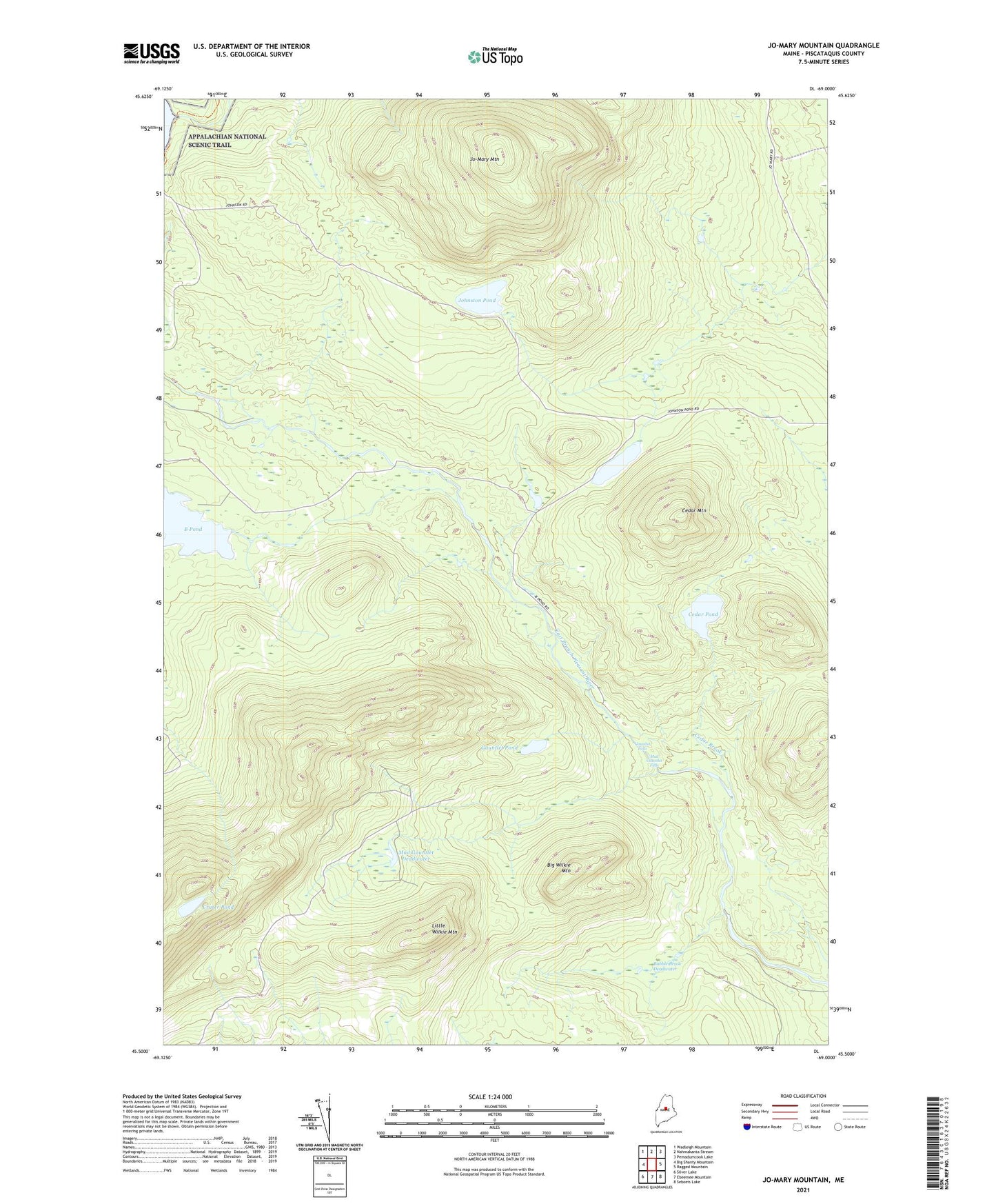
2024 topographic map quadrangle Jo-Mary Mountain in the state of Maine. Scale: 1:24000. Based on the newly updated USGS 7.5' US Topo map series, this map is in the following counties: Piscataquis. The map contains contour data, water features, and other items you are used to seeing on USGS maps, but also has updated roads and other features. This is the next generation of topographic maps. Printed on high-quality waterproof paper with UV fade-resistant inks.
Quads adjacent to this one:
West: Big Shanty Mountain
Northwest: Wadleigh Mountain
North: Nahmakanta Stream
Northeast: Pemadumcook Lake
East: Ragged Mountain
Southeast: Seboeis Lake
South: Ebeemee Mountain
Southwest: Silver Lake
This map covers the same area as the classic USGS quad with code o45069e1.
Contains the following named places: Babble Brook, Babble Brook Deadwater, Big Wilkie Mountain, Brice Brook, Cedar Brook, Cedar Mountain, Cedar Pond, Crater Pond, Gauntlet Brook, Gauntlet Falls, Gauntlet Pond, Guernsey Brook, Johnston Pond, Jo-Mary Mountain, Jo-Mary Pond, Little Wilkie Mountain, Mud Gauntlet Brook, Mud Gauntlet Deadwater, Mud Gauntlet Falls, TB R10 WELS, Trestle Brook