MyTopo
King And Bartlett Lake Maine US Topo Map
Couldn't load pickup availability
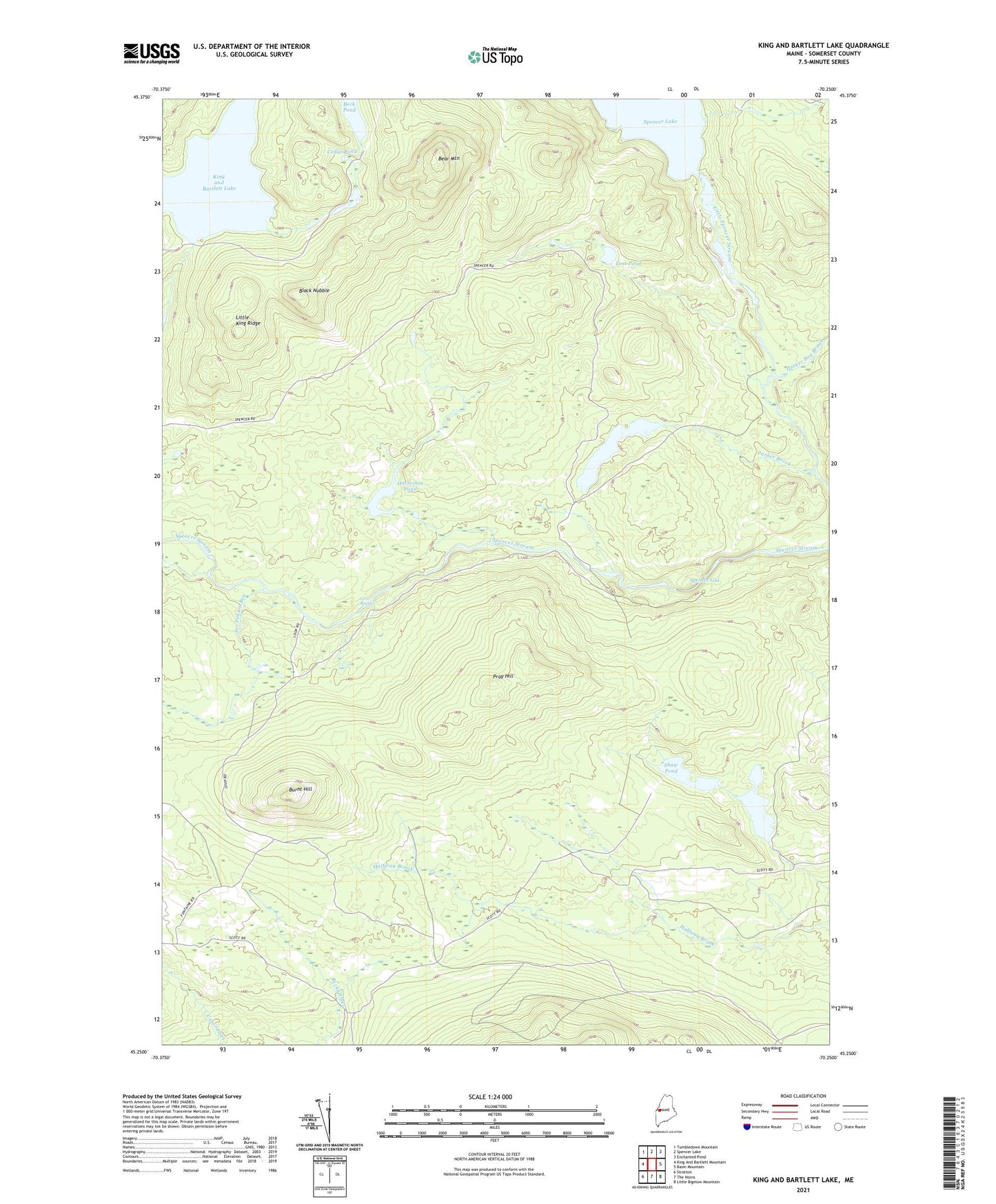
2024 topographic map quadrangle King And Bartlett Lake in the state of Maine. Scale: 1:24000. Based on the newly updated USGS 7.5' US Topo map series, this map is in the following counties: Somerset. The map contains contour data, water features, and other items you are used to seeing on USGS maps, but also has updated roads and other features. This is the next generation of topographic maps. Printed on high-quality waterproof paper with UV fade-resistant inks.
Quads adjacent to this one:
West: King And Bartlett Mountain
Northwest: Tumbledown Mountain
North: Spencer Lake
Northeast: Enchanted Pond
East: Basin Mountain
Southeast: Little Bigelow Mountain
South: The Horns
Southwest: Stratton
This map covers the same area as the classic USGS quad with code o45070c3.
Contains the following named places: Bear Mountain, Beck Pond, Black Nubble, Burnt Hill, Cedar Pond, Gore Rapids, Horseshoe Pond, Joe Pokum Bog, King and Bartlett Camps, King and Bartlett Lake, King-Bartlett Lake Dam, Little King Ridge, Lost Pond, Lower Shaw Pond, Parker Bog Brook, Parker Brook, Parker Pond, Pray Hill, Shaw Pond, Spencer Gut, Spencer Lake, Spencer Lake Dam, T3 R4 BKP WKR