MyTopo
Tomah Ridge Maine US Topo Map
Couldn't load pickup availability
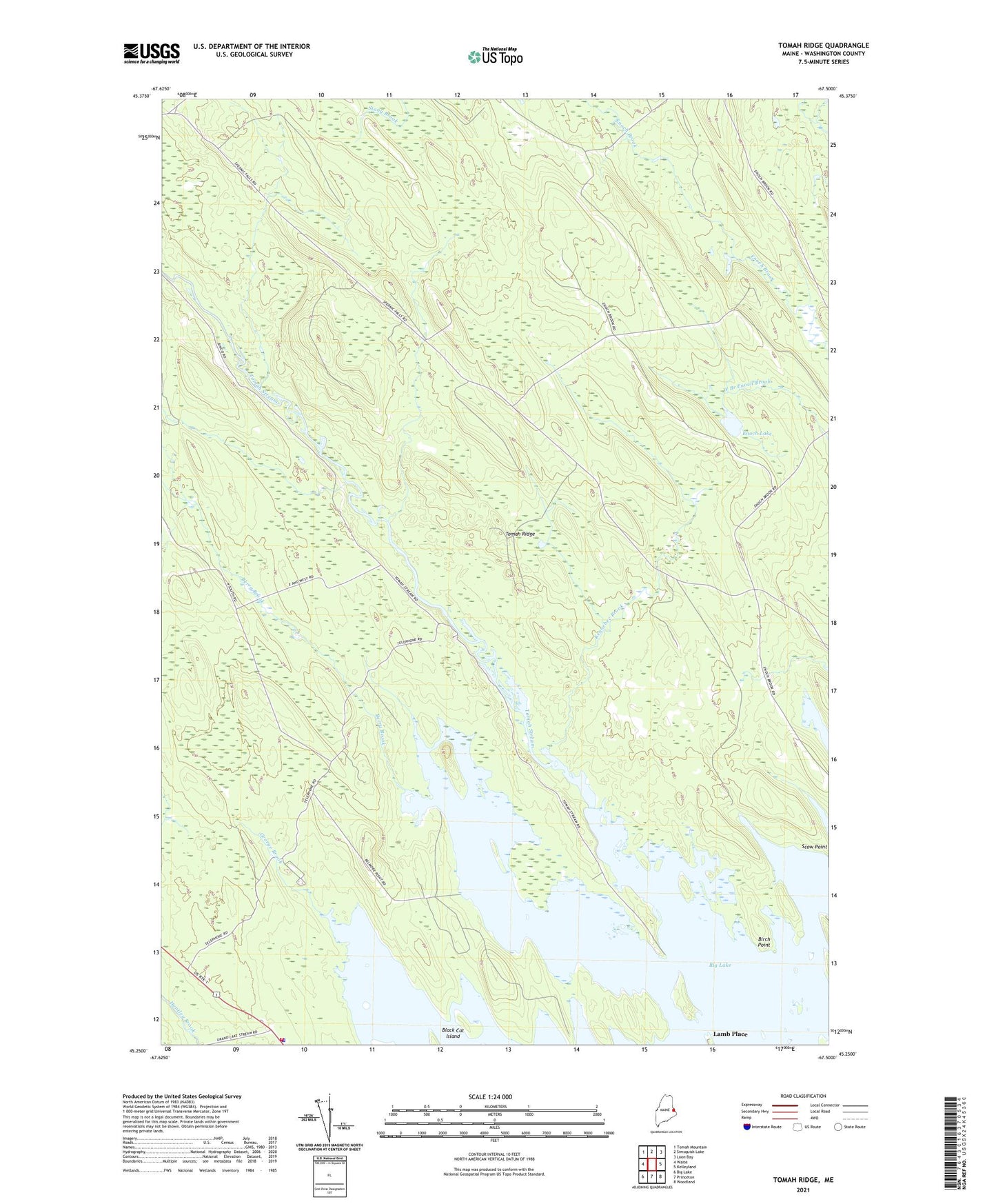
2021 topographic map quadrangle Tomah Ridge in the state of Maine. Scale: 1:24000. Based on the newly updated USGS 7.5' US Topo map series, this map is in the following counties: Washington. The map contains contour data, water features, and other items you are used to seeing on USGS maps, but also has updated roads and other features. This is the next generation of topographic maps. Printed on high-quality waterproof paper with UV fade-resistant inks.
Quads adjacent to this one:
West: Waite
Northwest: Tomah Mountain
North: Simsquish Lake
Northeast: Loon Bay
East: Kelleyland
Southeast: Woodland
South: Princeton
Southwest: Big Lake
Contains the following named places: Berry Brook, Berry Brook Flowage, Birch Point, Black Cat Island, Enoch Lake, Fowler Township, George Brook, George Brook Flowage, Indian Township Reservation, Keeley Farm, Kennebec Brook, Kennebec Dam, Lamb Place, Passamaquoddy Fire Department, Passamaquoddy Indian Township Reservation, Passamaquoddy Police Department, Tomah Ridge, Tomah Stream, West Branch Millberry Brook