MyTopo
Wadleigh Mountain Maine US Topo Map
Couldn't load pickup availability
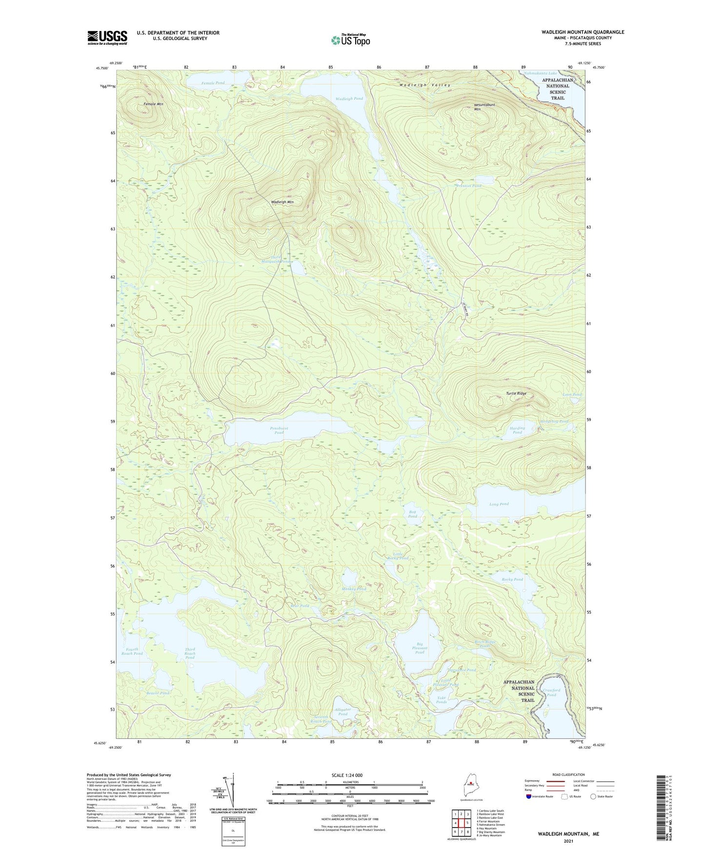
2021 topographic map quadrangle Wadleigh Mountain in the state of Maine. Scale: 1:24000. Based on the newly updated USGS 7.5' US Topo map series, this map is in the following counties: Piscataquis. The map contains contour data, water features, and other items you are used to seeing on USGS maps, but also has updated roads and other features. This is the next generation of topographic maps. Printed on high-quality waterproof paper with UV fade-resistant inks.
Quads adjacent to this one:
West: Farrar Mountain
Northwest: Caribou Lake South
North: Rainbow Lake West
Northeast: Rainbow Lake East
East: Nahmakanta Stream
Southeast: Jo-Mary Mountain
South: Big Shanty Mountain
Southwest: Hay Mountain
Contains the following named places: Alligator Pond, Bear Pond, Beaver Pond, Big Pleasant Pond, Birch Ridge Ponds, Bog Pond, Crawford Pond, Farrar Brook, Female Mountain, Female Pond, First Musquash Pond, Fourth Roach Pond, Harding Pond, Hedgehog Pond, Little Penobscot Pond, Little Pleasant Pond, Little Rocky Pond, Long Pond, Loon Pond, Monkey Pond, Nesuntabunt Mountain, Penobscot Pond, Prentiss Pond, Rocky Pond, Second Musquash Pond, Seventh Roach Pond, Sing Sing Pond, Spruance Pond, T1 R11 WELS, TA R11 WELS, Third Musquash Pond, Third Roach Pond, Turtle Ridge, Wadleigh Mountain, Wadleigh Mountain Lookout Tower, Wadleigh Pond, Wadleigh Valley, Yoke Ponds