MyTopo
Nahmakanta Stream Maine US Topo Map
Couldn't load pickup availability
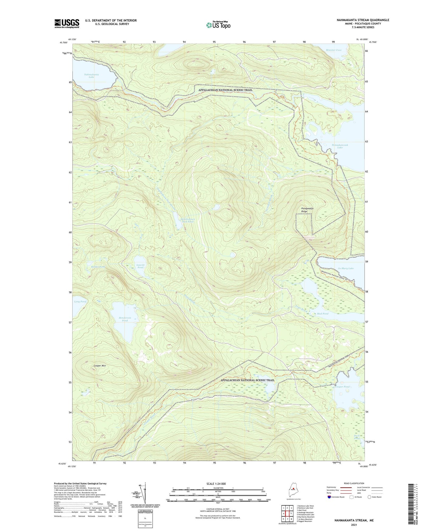
2024 topographic map quadrangle Nahmakanta Stream in the state of Maine. Scale: 1:24000. Based on the newly updated USGS 7.5' US Topo map series, this map is in the following counties: Piscataquis. The map contains contour data, water features, and other items you are used to seeing on USGS maps, but also has updated roads and other features. This is the next generation of topographic maps. Printed on high-quality waterproof paper with UV fade-resistant inks.
Quads adjacent to this one:
West: Wadleigh Mountain
Northwest: Rainbow Lake West
North: Rainbow Lake East
Northeast: Abol Pond
East: Pemadumcook Lake
Southeast: Ragged Mountain
South: Jo-Mary Mountain
Southwest: Big Shanty Mountain
This map covers the same area as the classic USGS quad with code o45069f1.
Contains the following named places: Church Pond, Cooper Mountain, Cooper Pond, Deadwater Brook, Deer Brook, Duck Pond, Henderson Pond, Leavitt Pond, Lower Jo-Mary Lake, Mud Pond, Nahmakanta Stream, Potaywadjo Ridge, Pratt Brook, Prentiss Brook, Rabbit Pond, T1 R10 WELS, TA R10 WELS, Tumbledown Dick Pond, Tumbledown Dick Stream, Twitchell Brook