MyTopo
Wells Maine US Topo Map
Couldn't load pickup availability
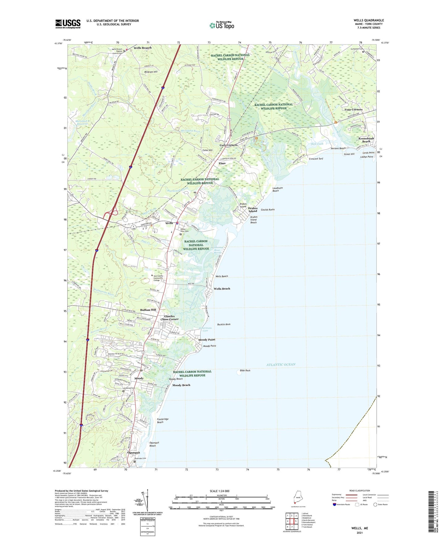
2024 topographic map quadrangle Wells in the state of Maine. Scale: 1:24000. Based on the newly updated USGS 7.5' US Topo map series, this map is in the following counties: York. The map contains contour data, water features, and other items you are used to seeing on USGS maps, but also has updated roads and other features. This is the next generation of topographic maps. Printed on high-quality waterproof paper with UV fade-resistant inks.
Quads adjacent to this one:
West: North Berwick
Northwest: Alfred
North: Kennebunk
Northeast: Biddeford
East: Kennebunkport
South: York Beach
Southwest: York Harbor
This map covers the same area as the classic USGS quad with code o43070c5.
Contains the following named places: Advent Christian Church, Back Creek, Beach Acres Campground, Bibb Rock, Blacksmith Brook, Bragdon Brook, Branch Brook, Bucklin Rock, Buffum Hill, Charles Chase Corner, Cocoons Day School, Coles Hill, Congregational Church of Wells, Cozy Corners, Crescent Surf, Depot Brook, Dorothy Fish Coastal Resource Library Wells Reserve, Drakes Island, Drakes Island Beach, Elms, Evergreen Cemetery, Fernald Brook, First Congregational Church, Fishermans Cove, Footbridge Beach, Four Corners, Goulds Rocks, Great Hill, Gregoires Campground, Hobbs Brook, Hobbs Pond, Hobbs Pond Dam, Kennebunk Airport, Kennebunk Beach, Kennebunk Christian Academy, Kennebunk Health and Homecare Services, Laudholm Beach, Laudholm Farm, Libbys Point, Little River, Lords Point, Lower Landing, Merriland River, Merriland River Reservoir, Messiah Christian Church, Mildram Hill, Moody, Moody Beach, Moody Point, Mousam River, Ocean View Cemetery, Ogunquit Beach, One Casino Square Shopping Center, Parsons Beach, Pinderosa Campground, Pope Creek, Riverside Cemetery, Saint Davids Episcopal Church, Stevens Brook, The Wells National Estuarine Research Reserve, The Wells Reserve Visitors Center, Town of Wells, Unnamed Cemetery, Upper Landing, Webhannet Golf Club, Webhannet River, Webhannet River Marsh, Wells, Wells Auto Museum, Wells Beach, Wells Beach Station, Wells Branch, Wells Branch Baptist Church Cemetery, Wells Corner Shopping Center, Wells Elementary School, Wells Emergency Medical Services, Wells Fire Department Branch Station, Wells Fire Department Main Station, Wells Harbor, Wells High School, Wells Information Center, Wells Junior High School, Wells Police Department, Wells Post Office, Wells Public Library, Wells Shopping Plaza Shopping Center, York County Community College, York County Community College Library, ZIP Code: 03907