MyTopo
West Lubec Maine US Topo Map
Couldn't load pickup availability
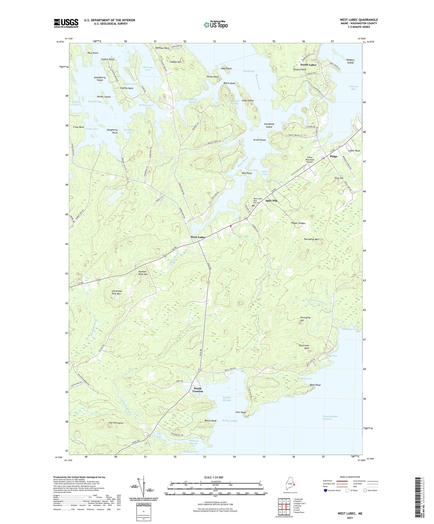
2021 topographic map quadrangle West Lubec in the state of Maine. Scale: 1:24000. Based on the newly updated USGS 7.5' US Topo map series, this map is in the following counties: Washington. The map contains contour data, water features, and other items you are used to seeing on USGS maps, but also has updated roads and other features. This is the next generation of topographic maps. Printed on high-quality waterproof paper with UV fade-resistant inks.
Quads adjacent to this one:
West: Whiting
Northwest: Pembroke
North: Eastport
Northeast: Eastport OE E
East: Lubec
South: Moose River
Southwest: Cutler
Contains the following named places: Baileys Ledge, Baileys Mistake, Bassett Creek, Batch Head, Black Head, Boot Cove, Boot Head, Carlos Cove, Case Cove, Christmas Tree Mountain, Cobble Hill, Coffins Neck, Coffins Point, Crow Neck School, Denbow Neck, Dougherty Cove, Dougherty Point, Eaton Cove, Ellis Hill, Federal Harbor, Gooseberry Island, Guvspuny Island, Hamilton Brook, Hamilton Cove, Haycock Harbor, Hog Island, Horan Head, Jims Head, Johnson Bay, Julia Cove, Lily Lake, Long Island, Long Island Passage, Lubec Fire Department Station 2, Lubec Municipal Airport, Mays Brook, Morong Cove, Morrison Cove, North Lubec, Number Nine Hill, Nutter Cove, Parker Island, Porcupine Hill, Porcupine Mountain, Race Point, Red Point, Ridge, Rodgers Island, Scrub Island, South Bay Campground, South Trescott, Split Hill, Straight Bay, Straight Bay School, Talbot Cove, Thayer Ledges, The Crows Nest, The Pool, The Porcupine, Town of Lubec, West Lubec, West Lubec Split Hill Cemetery, Wiggins Brook, Wilcox School, ZIP Code: 04652