MyTopo
Lubec Maine US Topo Map
Couldn't load pickup availability
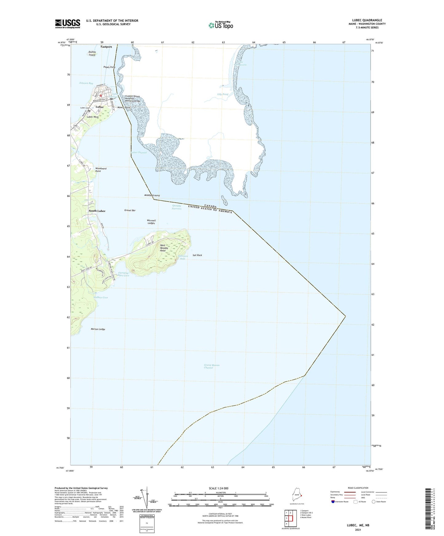
2024 topographic map quadrangle Lubec in the state of Maine. Scale: 1:24000. Based on the newly updated USGS 7.5' US Topo map series, this map is in the following counties: Washington. The map contains contour data, water features, and other items you are used to seeing on USGS maps, but also has updated roads and other features. This is the next generation of topographic maps. Printed on high-quality waterproof paper with UV fade-resistant inks.
Quads adjacent to this one:
West: West Lubec
Northwest: Eastport
North: Eastport OE E
Southwest: Moose River
This map covers the same area as the classic USGS quad with code o44066g8.
Contains the following named places: Carrying Place Cove, Christian Temple Church, Downeast Emergency Medical Services Lubec, Dudley Island, Franklin Delano Roosevelt Memorial Bridge, Gravel Bar, Gullivers Hole, Lubec, Lubec Cemetery, Lubec Census Designated Place, Lubec Channel, Lubec Channel Light, Lubec Channel Light Station, Lubec Consolidated School, Lubec Memorial Library, Lubec Narrows, Lubec Neck, Lubec Post Office, Lubec Volunteer Fire Department, Middle Ground, Morton Ledge, Mowry Point, Popes Folly, Quoddy Head State Park, Quoddy Narrows, Sail Rock, South Lubec, Wallace Cove, West Quaddy Head Light, West Quoddy Head, West Quoddy Head Light Station, West Quoddy Life Saving Station, Woodward Point, Wormell Ledges