
MyTopo
Whiting Maine US Topo Map
Couldn't load pickup availability
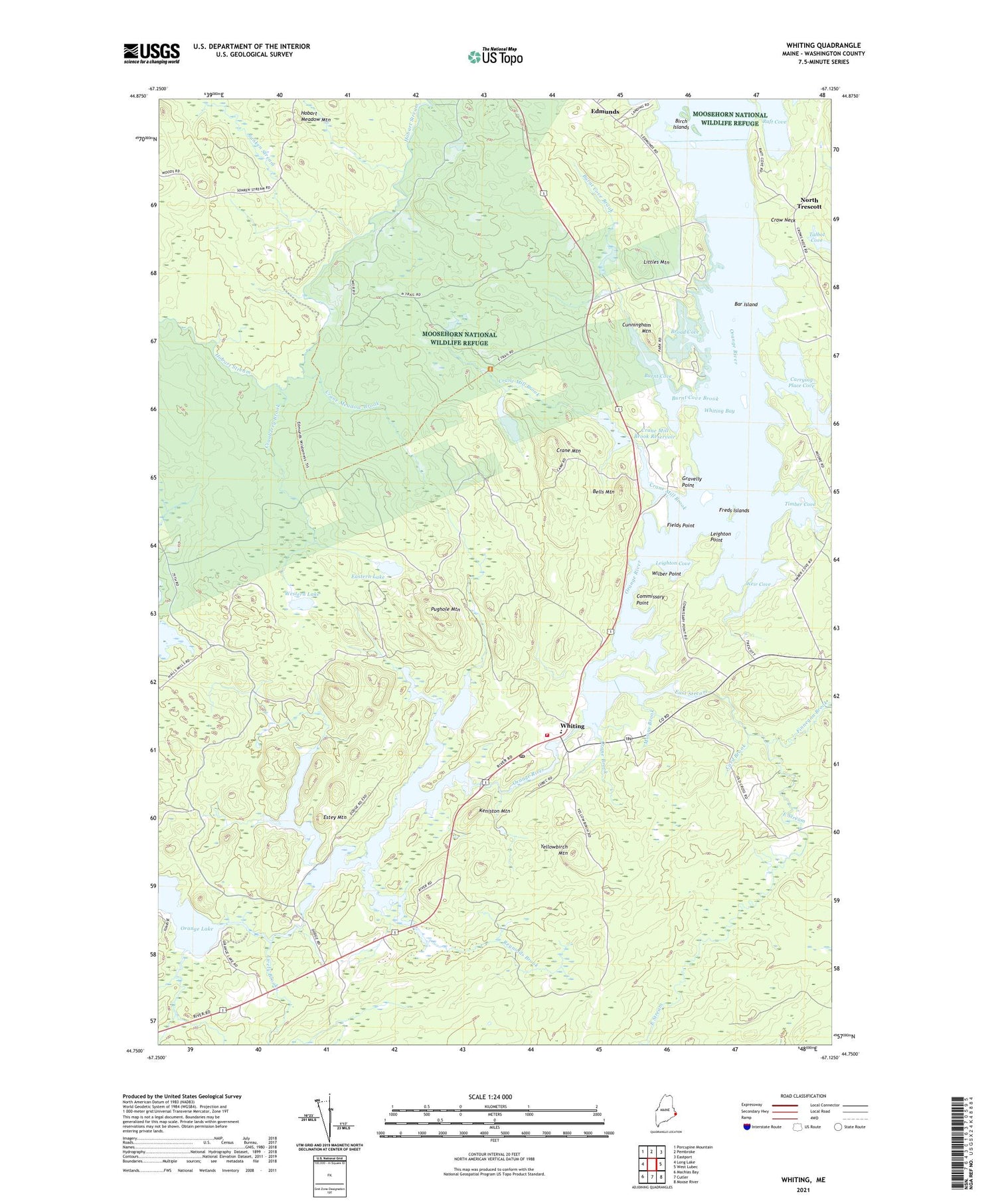
2021 topographic map quadrangle Whiting in the state of Maine. Scale: 1:24000. Based on the newly updated USGS 7.5' US Topo map series, this map is in the following counties: Washington. The map contains contour data, water features, and other items you are used to seeing on USGS maps, but also has updated roads and other features. This is the next generation of topographic maps. Printed on high-quality waterproof paper with UV fade-resistant inks.
Quads adjacent to this one:
West: Long Lake
Northwest: Porcupine Mountain
North: Pembroke
Northeast: Eastport
East: West Lubec
Southeast: Moose River
South: Cutler
Southwest: Machias Bay
Contains the following named places: Bar Island, Bells Mountain, Birch Islands, Broad Cove, Burnt Cove, Burnt Cove Brook, Card Brook, Carrying Place Cove, Cobscook Bay State Park, Commissary Point, Cranberry Brook, Crane Brook, Crane Dam, Crane Meadow Brook, Crane Mill Brook, Crane Mill Brook Reservoir, Crane Mountain, Crow Neck, Cunningham Mountain, East Stream, East Stream School, Eastern Lake, Edmunds, Estey Mountain, Fields Point, Finnegan Brook, Freds Islands, Gravelly Point, Hobart Meadow Mountain, Keniston Mountain, Leighton Cove, Leighton Point, Little Lake, Littles Mountain, Lively Brook, Mill Dam, Moons Brook, Moosehorn Wilderness (Birch Islands Unit), Moosehorn Wilderness (Edmunds Unit), North Trescott, Orange Lake, Orange River, Orange River Dam, Orange River Reservoir, Pughole Mountain, Raft Cove, Reynolds Brook, Roaring Lake, Sunken Stream, Timber Cove, Weir Cove, Western Lake, Whiting, Whiting Bay, Whiting Bay Dam, Whiting Village School, Whiting Volunteer Fire Department, Wilber Point, Yellowbirch Mountain


