MyTopo
Long Lake Maine US Topo Map
Couldn't load pickup availability
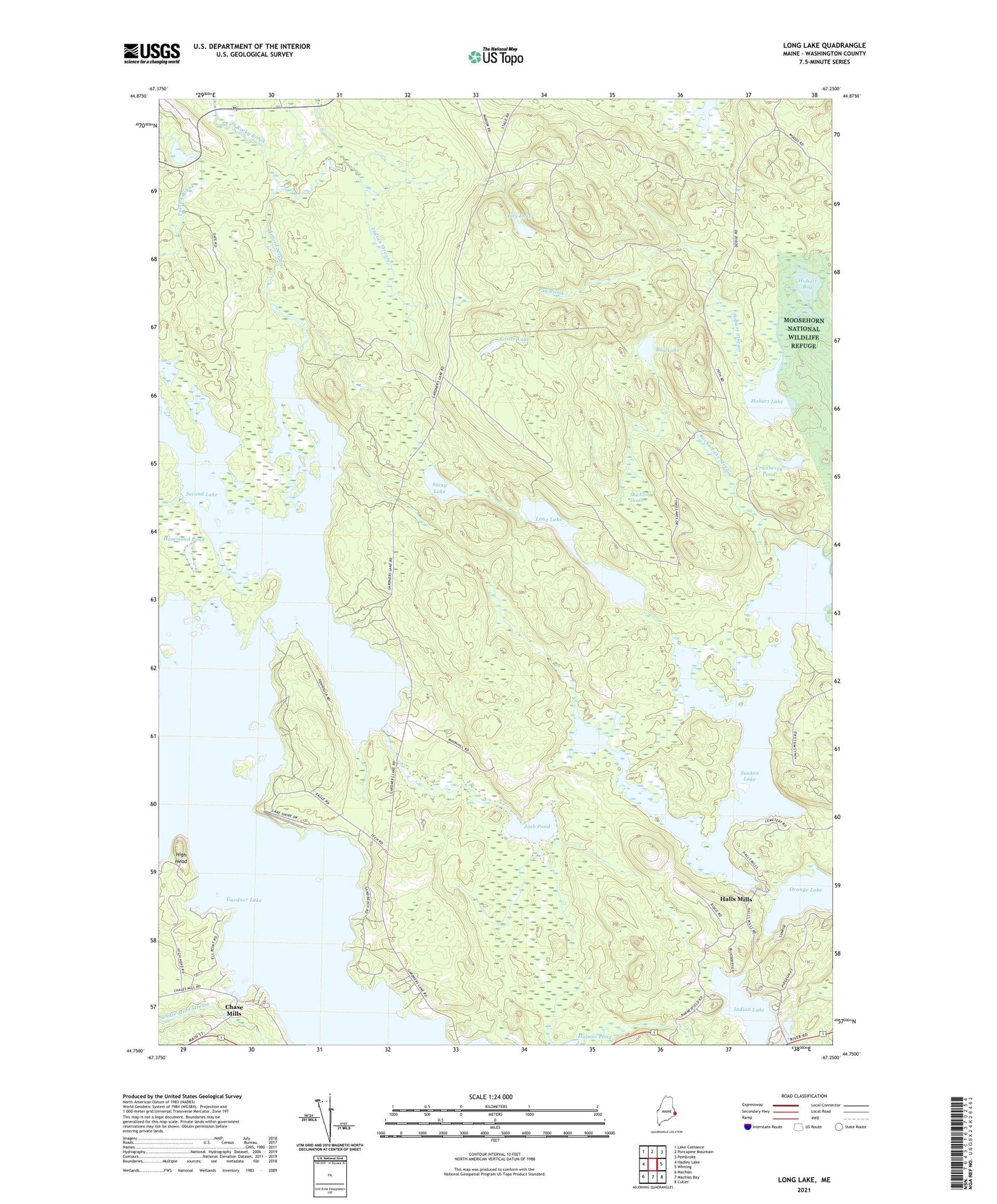
2024 topographic map quadrangle Long Lake in the state of Maine. Scale: 1:24000. Based on the newly updated USGS 7.5' US Topo map series, this map is in the following counties: Washington. The map contains contour data, water features, and other items you are used to seeing on USGS maps, but also has updated roads and other features. This is the next generation of topographic maps. Printed on high-quality waterproof paper with UV fade-resistant inks.
Quads adjacent to this one:
West: Hadley Lake
Northwest: Lake Cathance
North: Porcupine Mountain
Northeast: Pembroke
East: Whiting
Southeast: Cutler
South: Machias Bay
Southwest: Machias
This map covers the same area as the classic USGS quad with code o44067g3.
Contains the following named places: Bog Lake, Chase Mill Dam, Chase Mills, Clifford Stream, Cranberry Pond, Deep Cove, Foster Lake, Gardner Lake, Gardner Lake School, Halls Mills, Hammond Pond, Harmon Stream, High Head, Hobart Bog, Hobart Bog Dam, Hobart Lake, Indian Lake, Indian Stream, Josh Pond, Lily Lake, Long Lake, Loon Lake, MacElroy Heath, MIT Camp, Pug Brook, Rocky Brook, Rocky Lake, Rocky Lake Dam, Rocky Lake Stream, Second Lake, Shiny Lake, Sunken Lake, Town of Whiting, Unorganized Territory of East Central Washington, ZIP Codes: 04628, 04691