MyTopo
Witham Mountain Maine US Topo Map
Couldn't load pickup availability
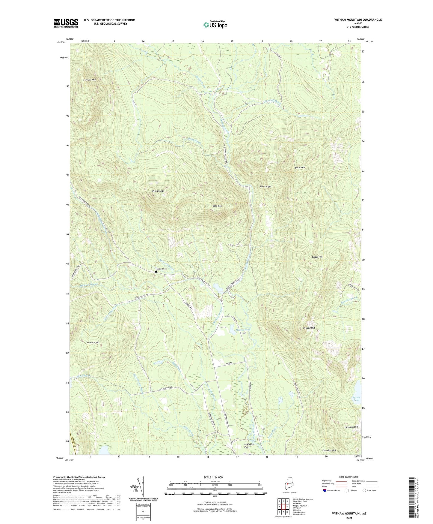
2021 topographic map quadrangle Witham Mountain in the state of Maine. Scale: 1:24000. Based on the newly updated USGS 7.5' US Topo map series, this map is in the following counties: Somerset, Franklin. The map contains contour data, water features, and other items you are used to seeing on USGS maps, but also has updated roads and other features. This is the next generation of topographic maps. Printed on high-quality waterproof paper with UV fade-resistant inks.
Quads adjacent to this one:
West: Poplar Mountain
Northwest: Little Bigelow Mountain
North: East Carry Pond
Northeast: Caratunk
East: Bingham
Southeast: Embden Pond
South: New Portland
Southwest: Kingfield
Contains the following named places: Bald Mountain, Barker Brook, Bear Brook, Briggs Hill, Britenell Brook, Burnt Hill, Chandler Hill, Churchill Brook, Highland Cemetery, Highland School, Howard Hill, Hutchins Hill, Lexington Township, Little Michael Stream, Michael Stream, Moores Pond, Peaked Hill, Pease Brook, Plantation of Highland, Safford Pond, Schoolhouse Brook, Spruce Pond, Stewart Mountain, Stony Brook, The Ledges, Witham Mountain