MyTopo
Bingham Maine US Topo Map
Couldn't load pickup availability
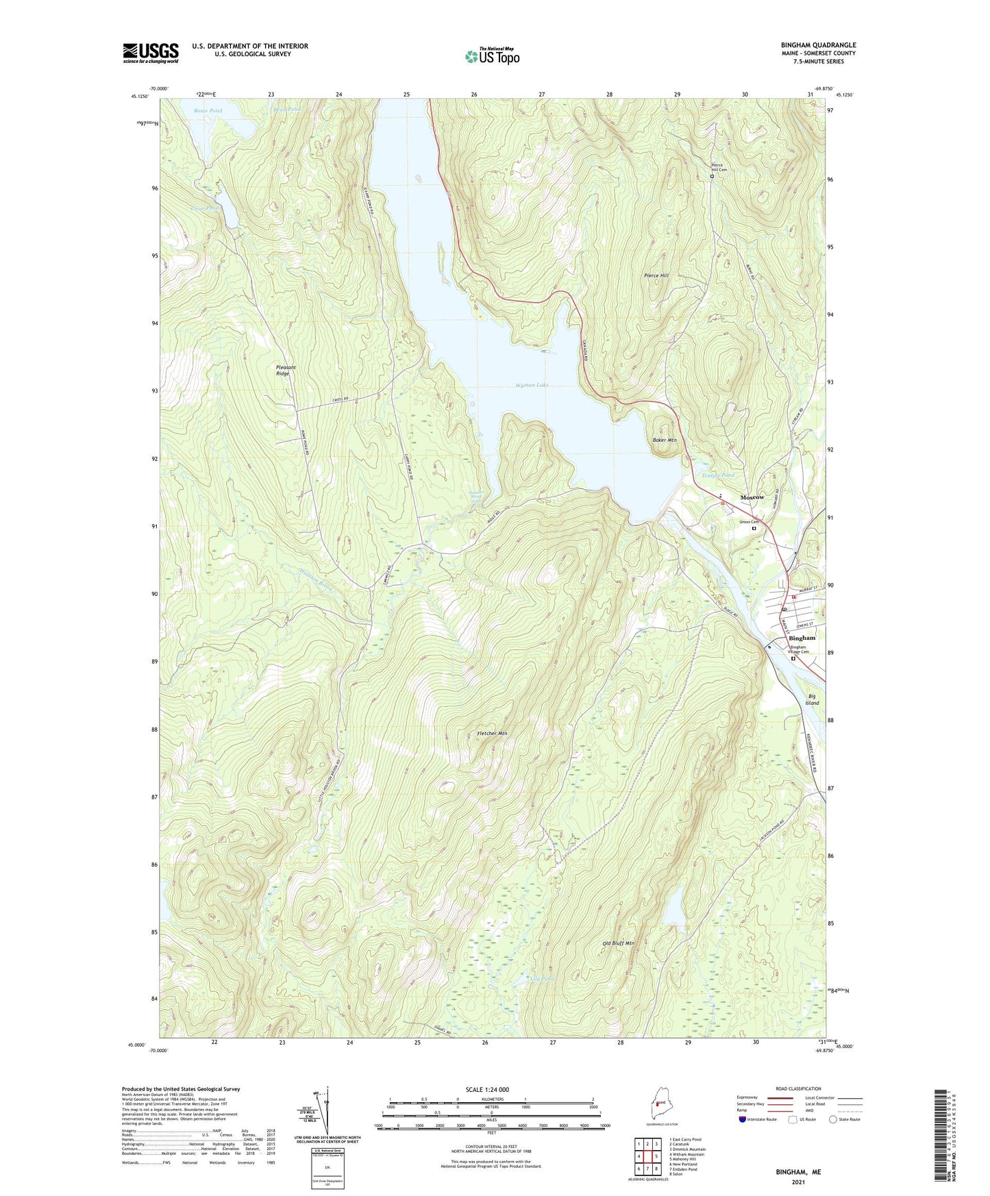
2024 topographic map quadrangle Bingham in the state of Maine. Scale: 1:24000. Based on the newly updated USGS 7.5' US Topo map series, this map is in the following counties: Somerset. The map contains contour data, water features, and other items you are used to seeing on USGS maps, but also has updated roads and other features. This is the next generation of topographic maps. Printed on high-quality waterproof paper with UV fade-resistant inks.
Quads adjacent to this one:
West: Witham Mountain
Northwest: East Carry Pond
North: Caratunk
Northeast: Dimmick Mountain
East: Mahoney Hill
Southeast: Solon
South: Embden Pond
Southwest: New Portland
This map covers the same area as the classic USGS quad with code o45069a8.
Contains the following named places: Austin Stream, Baker Mountain, Big Island, Bingham, Bingham Congregational Church, Bingham Fire Department, Bingham Post Office, Bingham Union Library, Bingham Village Cemetery, Clear Pond, Concord Township, Fletcher Mountain, Houston Brook, Houston Brook Falls, Jackson Pond, Lily Pond, Little Houston Brook, Longfellow School, Mill Stream Dam, Mink Brook, Moscow, Moscow Elementary School, Old Bluff Mountain, Pierce Hill, Pierce Hill Cemetery, Plantation of Pleasant Ridge, Pleasant Ridge, Quimby Middle School, Rowe Pond, Temple Pond, Union Cemetery, Unorganized Territory of Central Somerset, Upper Kennebec Valley Ambulance Service, Wyman Dam, Wyman Dam Post Office, Wyman Lake