MyTopo
Embden Pond Maine US Topo Map
Couldn't load pickup availability
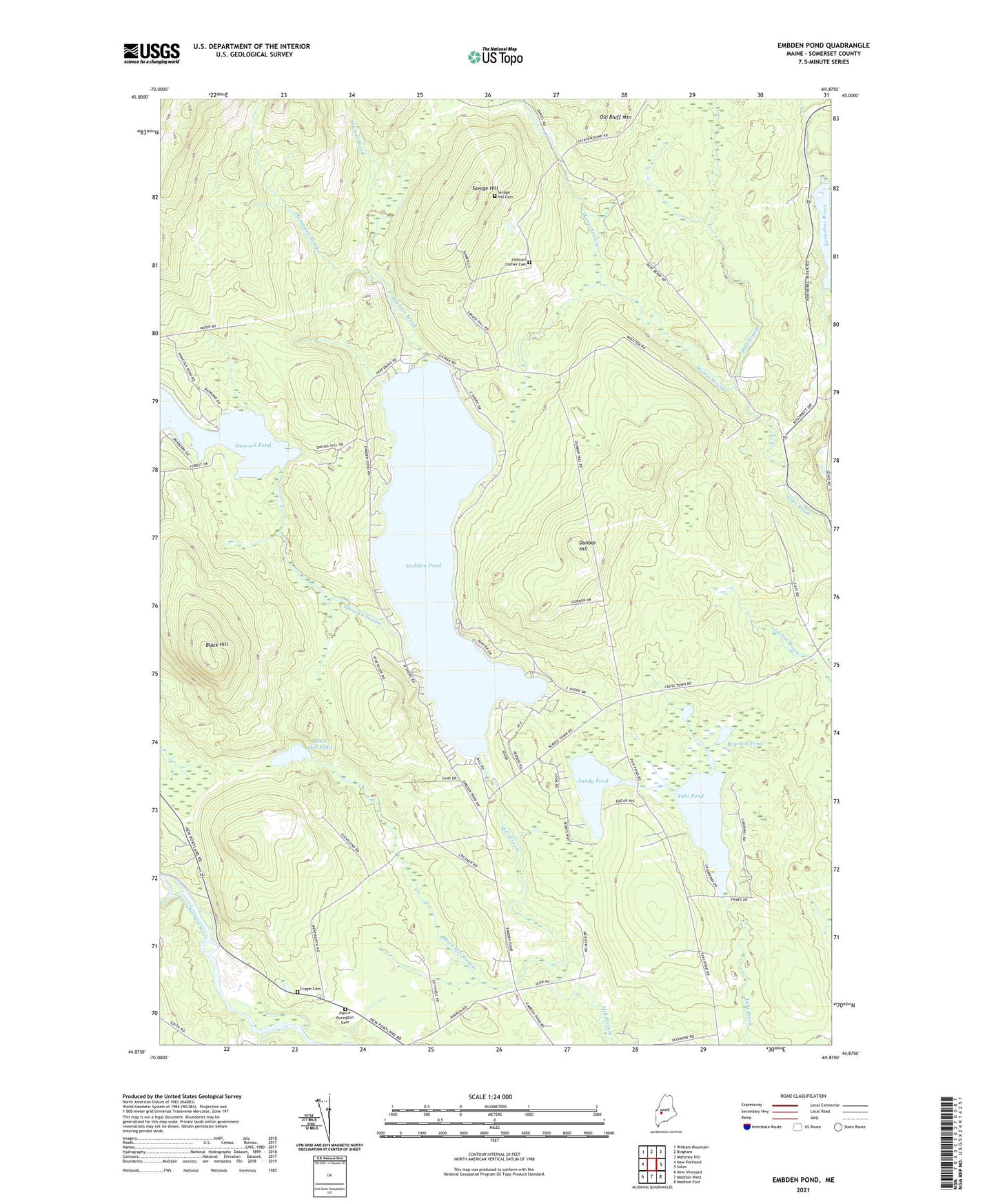
2024 topographic map quadrangle Embden Pond in the state of Maine. Scale: 1:24000. Based on the newly updated USGS 7.5' US Topo map series, this map is in the following counties: Somerset. The map contains contour data, water features, and other items you are used to seeing on USGS maps, but also has updated roads and other features. This is the next generation of topographic maps. Printed on high-quality waterproof paper with UV fade-resistant inks.
Quads adjacent to this one:
West: New Portland
Northwest: Witham Mountain
North: Bingham
Northeast: Mahoney Hill
East: Solon
Southeast: Madison East
South: Madison West
Southwest: New Vineyard
This map covers the same area as the classic USGS quad with code o44069h8.
Contains the following named places: Black Hill, Black Hill Pond, Black Hill Stream, Boynton Pond, Concord Corner Cemetery, Deveraux Camps, Dunbar Hill, Ela Rearing Station, Embden Elementary School, Embden Pond, Embden Pond Dam, Emerson School, Fahi Pond, Fahi Pond Dam, Hancock Pond, Hancock Pond Dam, Hancock Stream, Hilton Brook, Hunniwell Brook, Hutchins Brook, Martin Stream, Mud Pond, North New Portland Fairgrounds, Old Bluff Mountain, Sandy Pond, Savage Hill, Savage Hill Cemetery, Town of Embden, Witham Brook, ZIP Code: 04958