MyTopo
Avilton Maryland US Topo Map
Couldn't load pickup availability
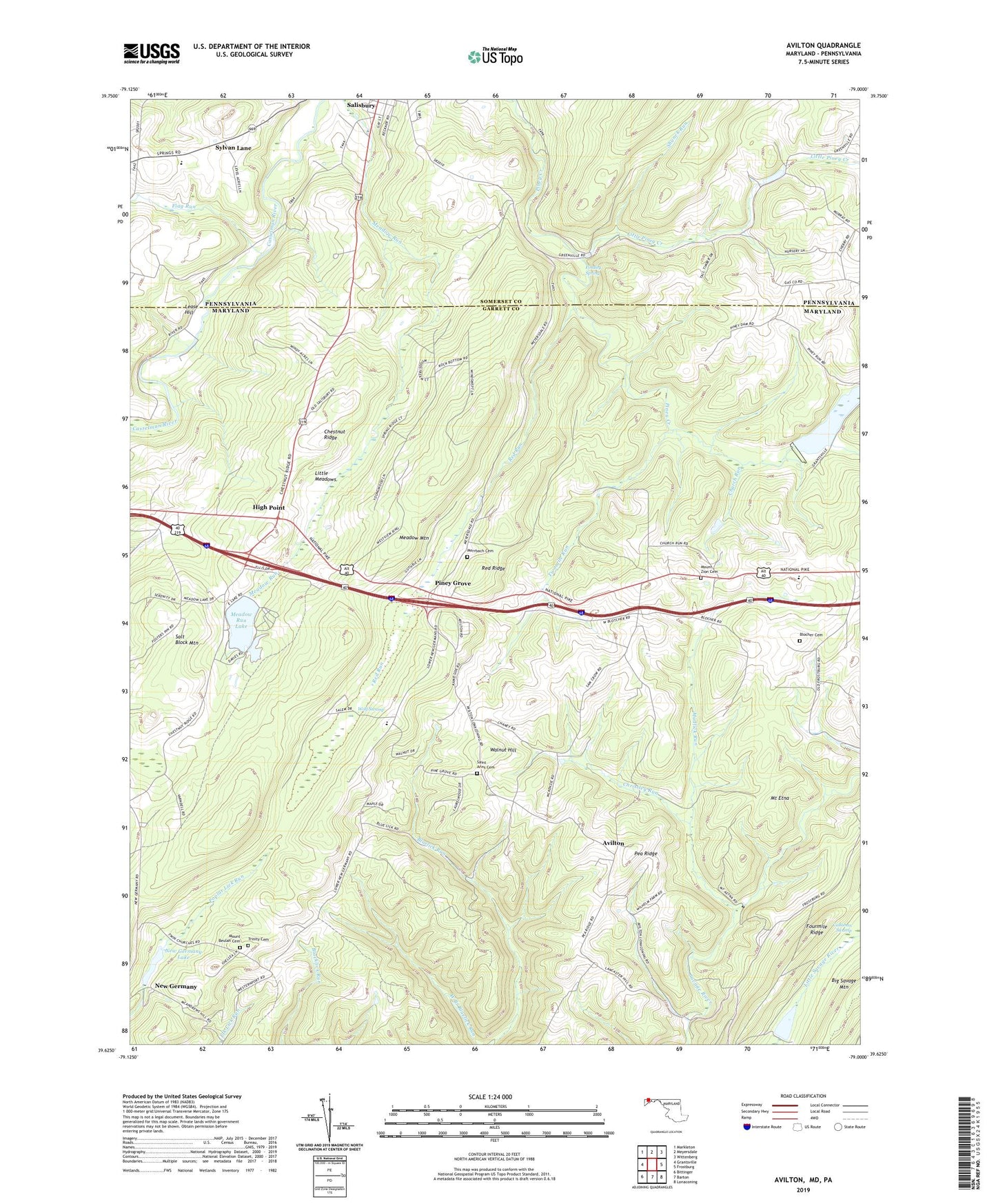
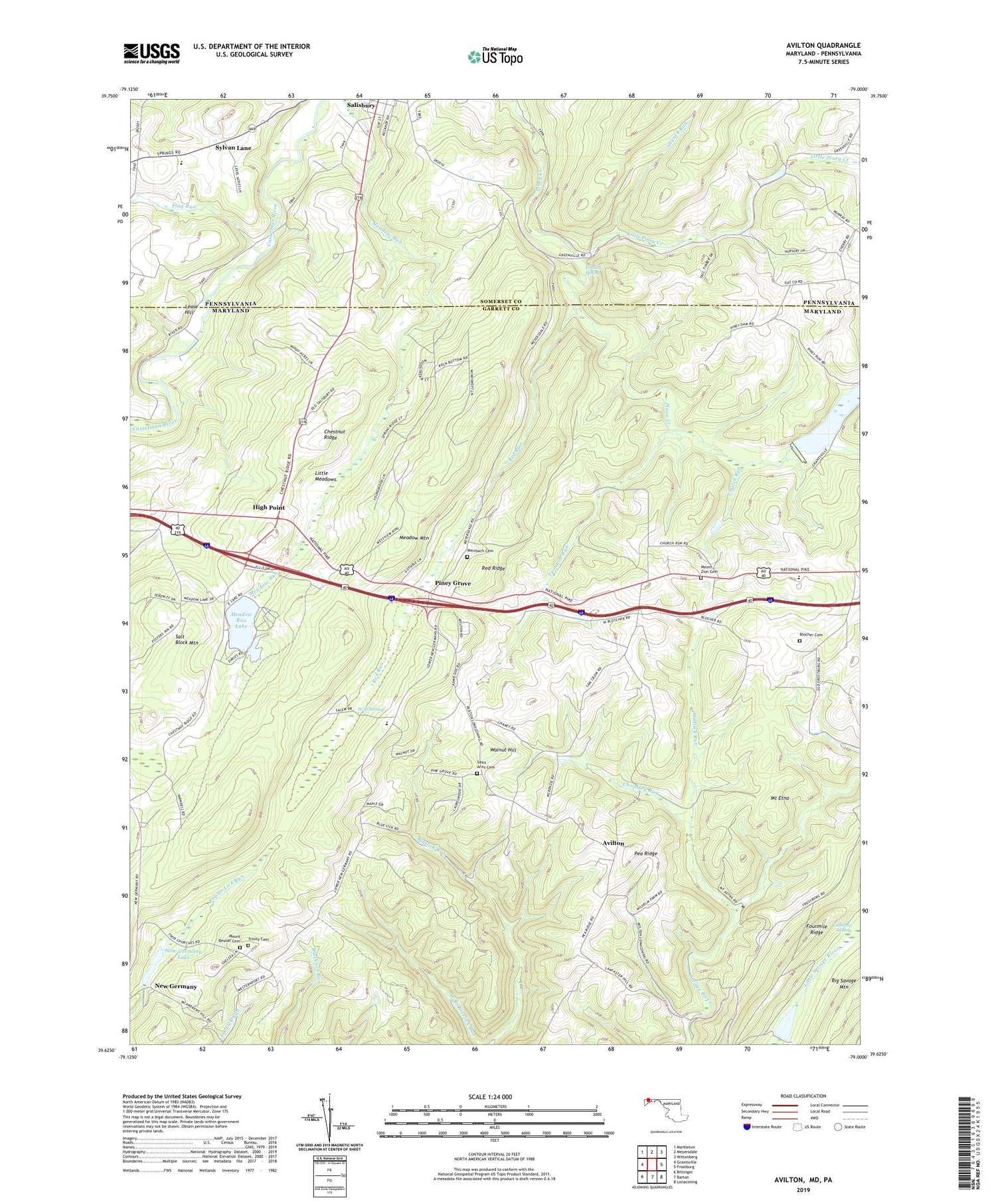
2019 topographic map quadrangle Avilton in the states of Maryland, Pennsylvania. Scale: 1:24000. Based on the newly updated USGS 7.5' US Topo map series, this map is in the following counties: Garrett, Somerset. The map contains contour data, water features, and other items you are used to seeing on USGS maps, but also has updated roads and other features. This is the next generation of topographic maps. Printed on high-quality waterproof paper with UV fade-resistant inks.
Quads adjacent to this one:
West: Grantsville
Northwest: Markleton
North: Meyersdale
Northeast: Wittenberg
East: Frostburg
Southeast: Lonaconing
South: Barton
Southwest: Bittinger
Contains the following named places: Avilton, Avilton School, Big Piney Run Dam, Bittinger Farm Pond Dam, Blackberry Ridge Farm, Blocher Cemetery, Cherry Grove Church, Chestnut Ridge, Christley Run, Church Run, Crossroad School, District 15 Avilton, Elk Lick Post Office, Findley Spring, Flag Run, Fourmile Ridge, Frostburg Reservoir, High Point, Lease Hill, Little Meadows, Little Piney Creek, Meadow Run Dam, Meadow Run Lake, Merrbach Cemetery, Mount Beulah Cemetery, Mount Beulah Church, Mount Etna, Mount Zion Cemetery, Mount Zion Church, Mudlick Run, New Germany, New Germany Lake, New Germany Recreation Area, New Germany School, New Germany State Park Dam, Pea Ridge, Piney Grove, Red Ridge, Red Run, Saint Annes Church, Saint Anns Cemetery, Salt Block Mountain, Shunck Run, Swaugers Mill, Sylvan Lane, Trinity Cemetery, Trinity Church, Twomile Run, WAIJ-FM (Grantsville), Walnut Hill, Wolf Swamp, ZIP Code: 15558