MyTopo
Brandywine Maryland US Topo Map
Couldn't load pickup availability
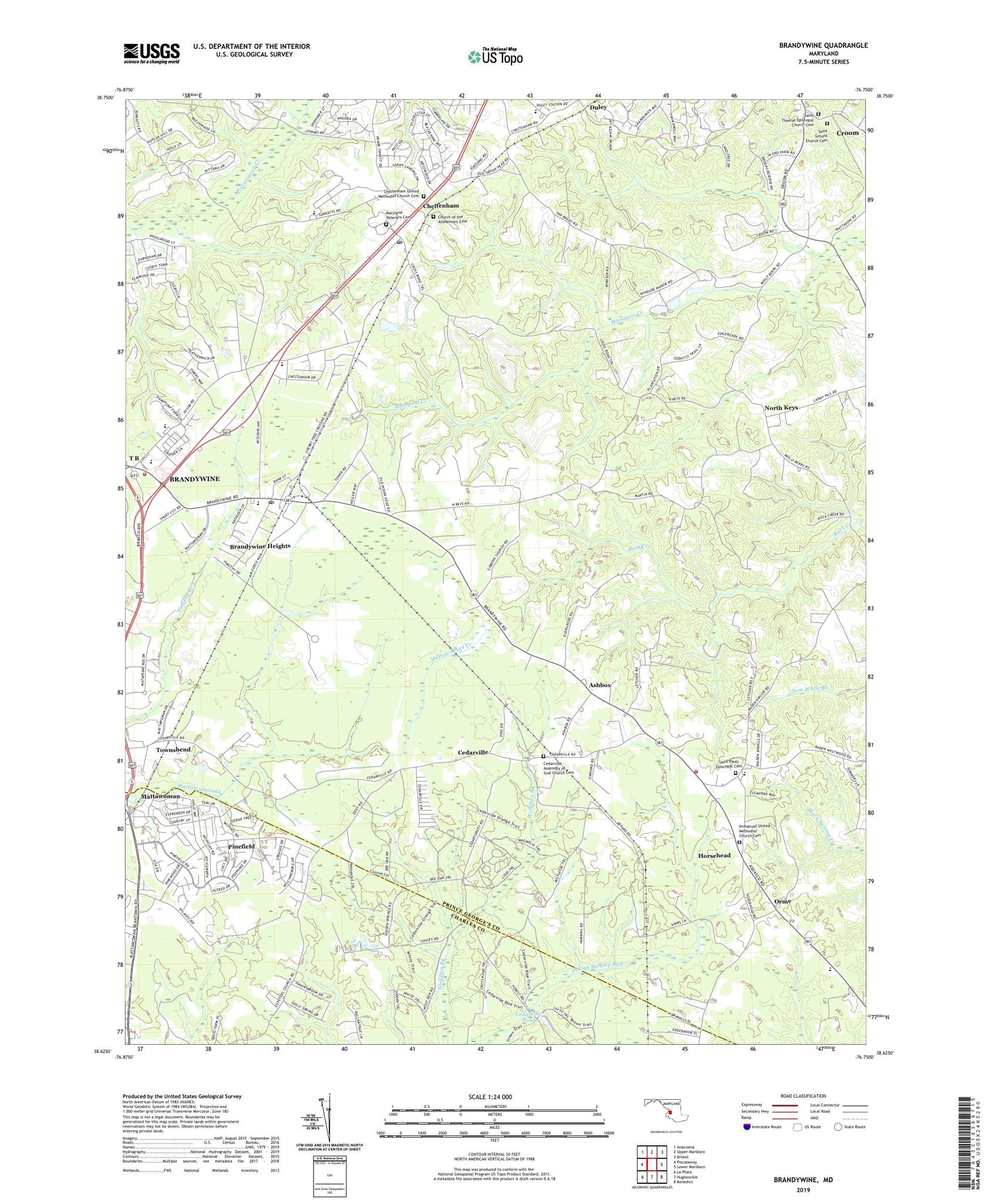
2019 topographic map quadrangle Brandywine in the state of Maryland. Scale: 1:24000. Based on the newly updated USGS 7.5' US Topo map series, this map is in the following counties: Prince George's, Charles. The map contains contour data, water features, and other items you are used to seeing on USGS maps, but also has updated roads and other features. This is the next generation of topographic maps. Printed on high-quality waterproof paper with UV fade-resistant inks.
Quads adjacent to this one:
West: Piscataway
Northwest: Anacostia
North: Upper Marlboro
Northeast: Bristol
East: Lower Marlboro
Southeast: Benedict
South: Hughesville
Southwest: La Plata
Contains the following named places: Ashbox, Baden, Baden Branch Library, Baden Branch Prince George's County Memorial Library, Baden Elementary School, Baden Volunteer Fire Department Station 836, Bee Oak Trail, Boys Village of Maryland, Brandwine Elementary School, Brandywine, Brandywine Area Recreation Area, Brandywine Bible Church, Brandywine Church, Brandywine Forest, Brandywine Heights, Brandywine Post Office, Brandywine School, Brandywine Volunteer Fire Department Station 840, Cedarville, Cedarville Assembly of God Church, Cedarville Assembly of God Church Cemetery, Cedarville Census Designated Place, Cedarville Mobile Home Park, Cedarville Natural Resources Management Area, Cedarville Pond, Cedarville School, Cedarville State Forest, Chapel of the Incarnation, Cheltenham, Cheltenham Acres, Cheltenham Acres Recreation Area, Cheltenham Post Office, Cheltenham United Methodist Church, Cheltenham United Methodist Church Cemetery, Church of the Atonement, Church of the Atonement Cemetery, Concordia Lutheran Preschool, Concordia Lutheran School and Child Care Center, Country Club South, County Line Trail, Croom Census Designated Place, Croom High School, Cross Road Trail, Curtis Field, District 11 Brandywine, Duley, Early Manor, Edgemeade School, Gibbons Church, Good Fortune Farm, Grace Methodist Episcopal Church, Gwynn Park, Gwynn Park High School, Gwynn Park Middle School, Heatherwick, Hidden Spring Trail, Holt Manor, Horsehead, Immanuel Church, Immanuel United Methodist Church Cemetery, Land Tree, Left Trail, Loop Trail, Magnolia Trail, Marlton South, Maryland Veterans Cemetery, Mattaponi Elementary School, Mattawoman Estates, Mistletoe Trail, North Keys, North Keys Estates, NOS Magnetic Observatory, Orme, Orme School, Panhandle Trail, Pinefield, Pinefield Community Park, Saint Michael Church, Saint Pauls Church, Saint Pauls Episcopal Cemetery, Saint Simons Church, Saint Simons Church Cemetery, Saint Simons School, Saint Thomas Church, Saint Thomas Episcopal Church Cemetery, South Trail, Sunrise Hills, Sunset Trail, T B, T B School, Talbert, The Village, Townshend, Trinity Baptist Church, West End Farms, West Trail, Western Regional Park, William Schmidt Environmental Center School, Windsor Manor, Wolf Den Trail, ZIP Codes: 20613, 20623