MyTopo
Dividing Creek Maryland US Topo Map
Couldn't load pickup availability
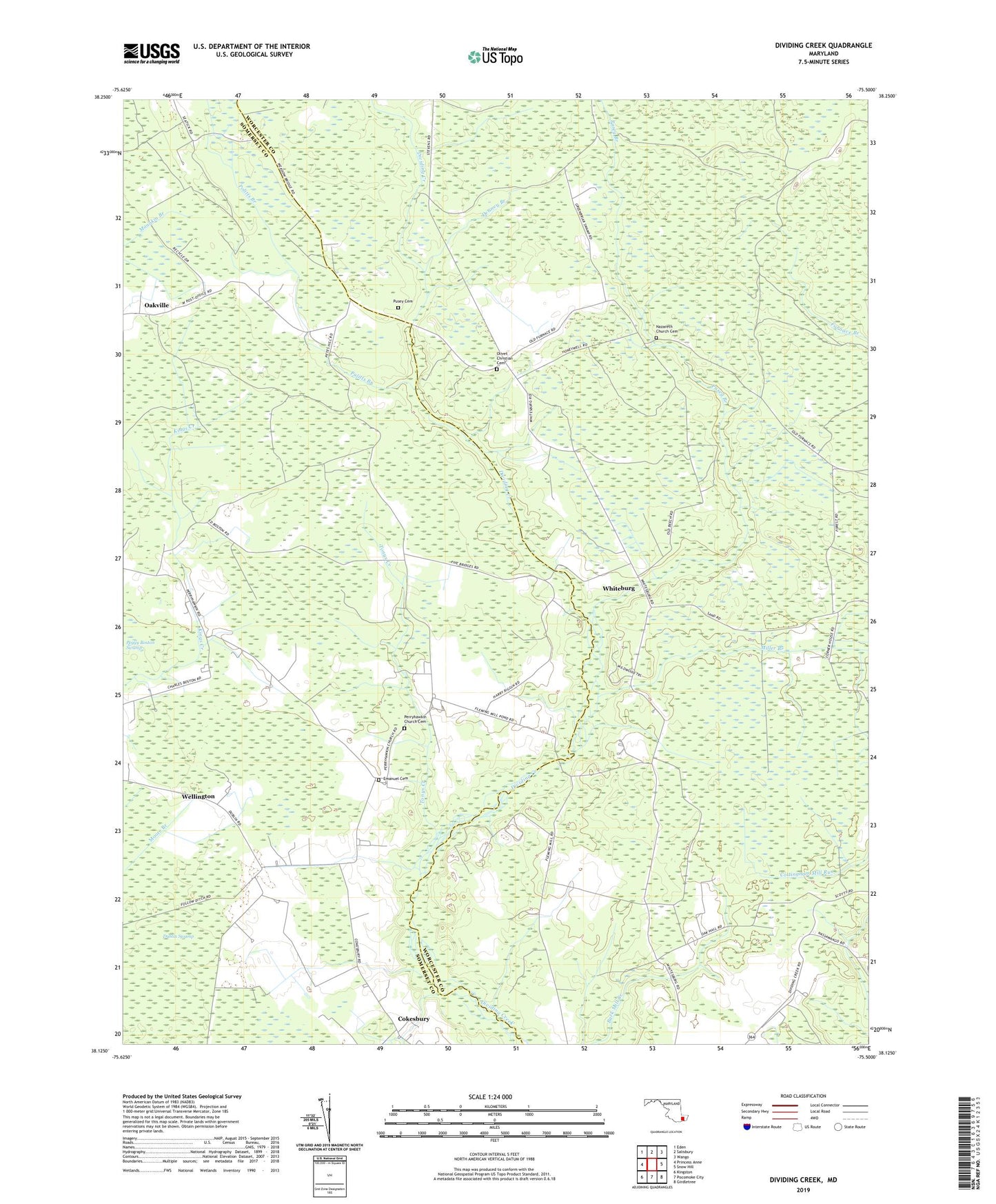
2019 topographic map quadrangle Dividing Creek in the state of Maryland. Scale: 1:24000. Based on the newly updated USGS 7.5' US Topo map series, this map is in the following counties: Worcester, Somerset. The map contains contour data, water features, and other items you are used to seeing on USGS maps, but also has updated roads and other features. This is the next generation of topographic maps. Printed on high-quality waterproof paper with UV fade-resistant inks.
Quads adjacent to this one:
West: Princess Anne
Northwest: Eden
North: Salisbury
Northeast: Wango
East: Snow Hill
Southeast: Girdletree
South: Pocomoke City
Southwest: Kingston
Contains the following named places: Adkinson School, Blueberry Hill, Cokesbury, Denney Branch, Emanuel Cemetery, Emanuel Methodist Church, Flemming Mill, Friendship Church, Highlands Church, Miller Branch, Nazareth Church, Nazareth Church Cemetery, Oakville, Olivet Christian Cemetery, Olivet Church, Perryhawkin Church, Perryhawkin Church Cemetery, Pocomoke State Forest, Politts Branch, Pusey Branch, Pusey Cemetery, Pusey State Game Refuge, Ridgehill School, Saint Marys Church, Shiloh Church, Tonys Creek, Wellington, Wellington State Wildlife Management Area, West, Whiteburg, Wildwoods, Williams Church