MyTopo
Snow Hill Maryland US Topo Map
Couldn't load pickup availability
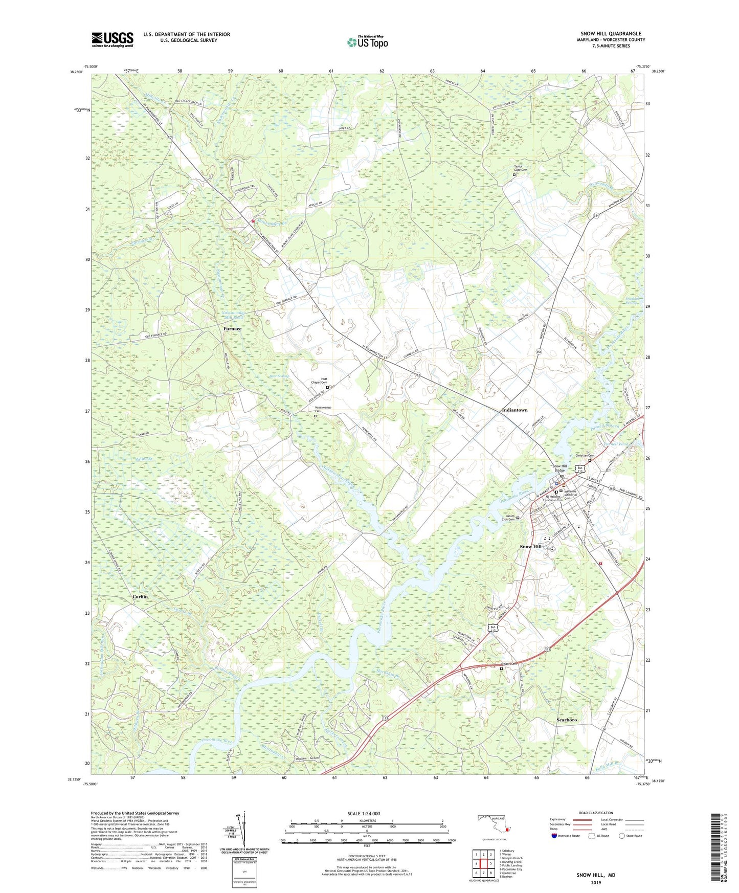
2023 topographic map quadrangle Snow Hill in the state of Maryland. Scale: 1:24000. Based on the newly updated USGS 7.5' US Topo map series, this map is in the following counties: Worcester. The map contains contour data, water features, and other items you are used to seeing on USGS maps, but also has updated roads and other features. This is the next generation of topographic maps. Printed on high-quality waterproof paper with UV fade-resistant inks.
Quads adjacent to this one:
West: Dividing Creek
Northwest: Salisbury
North: Wango
Northeast: Ninepin Branch
East: Public Landing
Southeast: Boxiron
South: Girdletree
Southwest: Pocomoke City
This map covers the same area as the classic USGS quad with code o38075b4.
Contains the following named places: All Hallows Episcopal Cemetery, All Hallows Episcopal Church, Bates Memorial United Methodist Church, Bear Swamp, Byrd Park, Campground Branch, Castle Haven Estates, Cedar Chapel Special School, Chandler State Game Refuge, Christian Cemetery, Collins Temple Church, Corbin, Corbin Branch, Corkers Creek, District 4 Western, Drexell Branch, Drexell Landing, Ebenezer United Methodist Church, Furnace, Furnace Branch, Hallet Heights, Hardship Branch, Harrison House Nursing Home, Hutt Chapel, Hutt Chapel Cemetery, Indiantown, John Walter Smith Memorial Park, Julia A Purnell Museum, Kirkwood Acres, Makemie Memorial Cemetery, Makemie Memorial United Presbyterian Church, Mattaponi Creek, Mattaponi Landing, Milburn Branch, Milburn Landing State Park, Millville Creek, Mount Olive Branch, Mount Zion Baptist Church, Mount Zion Cemetery, Mount Zion School Museum, Nassawango Cemetery, Nassawango Church, Nassawango Country Club, Nassawango Creek, Nassawango Forest Fire Station, Nassawango Hills, Nassawango Iron Furnace, Nassawango Mill, Nelson Cemetery, Old School Baptist Church, Purnell Branch, Purnell Pond, Red Landing, Rolling Hills, Saint James Holiness Church, Scarboro, Shad Landing, Shad Landing State Park, Snow Hill, Snow Hill Bridge, Snow Hill Christian Church, Snow Hill Christian Nursery School, Snow Hill Elementary School, Snow Hill High School, Snow Hill Middle School, Snow Hill Police Department, Snow Hill Post Office, Snow Hill Town Hall, Snow Hill Volunteer Fire Company - Station 400, Snow Hill Wastewater Treatment Plant, Taylor Gate Cemetery, Taylor Gate Church, Town of Snow Hill, Tyndall Estates, Whatcoat United Methodist Church, Worcester County Courthouse, Worcester County Fire Marshal's Office, Worcester County Historical Society, Worcester County Jail, Worcester County Library - Snow Hill Branch, Worcester County Sheriff's Office, ZIP Code: 21863