MyTopo
Eden Maryland US Topo Map
Couldn't load pickup availability
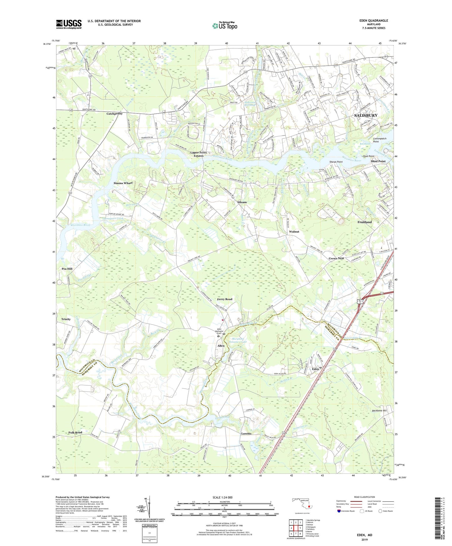
2023 topographic map quadrangle Eden in the state of Maryland. Scale: 1:24000. Based on the newly updated USGS 7.5' US Topo map series, this map is in the following counties: Wicomico, Somerset. The map contains contour data, water features, and other items you are used to seeing on USGS maps, but also has updated roads and other features. This is the next generation of topographic maps. Printed on high-quality waterproof paper with UV fade-resistant inks.
Quads adjacent to this one:
West: Wetipquin
Northwest: Mardela Springs
North: Hebron
Northeast: Delmar
East: Salisbury
Southeast: Dividing Creek
South: Princess Anne
Southwest: Monie
This map covers the same area as the classic USGS quad with code o38075c6.
Contains the following named places: Allen, Allen Census Designated Place, Allen Methodist Cemetery, Allen Methodist Church, Allen Post Office, Allen Volunteer Fire Department Station 15, Allentown Pond Dam, Anderson Mill Pond, Back Creek, Barkley Branch, Bell Creek, Bell Marsh, Bordeleau Vineyards and Winery, Brinkley Heights, Catchpenny, Cedarcrest, Centennial Village, Chinaberry Manor, Collins Gut, Collins Wharf Sodding Farm, Cottonpatch Creek, Cottonpatch Point, Country Club South, Cox Landing, Crossroads Church of God, Crows Nest, Cutmaptico Creek, District 16 Fruitland, District 7 Trappe, Eden, Eden Census Designated Place, Eden Estates, Eden Post Office, Ferry Road, First Methodist Church, Flower Hill Church, Friendship Church, Garden of Eden Orchards, Grace Landing Community Church, Harcum Creek, Harcums Wharf, Head of Creek, High Bank Estates, Holiness Christian Church, Holly Manor, Holy Temple Church, John Wesley United Methodist Church, Loretto, Mac Kinnis Airport, Maryland Noname 2 Lake, Meadow Bridge Creek, Meadow Manor, Mill Creek, Moore Creek, Morris School, Nithsdale, Oakridge Mobile Home Park, Parrotts Wharf, Passerdyke Creek, Patricks Landing, Pea Hill, Pea Hill Gut, Pemberton Historical Park, Pemberton Little League Park, Pine Bluff Sanitarium, Pirates Wharf, Polk Landing, Polk Road, Quantico, Quantico Forest Fire Tower, Quantico Post Office, Quantico Road Church, Quantico Wharf, Ray Park Heights, River Isle Estates, Rockawalking Creek, Rockawalking Estates, Rolling Meadows, Sabers Creek, Saint Phillips Episcopal Church, Sandy Point, Shad Point, Sharps Creek, Sharps Point, Siloam, Siloam United Methodist Church, Silver Run, Simms Wharf, Somerset Creek, Stephens Branch, Stock Creek, Stonehedge Estates, Tall Timbers Park, Tangs Creek, Terry Branch, The Village at Harbor Pointe Assisted Living Center, Timberlake, Tonytank Creek, Trinity, Twiggs Corner, Union Ferry, University of Maryland - Eastern Shore Research and Education Center, University of Maryland Experimental Station, Upper Ferry, Upper Ferry Acres, Upper Ferry Estates, Wagner Landing, Walnut, Washington Church, West Side Mobile Home Park, Westbury Acres, Westside Primary School, Whayland, White Creek, Wicomico County, Woods Edge, WSBY-FM (Salisbury), Zion Church, ZIP Codes: 21810, 21822, 21826