MyTopo
Flintstone Maryland US Topo Map
Couldn't load pickup availability
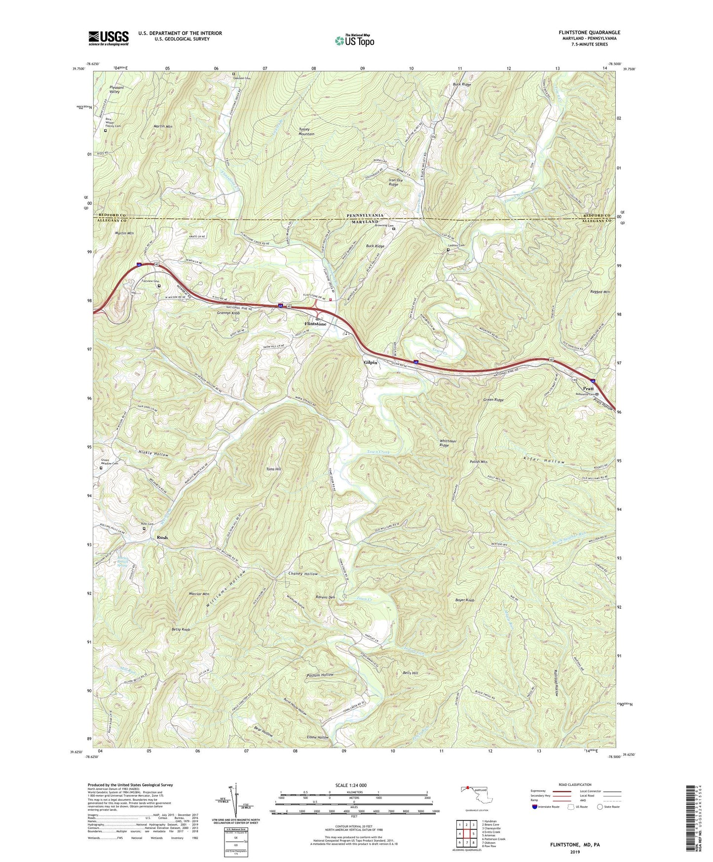
2023 topographic map quadrangle Flintstone in the states of Maryland, Pennsylvania. Scale: 1:24000. Based on the newly updated USGS 7.5' US Topo map series, this map is in the following counties: Allegany, Bedford. The map contains contour data, water features, and other items you are used to seeing on USGS maps, but also has updated roads and other features. This is the next generation of topographic maps. Printed on high-quality waterproof paper with UV fade-resistant inks.
Quads adjacent to this one:
West: Evitts Creek
Northwest: Hyndman
North: Beans Cove
Northeast: Chaneysville
East: Artemas
Southeast: Paw Paw
South: Oldtown
Southwest: Patterson Creek
Contains the following named places: Amorine Branch, Bear Hollow, Bedrock Quarry, Bells Hill, Betsy Knob, Boyer Knob, Browning Cemetery, Buck Ridge, Burnt House Hollow, Burnt Mills Trail, Chaney Hollow, Dickens Trail, District 3 Flintstone, Don Pleasant Dam, Elbow Hollow, Fairview Cemetery, Flintstone, Flintstone Census Designated Place, Flintstone Creek, Flintstone Creek School, Flintstone Elementary School, Flintstone Post Office, Flintstone United Methodist Church, Flintstone Volunteer Fire Company, Gilpin, Glendale Church, Grannys Knob, Green Meadow Cemetery, Green Ridge, Gum Spring Trail, Hinkle Hollow, Indian Lick, Iron Ore Ridge, Lashley Cemetery, Laurel Branch, Lick Run, Martin Mountain, Maryland Natural Resource Police Western Region Town Hill Office, Milkhouse Hollow, Murley Branch, Murley Branch Spring, Oakdale Cemetery, Oakdale Church, Paradise Church, Pleasant Valley, Polish Mountain, Possum Hollow, Pratt, Rainbow Lake, Ravens Den, Rice - Wilson Family Cemetery, Robinette Cemetery, Rush, Rush Baptist Church, Rush Cemetery, Toms Hill, Town Creek, Whittaker Ridge, Wigfield Trail, Williams Hollow, ZIP Code: 21530