MyTopo
Hyndman Pennsylvania US Topo Map
Couldn't load pickup availability
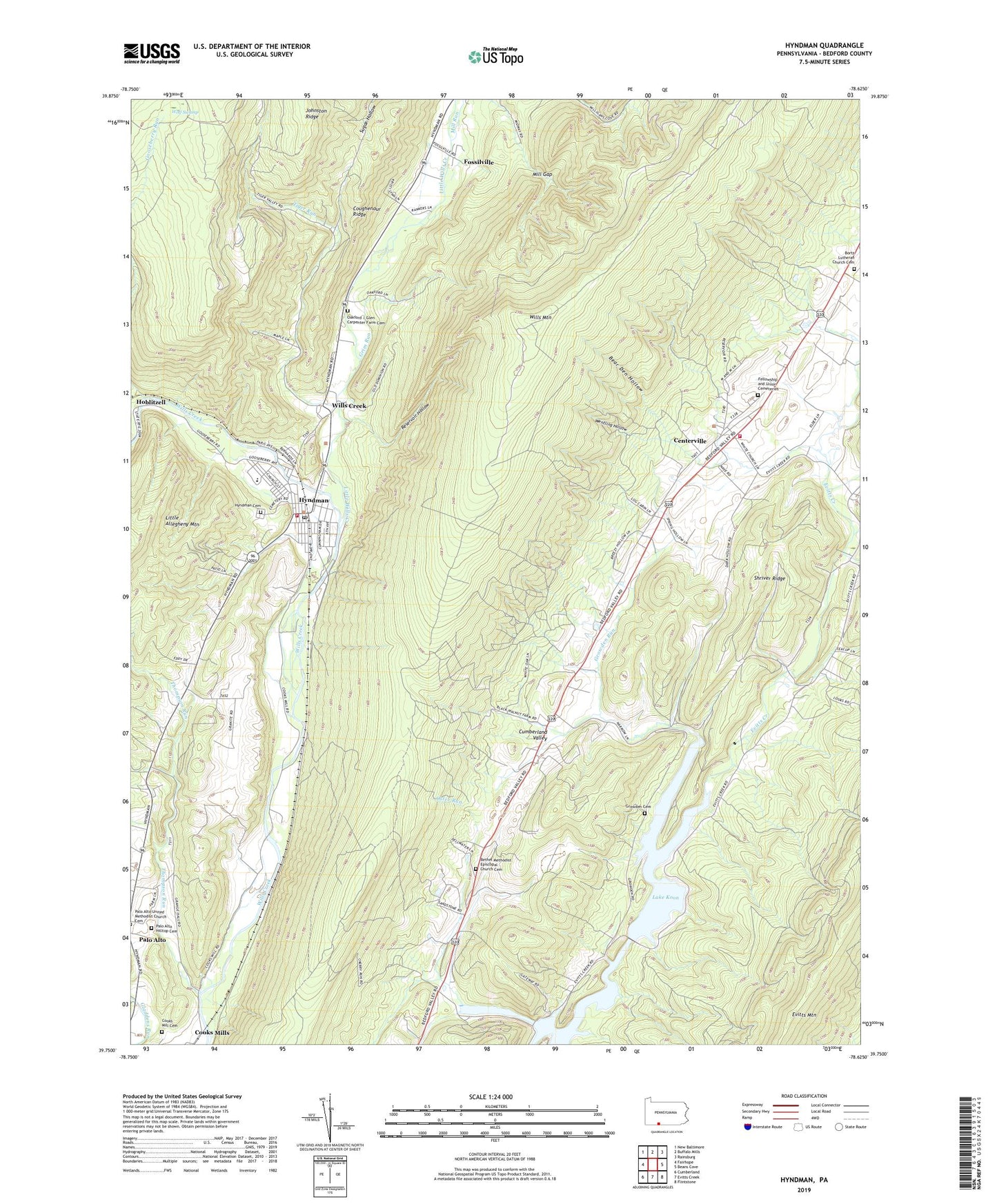
2023 topographic map quadrangle Hyndman in the state of Pennsylvania. Scale: 1:24000. Based on the newly updated USGS 7.5' US Topo map series, this map is in the following counties: Bedford. The map contains contour data, water features, and other items you are used to seeing on USGS maps, but also has updated roads and other features. This is the next generation of topographic maps. Printed on high-quality waterproof paper with UV fade-resistant inks.
Quads adjacent to this one:
West: Fairhope
Northwest: New Baltimore
North: Buffalo Mills
Northeast: Rainsburg
East: Beans Cove
Southeast: Flintstone
South: Evitts Creek
Southwest: Cumberland
This map covers the same area as the classic USGS quad with code o39078g6.
Contains the following named places: Bear Den Hollow, Bedford Valley Post Office, Bethel Church, Bethel Methodist Episcopal Church Cemetery, Borough of Hyndman, Bortz Church, Bortz Lutheran Church Cemetery, Centerville, Cooks Mill Cemetery, Coughenour Ridge, Cruse, Cumberland Valley Elementary School, Cumberland Valley Township Fire Department - Station 45, Evitts, Fort Lookout School, Fossilville, Gooseberry Run, Grim Run, Growden Cemetery, Growden Run, Hoblitzell, Hydman Post Office, Hyndman, Hyndman Area Rescue Squad - Station 14, Hyndman Cemetery, Hyndman Middle Senior High School, Hyndman Volunteer Fire Department - Station 34, Kennel School, Lake Gordon, Lake Koon, Little Wills Creek, Londonderry Intermediate Elementary School, Manassas School, Mill Gap, Mill Run, Mineral Spring School, Oakford Cemetery, Old Mail Trail, Oster Run, Palo Alto Hilltop Cemetery, Reservoir Hollow, Schaffer School, Shriver Ridge, Thomas W Koon Dam, Thompson Run, Tiger Run, Tiger Run School, Township of Cumberland Valley, Township of Londonderry, Union Cemetery, Wentling Hollow, Wills Creek, Wills Mountain, Wolf Swamp, Wolfords Gap