MyTopo
Nanticoke Maryland US Topo Map
Couldn't load pickup availability
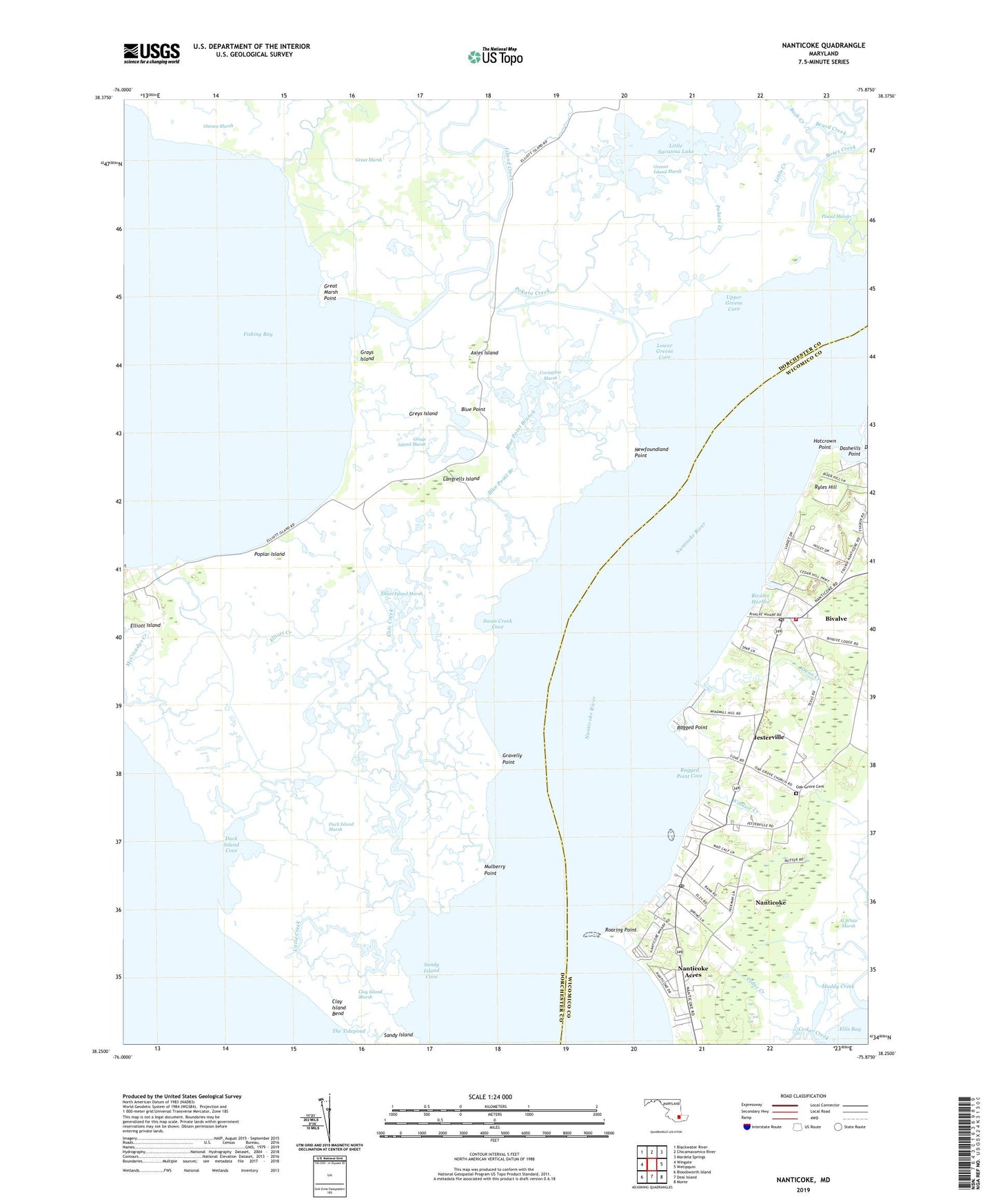
2019 topographic map quadrangle Nanticoke in the state of Maryland. Scale: 1:24000. Based on the newly updated USGS 7.5' US Topo map series, this map is in the following counties: Dorchester, Wicomico. The map contains contour data, water features, and other items you are used to seeing on USGS maps, but also has updated roads and other features. This is the next generation of topographic maps. Printed on high-quality waterproof paper with UV fade-resistant inks.
Quads adjacent to this one:
West: Wingate
Northwest: Blackwater River
North: Chicamacomico River
Northeast: Mardela Springs
East: Wetipquin
Southeast: Monie
South: Deal Island
Southwest: Bloodsworth Island
Contains the following named places: Al White Marsh, Asbury Church, Axies Island, Back Creek, Beard Creek, Bivalve, Bivalve Census Designated Place, Bivalve Harbor, Bivalve Post Office, Bivalve United Methodist Church, Blue Point, Blue Point Branch, Bozes Creek, Briar Patch, Broad Creek, Bull Run, Cedar Creek, Cedar Hill Park, Clay Island Bend, Clay Island Marsh, Covington Marsh, Cow Creek, Dasheills Point, District 12 Nanticoke, District 18 Elliott, Duck Island Cove, Duck Island Creek, Duck Island Marsh, Dunn Creek, Elliott, Elliott Creek, Elliott Island Marsh, Elzey Church, Fishing Bay Wildlife Management Area, Gravelly Point, Grays Island, Grays Island Marsh, Great Marsh, Great Marsh Point, Greens Island Marsh, Greys Island, Hatcrown Point, Irish Creek, Island Creek, Jacks Creek, Jesterville, Jesterville Census Designated Place, Langrells Creek, Langrells Island, Little Creek, Little Savanna Lake, Lower Greens Cove, Muddy Creek, Mulberry Point, Nanticoke, Nanticoke Acres, Nanticoke Acres Census Designated Place, Nanticoke Census Designated Place, Nanticoke Harbor, Nanticoke Post Office, Nanticoke United Methodist Church, Nanticoke Wharf, Newfoundland Creek, Newfoundland Point, Newfoundland Point Creek, Oak Grove Cemetery, Oystershell Creek, Pokata Creek, Poplar Island, Ragged Point, Ragged Point Cove, Roaring Point, Ryles Hill, Sandy Island Cove, Steelyard Creek, Swan Creek Cove, The Tidepond, Twin River Trailer Park, Upper Greens Cove, West Side Volunteer Fire Department Station 12, Wetipquin Creek, Windsor Creek, ZIP Code: 21814