
MyTopo
Pittsville Maryland US Topo Map
Couldn't load pickup availability
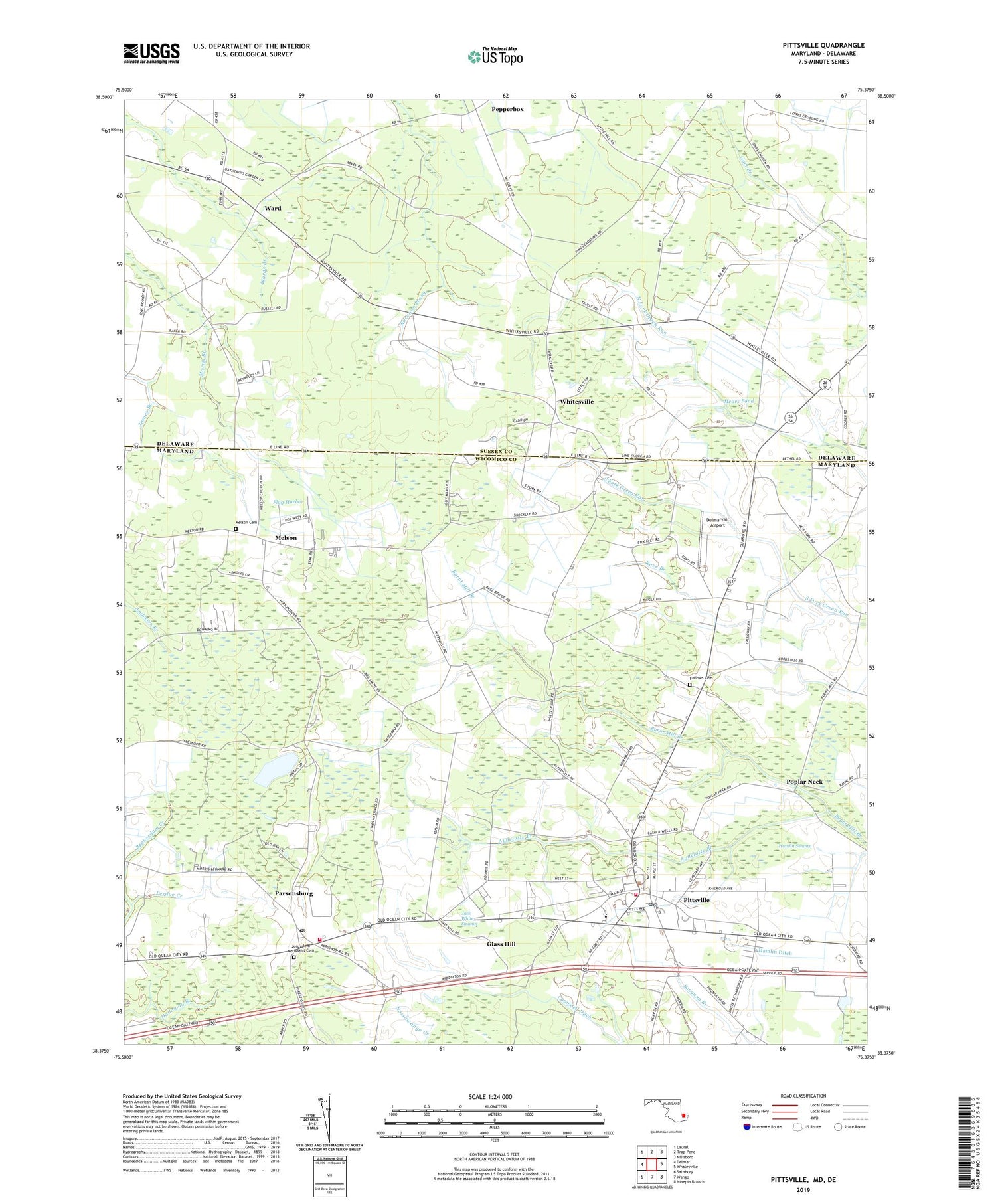
2019 topographic map quadrangle Pittsville in the states of Maryland, Delaware. Scale: 1:24000. Based on the newly updated USGS 7.5' US Topo map series, this map is in the following counties: Wicomico, Sussex. The map contains contour data, water features, and other items you are used to seeing on USGS maps, but also has updated roads and other features. This is the next generation of topographic maps. Printed on high-quality waterproof paper with UV fade-resistant inks.
Quads adjacent to this one:
West: Delmar
Northwest: Laurel
North: Trap Pond
Northeast: Millsboro
East: Whaleyville
Southeast: Ninepin Branch
South: Wango
Southwest: Salisbury
Contains the following named places: Aydelotte Branch, Ayres United Methodist Church, Beaver Run Business Center, Bethel United Methodist Church, Church of God of Prophecy, Delmarvair Airport, District 4 Pittsburg, East Winds, Eden United Methodist Church, Farlows Cemetery, Figgs Ditch, Flag Harbor, Gathering Tree Church, Glass Hill, Greenland, Hamlin Ditch, Hamlin Swamp, Hampton Court, Hearns, Jack White Swamp, Jerusalem Methodist Cemetery, Jerusalem United Methodist Church, Line Church, Melson, Melson Cemetery, Mount Calvary Holiness Church, Parsonsburg, Parsonsburg Census Designated Place, Parsonsburg Post Office, Parsonsburg Volunteer Fire Department Station 6, Pepperbox, Perdue Creek, Pittsville, Pittsville Elementary and Middle School, Pittsville Elementary School, Pittsville Manor, Pittsville Post Office, Pittsville Town Hall, Pittsville Volunteer Fire Department Station 7, Poplar Neck, Race Branch, Race Bridge, Rush Acres, Salisbury Mennonite Elementary School, Town of Pittsville, Ward, Whitesville, Wil-e-lew, ZIP Code: 21849


