
MyTopo
Trap Pond Delaware US Topo Map
Couldn't load pickup availability
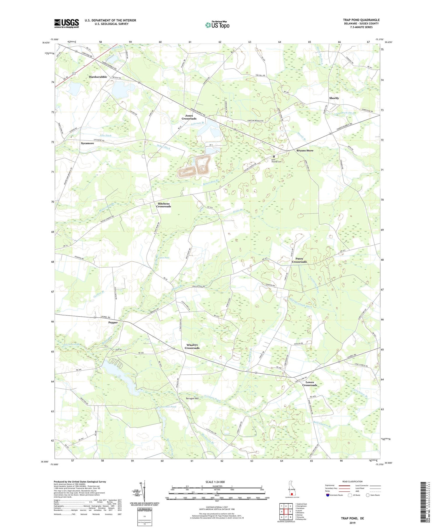
2023 topographic map quadrangle Trap Pond in the state of Delaware. Scale: 1:24000. Based on the newly updated USGS 7.5' US Topo map series, this map is in the following counties: Sussex. The map contains contour data, water features, and other items you are used to seeing on USGS maps, but also has updated roads and other features. This is the next generation of topographic maps. Printed on high-quality waterproof paper with UV fade-resistant inks.
Quads adjacent to this one:
West: Laurel
Northwest: Seaford East
North: Georgetown
Northeast: Harbeson
East: Millsboro
Southeast: Whaleyville
South: Pittsville
Southwest: Delmar
This map covers the same area as the classic USGS quad with code o38075e4.
Contains the following named places: Asketum Branch, Baker and West Ditch, Bethany Church, Bethesda Church, Bryans Store, Davis Pond Dam, Delmarva Christian Camp, Delmarva Peninsula, Dukes Ditch, Eastern Shore, Epworth Church, Epworth Fellowship Church, Grays Branch, Hardscrabble, Hill Savannah Ditch, Hitchens Crossroads, Homestead Mobile Home Park, Jobs Ditch, Jones Crossroads, Little Hill Church, Lowes Crossroads, Mount Olivet Church, Pepper, Pepper Branch, Pepper Pond, Pusey Crossroads, Raccoon Pond, Raccoon Prong, Ross Point School, Saint John American Methodist Episcopal Zion Church, Saint Thomas Cemetery, Saint Thomas Church, Saunders Branch, Shortly, Stoney Branch, Sycamore, Terrapin Hill, Terrapin Pond, Thompson Branch, Trap Pond, Trap Pond Dam, Trap Pond State Park, Trinity Church, Trussum Pond, Trussum Pond Dam, West Pond, Whaleys Crossroads, Woodcrest Estates, Workmans Corners


