MyTopo
Millsboro Delaware US Topo Map
Couldn't load pickup availability
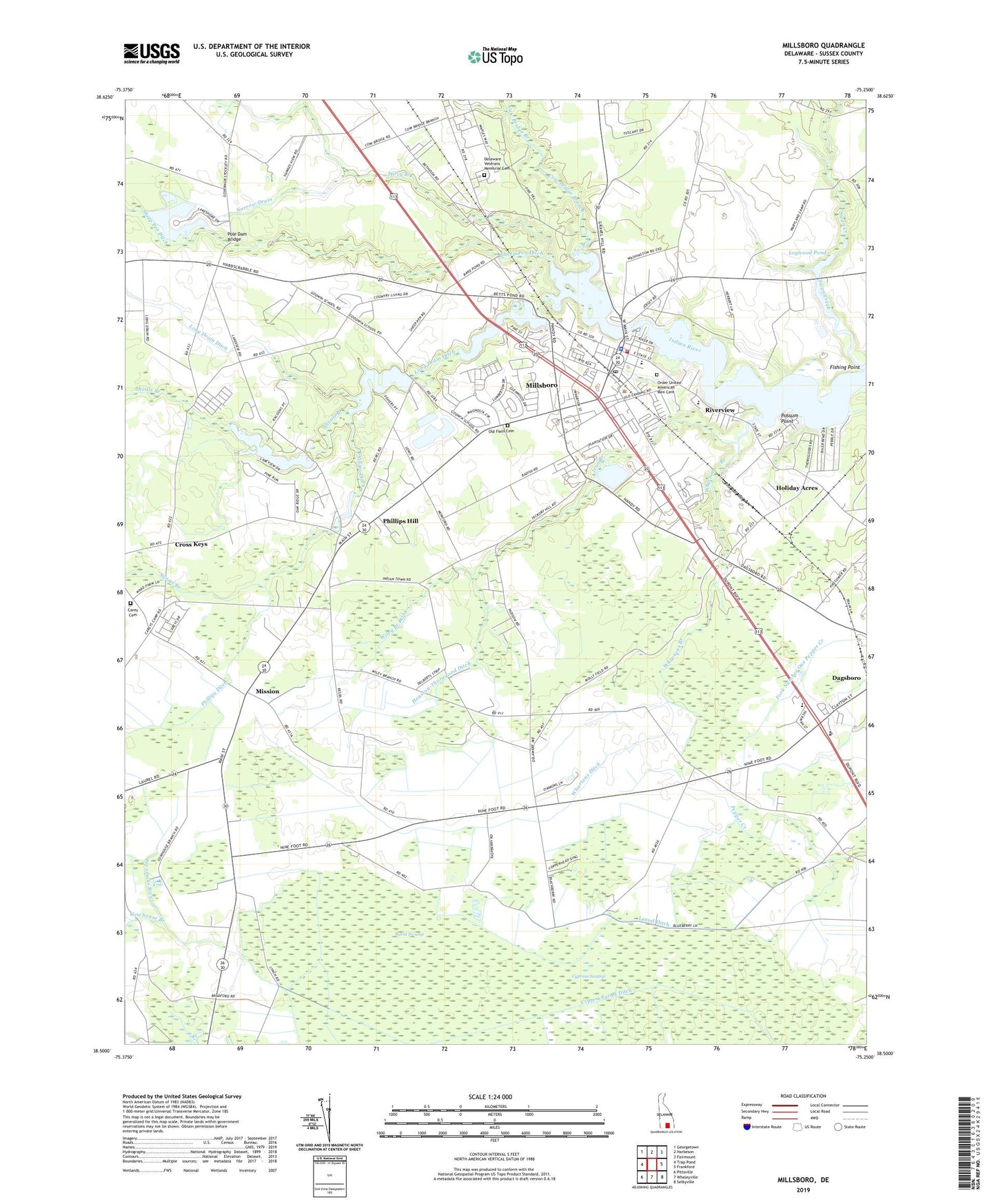
2023 topographic map quadrangle Millsboro in the state of Delaware. Scale: 1:24000. Based on the newly updated USGS 7.5' US Topo map series, this map is in the following counties: Sussex. The map contains contour data, water features, and other items you are used to seeing on USGS maps, but also has updated roads and other features. This is the next generation of topographic maps. Printed on high-quality waterproof paper with UV fade-resistant inks.
Quads adjacent to this one:
West: Trap Pond
Northwest: Georgetown
North: Harbeson
Northeast: Fairmount
East: Frankford
Southeast: Selbyville
South: Whaleyville
Southwest: Pittsville
This map covers the same area as the classic USGS quad with code o38075e3.
Contains the following named places: Askecksy, Bark Pond, Betts Pond, Burnt Swamp, Burton Acres, Carey Camp, Carey Cemetery, Carey Church, Careys Estate Mobile Home Park, Country Living Mobile Home Park, Cow Bridge, Cow Bridge Branch, Cowhouse Branch, Cross Keys, Cupola Park, Cypress Farms Ditch, Dagsboro Church, Dagsboro Church of Christ, Dagsboro Church of God, Dagsboro Hundred, Delaware Colony State Training School, Delaware Veterans Memorial Cemetery, Dickerson Chapel American Methodist Episcopal Church, East Millsboro Elementary School, Evans Park Mobile Home Park, Fishing Point, Forest Park Mobile Home Park, Grace United Methodist Church, Gumboro Hundred, Hickory Hill, Hickory Hill Church, Holiday Acres, Holiday Estates, Houston-Thorogood Ditch, Ingram Pond, Iron Branch, Kerseys Evergreen Acres, Lakeview Estates, Laurel Ditch, Logwood Pond, Long Drain Ditch, Mid Sussex Shopping Center, Millsboro, Millsboro Cemetery, Millsboro Division, Millsboro Fire Company, Millsboro Police Department, Millsboro Pond, Millsboro Post Office, Millsboro Public Library, Millsboro Town Center, Millsboro Town Square Shopping Center, Mirey Branch, Mission, Narrow Drain, Nentego Manor, New Holy Trinity Church of God in Christ, Oak Drive, Old Field Cemetery, Old Field Church, Old Landing, Pentecostal Church of God, Pentecostal Holiness Church, Phillips Ditch, Phillips Hill, Pine Lodge Addition, Pole Dam Bridge, Possum Point, Riverview, Saint Luke Baptist Church, Saint Marks Church, Sandy Beach, Shaft Ox Corner, Sheep Pen Ditch, Shoals Branch, Sunset Branch, Sussex Central Junior High School, Swan Creek, Tenfoot Ditch, Town of Millsboro, Town of Millsboro Sewage Treatment Plant, W B Atkins Memorial Park, Waples Pond, Wesleyan Church, West Woods Church, Whartons Branch, Whartons Ditch, Wiley Branch Ditch, ZIP Code: 19966