MyTopo
Ridgely Maryland US Topo Map
Couldn't load pickup availability
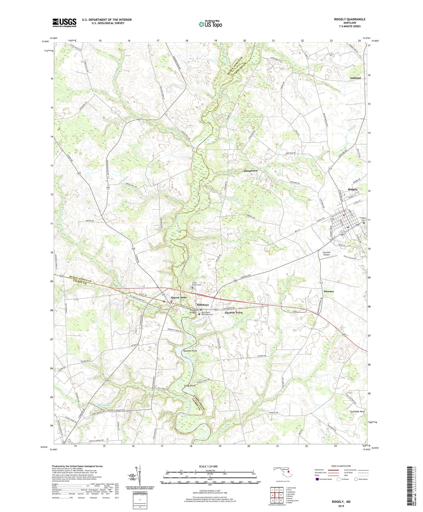
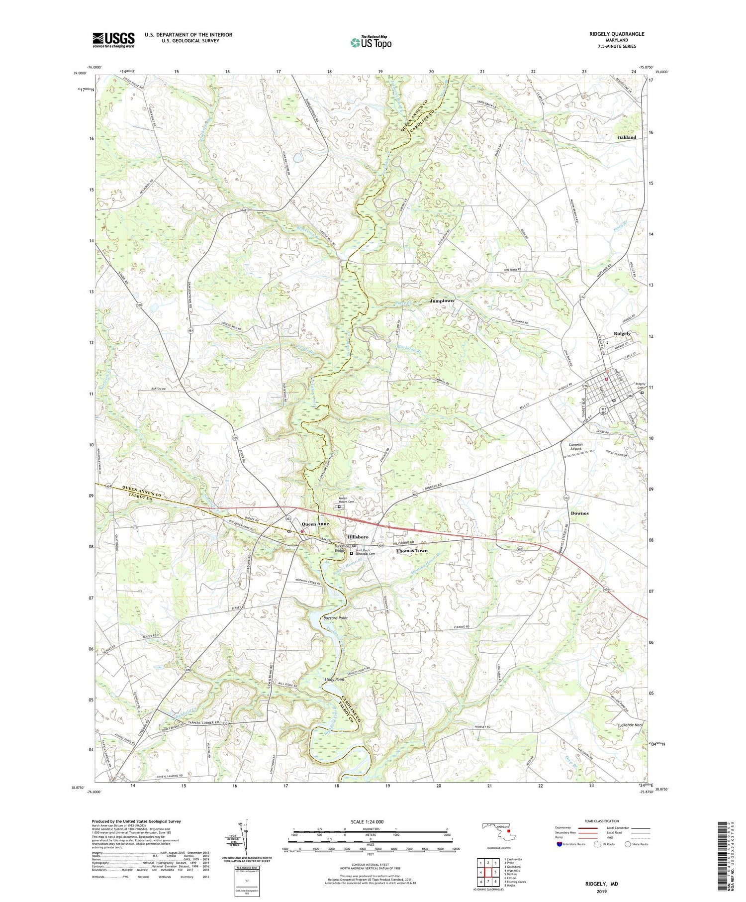
2019 topographic map quadrangle Ridgely in the state of Maryland. Scale: 1:24000. Based on the newly updated USGS 7.5' US Topo map series, this map is in the following counties: Caroline, Queen Anne's, Talbot. The map contains contour data, water features, and other items you are used to seeing on USGS maps, but also has updated roads and other features. This is the next generation of topographic maps. Printed on high-quality waterproof paper with UV fade-resistant inks.
Quads adjacent to this one:
West: Wye Mills
Northwest: Centreville
North: Price
Northeast: Goldsboro
East: Denton
Southeast: Hobbs
South: Fowling Creek
Southwest: Easton
Contains the following named places: Allan Church, Blackston Branch, Blockston Branch, Bradleysburg, Buckels Corner, Buzzard Point, Cannons Corner, Carmean Airport, Cordova, Cordova Elementary School, Cordova Park, District 6 Hillsboro, District 7 Ridgely, Downes, Fox Field, Gary Field Airport, Geary Millpond, Green Mount Cemetery, Highfield Creek, Hillsboro, Hillsboro Estates, Hillsboro Post Office, Hillsboro United Methodist Church, Horseshoe Estates, Immanuel Evangelical Lutheran Church, Ja-Mar, Jarmans Branch, Jumptown, Knotts Mill, Knotts Mill Pond, Martin Sutton Memorial Park, Mason Branch, Meadow Brook Airport, Meeting House Branch, Mill Run, Mitchell Corner, New Hope Baptist Church, Norwich Creek, Oakland, Obers Corner, Piney Branch, Queen Anne, Queen Anne - Hillsboro Volunteer Fire Company, Queen Anne Post Office, Queen Anne United Methodist Church, Ridgely, Ridgely Branch Library, Ridgely Cemetery, Ridgely Elementary School, Ridgely Police Department, Ridgely Post Office, Ridgely Railroad Station, Ridgely Town Hall, Ridgely Volunteer Fire Department Station 400, Rolph Landing, Roosevelt Park, Saint Pauls Episcopal Cemetery, Saint Pauls Episcopal Church, School House Branch, School Number 1, School Number 3, Scotts Branch, Stony Point, Stony Point Landing, Tappers Corner, Thawleys Chapel, The Caroline Center, The Church of Jesus Christ of Latter Day Saints, Thomas Town, Town of Hillsboro, Town of Queen Anne, Town of Ridgely, Trinity, Trinity Church, Tuckahoe Bridge, Tuckahoe Chapel, Tuckahoe Hundred, Tuckahoe Lake, Tuckahoe Shopping Center, Tuckahoe State Park, Tuckahoe State Park Dam, Uplands Holding Golf Course, Waljacks Corners, Wayman Wharf, ZIP Codes: 21641, 21657, 21660