MyTopo
Price Maryland US Topo Map
Couldn't load pickup availability
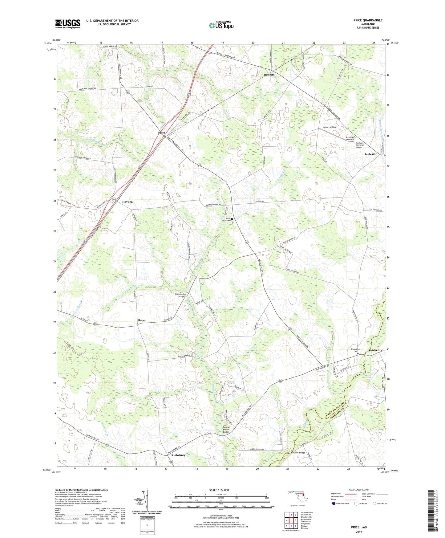
2023 topographic map quadrangle Price in the state of Maryland. Scale: 1:24000. Based on the newly updated USGS 7.5' US Topo map series, this map is in the following counties: Queen Anne's, Caroline. The map contains contour data, water features, and other items you are used to seeing on USGS maps, but also has updated roads and other features. This is the next generation of topographic maps. Printed on high-quality waterproof paper with UV fade-resistant inks.
Quads adjacent to this one:
West: Centreville
Northwest: Chestertown
North: Church Hill
Northeast: Sudlersville
East: Goldsboro
Southeast: Denton
South: Ridgely
Southwest: Wye Mills
This map covers the same area as the classic USGS quad with code o39075a8.
Contains the following named places: Apostolic Church of God, Benedictine School, Benedictine School for Exceptional Children, Bethany United Methodist Church, Bridgetown Cemetery, Bridgetown Church, Carter Farms, Clark Corners, Clucktown Bridge, Deans Meadows, District 6 Ruthsburg, Eastern Correctional Camp, Eastern Pre-Release Unit, German Branch Bridge, Hayden, Hope, Ingleside, Ingleside Post Office, Lyn Woods, Lynn Woods, Mason Bridge, Mount Olive Cemetery, Mount Olive Church, Myles Landing, Price, Price Post Office, Queen Annes County Home, Roberts, Rochester Memorial Garden, Roe, Ruthsburg, Saint Gertrude Academy, Saint Gertrudes Convent, Saint Paul United Methodist Church, The Plains, Tuckahoe State Park, Wildcat Branch, ZIP Code: 21623