MyTopo
Centreville Maryland US Topo Map
Couldn't load pickup availability
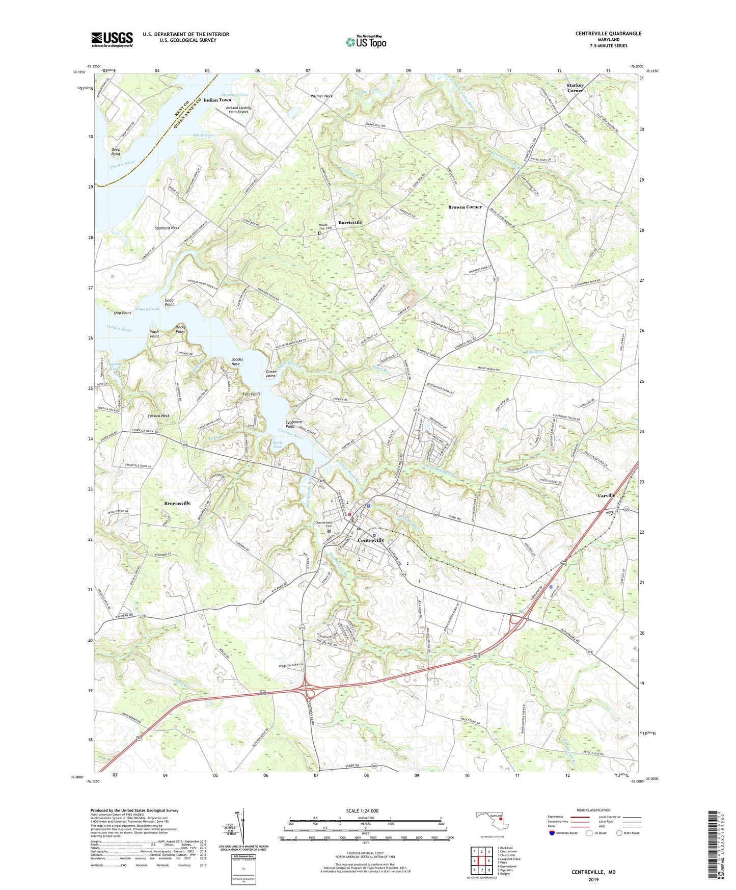
2023 topographic map quadrangle Centreville in the state of Maryland. Scale: 1:24000. Based on the newly updated USGS 7.5' US Topo map series, this map is in the following counties: Queen Anne's, Kent. The map contains contour data, water features, and other items you are used to seeing on USGS maps, but also has updated roads and other features. This is the next generation of topographic maps. Printed on high-quality waterproof paper with UV fade-resistant inks.
Quads adjacent to this one:
West: Langford Creek
Northwest: Rock Hall
North: Chestertown
Northeast: Church Hill
East: Price
Southeast: Ridgely
South: Wye Mills
Southwest: Queenstown
This map covers the same area as the classic USGS quad with code o39076a1.
Contains the following named places: Alder Branch, Ashland Landing, Ashland Landing Farm Airport, Bethel African Methodist Episcopal Church, Bethel Church, Browns Corner, Brownsville, Burrisville, Camp Gunston, Carville, Cedar Point, Centreville, Centreville Business Park, Centreville Elementary School, Centreville High School, Centreville Landing, Centreville Middle School, Centreville Police Department, Centreville Post Office, Centreville Town Hall, Centreville United Methodist Church, Charles Wesley United Methodist Church, Chesterfield Cemetery, Church Hill Airport, Church of God, Conquest Beach, Corsica Hills Nursing Home, Corsica Landing, Corsica Landing Estates, Corsica Neck, Deep Point, Deerfield, District 3 Centreville, Earle Chapter Church, Earle Cove, Earle Creek, Earles Branch, Emory Creek, Epworth Methodist Church, Fort Point, Fort Point Station, Four-H Club Park, Goodwill Fire Company Station 4, Grace Methodist Church, Gravel Run, Green Point, Gunston School, Hunters Ridge, Indian Town, Jacobs Nose, Kennard Elementary School, Kimberly Park, Maryland Fire and Rescue Institute Upper Eastern Shore Regional Training Center, Maryland State Police - Barrack S Centreville, Memorial Park, Mezick Farm Pond Dam, Mill Stream Branch, Miller Creek, Millstream Park, Mother of Sorrows Roman Catholic Church, Mount Zion Cemetery, Mount Zion Church, Mummys Cove, Orchard View, Pusey Landing, Queen Annes Circle, Queen Anne's County, Queen Annes County Courthouse, Queen Annes County Free Library, Queen Anne's County High School, Queen Anne's County Sheriffs Office, Queen Anne's County Sheriff's Office, Queen Anne's Evening High School, Rocky Point, Route Eighteen Park, Saint Pauls Episcopal Church, Saint Pauls Memorial Church, Salem Church, Salem School, Ship Point, Shippen Creek, Spaniard Neck, Sparks Corner, Starkey Corner, Sycamore Point, Tall Timbers Estates, Three Bridges Branch, Tilghman Cove, Tilghmans Terrace, Town of Centreville, Wash Point, White Cove, Woodstream, Yellow Bank Stream, ZIP Code: 21617