MyTopo
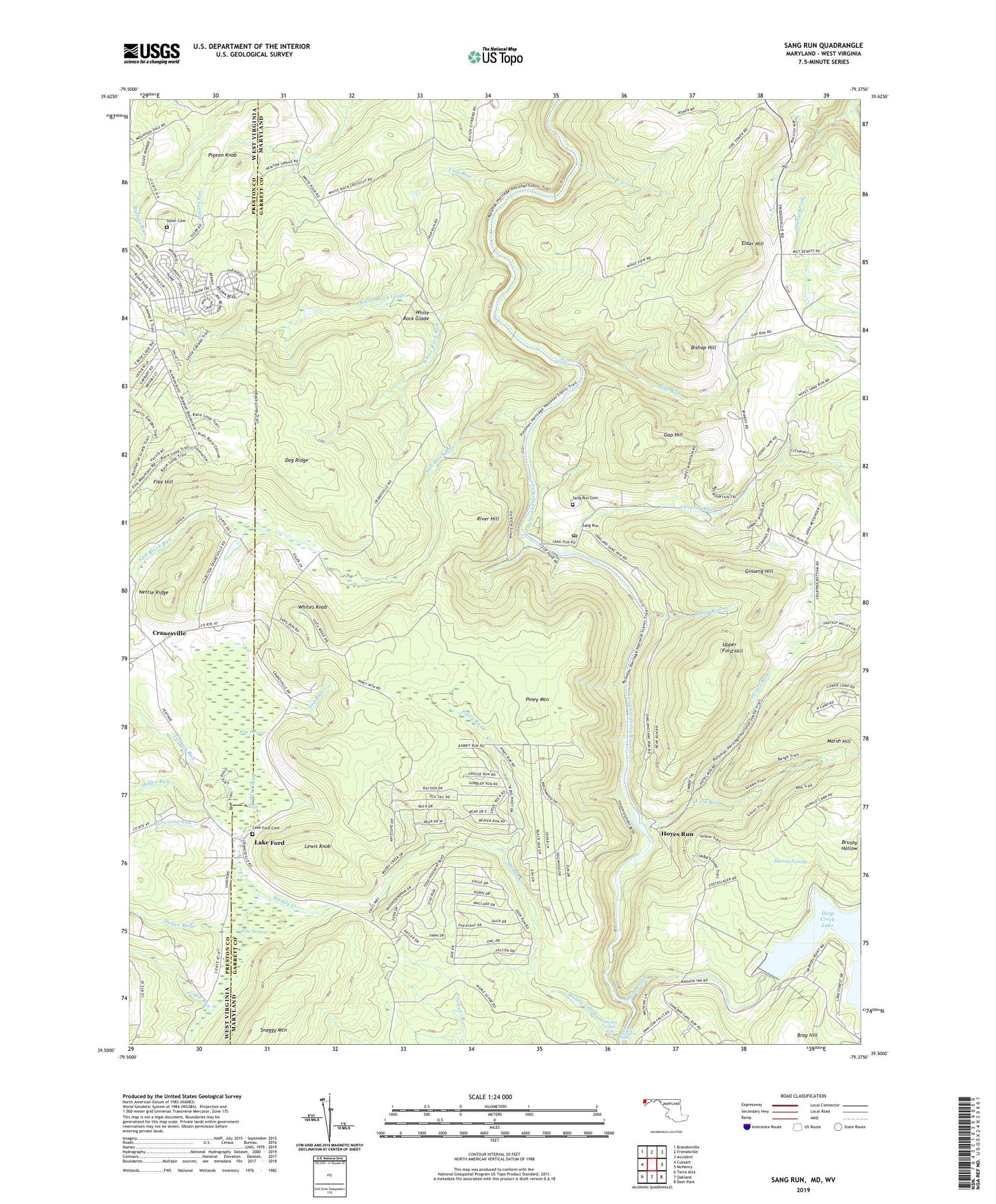
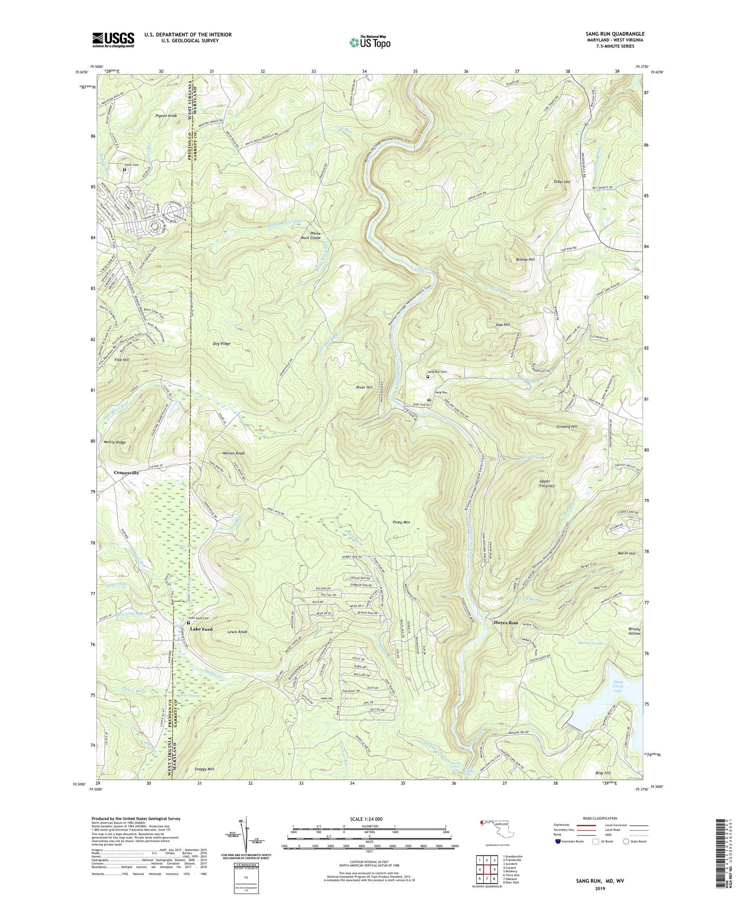
Sang Run Maryland US Topo Map
Couldn't load pickup availability
2019 topographic map quadrangle Sang Run in the states of Maryland, West Virginia. Scale: 1:24000. Based on the newly updated USGS 7.5' US Topo map series, this map is in the following counties: Garrett, Preston. The map contains contour data, water features, and other items you are used to seeing on USGS maps, but also has updated roads and other features. This is the next generation of topographic maps. Printed on high-quality waterproof paper with UV fade-resistant inks.
Quads adjacent to this one:
West: Cuzzart
Northwest: Brandonville
North: Friendsville
Northeast: Accident
East: McHenry
Southeast: Deer Park
South: Oakland
Southwest: Terra Alta
Contains the following named places: Bishop Hill, Bray Hill, Brew Mahr Mill, Browning Dam, Browning Dam Reservoir, Browning Mill, Browning Run, Cranesville, Cranesville School, Cranesville United Methodist Church, Cupp Run, Deep Creek, Deep Creek Hydro-Electric Dam, Deep Creek Quarry, Dog Ridge, Elder Hill, Elder School, Fork Run, Gap Falls, Gap Hill, Gap Run, Ginseng Hill, Ginseng Run, Hayes Run, Hoyes Quarry, Hoyes Run, Hoyes Run School, Lake Ford, Lake Ford Cemetery, Lake Ford United Methodist Church, Lewis Knob, Lower Swallow Falls, Lynn Dale School, Muddy Creek, Muddy Creek Falls, Murray Swamp, Ned Run, Nettle Ridge, Pigeon Knob, Pine Grove Church, Pine Swamp, Piney Mountain, Piney Run, River Hill, Salt Block Run, Sang Run, Sang Run Post Office, Sisler Cemetery, Steep Run, Stony Brook, Swallow Falls Church, Tankiln Run, Trap Run, Upper Ford Hill, Upper Sang Run Cemetery, White Oak Springs Run, White Rock Church, White Rock Glade, White Rock Run, Whites Knob, ZIP Code: 21541