MyTopo
Brandonville West Virginia US Topo Map
Couldn't load pickup availability
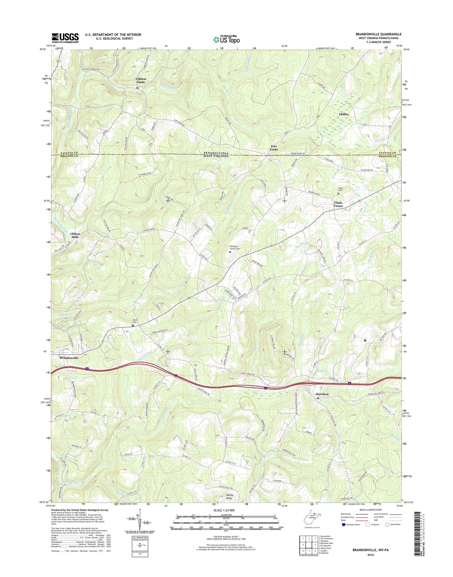
2023 topographic map quadrangle Brandonville in the states of West Virginia, Pennsylvania. Scale: 1:24000. Based on the newly updated USGS 7.5' US Topo map series, this map is in the following counties: Preston, Fayette. The map contains contour data, water features, and other items you are used to seeing on USGS maps, but also has updated roads and other features. This is the next generation of topographic maps. Printed on high-quality waterproof paper with UV fade-resistant inks.
Quads adjacent to this one:
West: Bruceton Mills
Northwest: Brownfield
North: Fort Necessity
Northeast: Ohiopyle
East: Friendsville
Southeast: Sang Run
South: Cuzzart
Southwest: Valley Point
This map covers the same area as the classic USGS quad with code o39079f5.
Contains the following named places: Barnes Run, Beaver Creek, Brandonville, Brandonville United Methodist Church, Bruceton Mills Wildlife Management Area, Canaan Church, Canaan School, Cherry Run, Clifton Mills, Clifton Mills Union Church, Cuppert School, Elk Run, Federal Correctional Institution Hazelton, Fike Run, Five Forks, Gibbon Glade, Gibbon Glade Post Office, Glade Farms, Glade Farms United Methodist Church, Glades, Glover School, Guthrie School, Hazelton, Hazelton Post Office, Hazelton Union Church, Hog Run, Kelley Knob, Locust Grove School House, Locust Grove United Methodist Church, McCracken School, Mill Run, Old Brick Church, Piney Run, Pleasant Grove Cemetery, Saint Johns Evangelical Lutheran Church, Salem, Salem Church of the Brethren, Salem School, Shady Grove Church, Shafer School, Spurgeon School, Teets Cemetery, Union Cemetery, Wrights, Zar, ZIP Code: 15440