MyTopo
Tingles Island Maryland US Topo Map
Couldn't load pickup availability
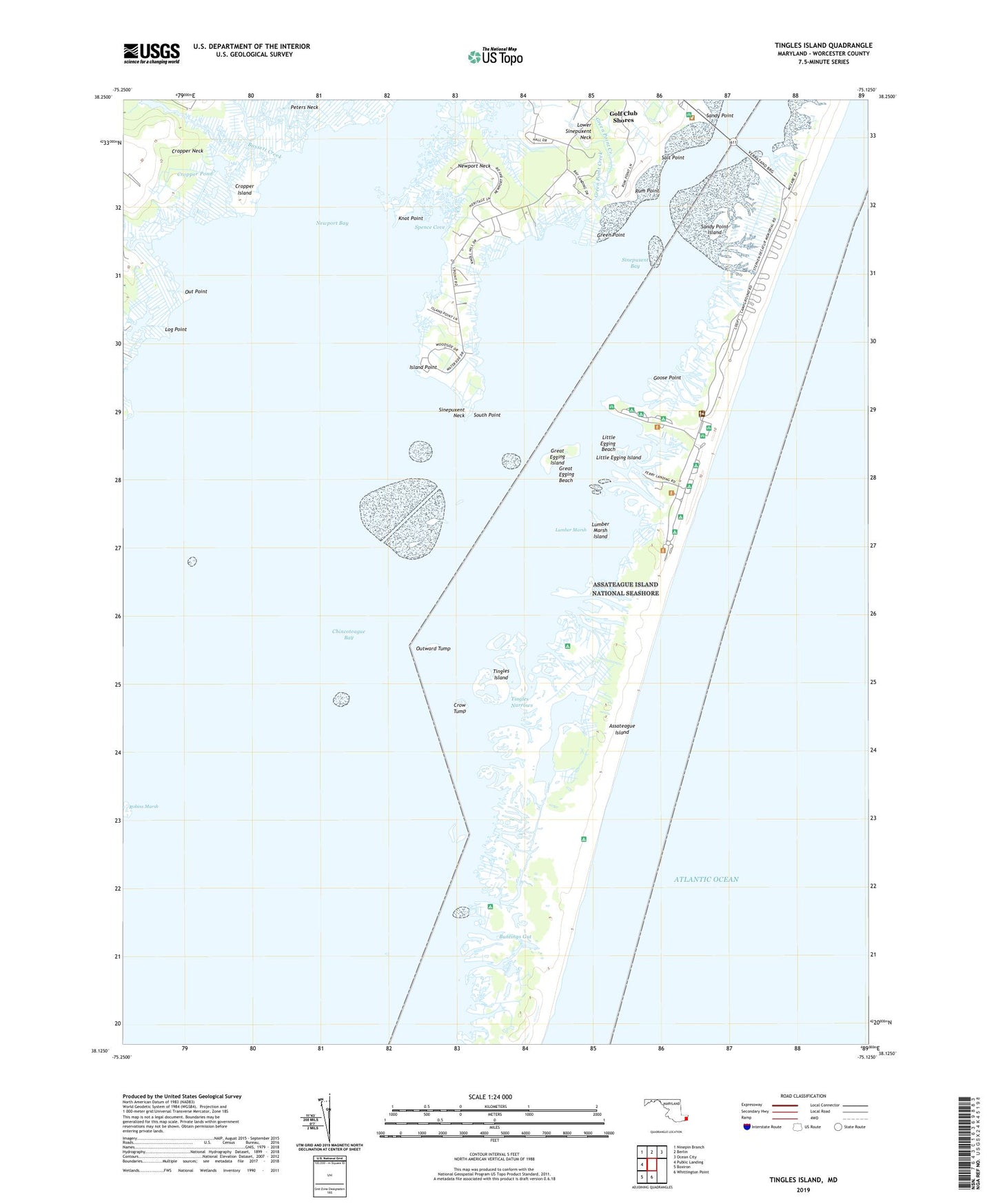
2023 topographic map quadrangle Tingles Island in the state of Maryland. Scale: 1:24000. Based on the newly updated USGS 7.5' US Topo map series, this map is in the following counties: Worcester. The map contains contour data, water features, and other items you are used to seeing on USGS maps, but also has updated roads and other features. This is the next generation of topographic maps. Printed on high-quality waterproof paper with UV fade-resistant inks.
Quads adjacent to this one:
West: Public Landing
Northwest: Ninepin Branch
North: Berlin
Northeast: Ocean City
South: Whittington Point
Southwest: Boxiron
This map covers the same area as the classic USGS quad with code o38075b2.
Contains the following named places: Assateague State Park, Bassett Creek, Bayside Campground, Beacon Clumps, Buntings Gut, Catbird Creek, Cropper Creek, Cropper Island, Cropper Pond, Crow Tump, District 10 Ocean City, District 3 Sinepuxent, Genezer Estates, Gibbs Pond, Goose Point, Great Egging Beach, Great Egging Island, Green Point, Green Point Creek, Island Point, Knot Point, Little Egging Beach, Little Egging Island, Log Point, Lower Sinepuxent Neck, Lumber Marsh, Lumber Marsh Island, Marshall Creek, Newport Bay, Newport Neck, Newport South, North Beach Campground, Out Point, Outward Tump, Peters Neck, Porter Creek, Robins Marsh, Rum Point, Rum Pointe Golf Course, Salt Point, Sandy Point, Sandy Point Island, South Point, Spence Cove, Tingles Island, Tingles Narrows, Winter Quarter