MyTopo
Becket Massachusetts US Topo Map
Couldn't load pickup availability
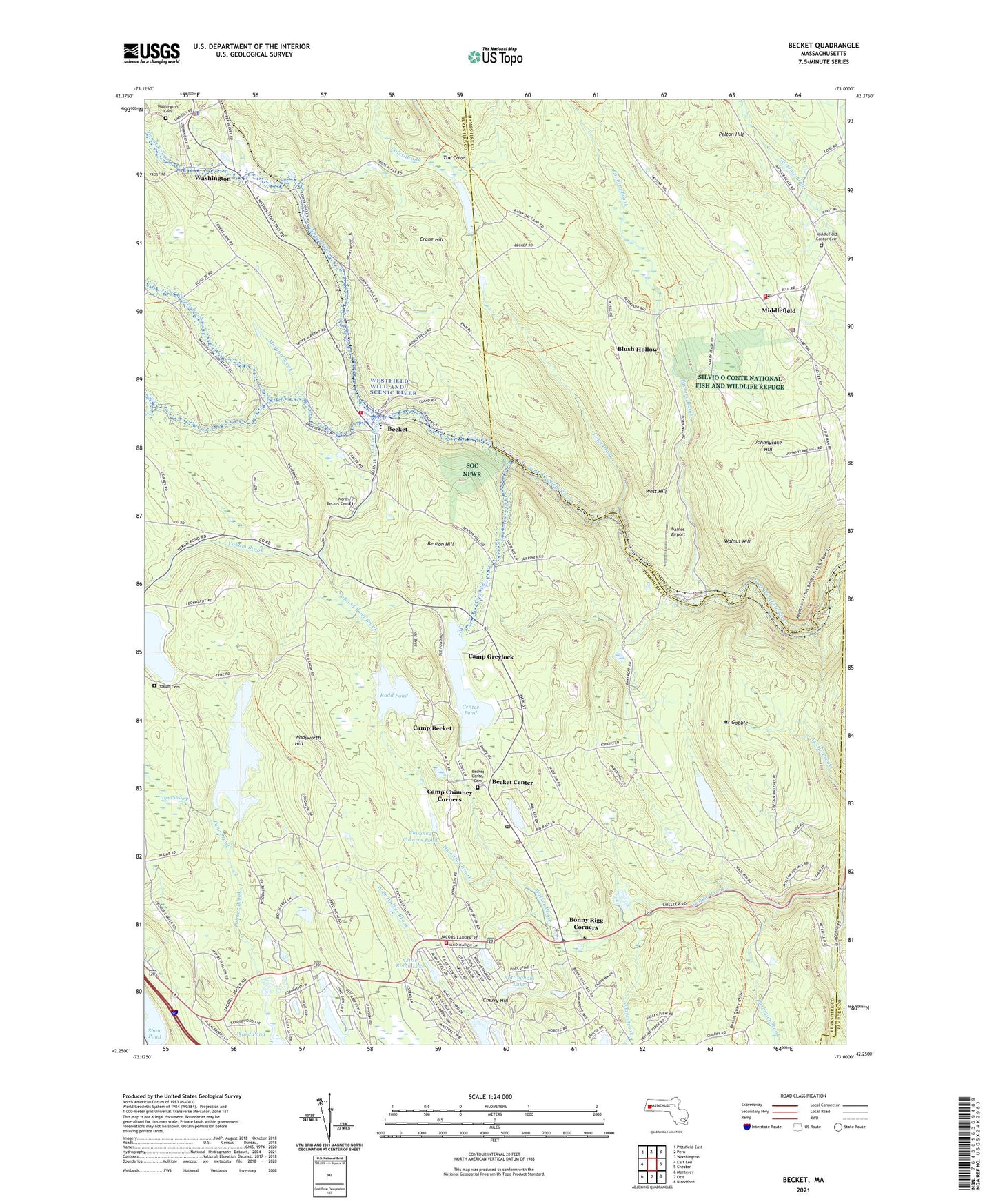
2021 topographic map quadrangle Becket in the state of Massachusetts. Scale: 1:24000. Based on the newly updated USGS 7.5' US Topo map series, this map is in the following counties: Berkshire, Hampshire, Hampden. The map contains contour data, water features, and other items you are used to seeing on USGS maps, but also has updated roads and other features. This is the next generation of topographic maps. Printed on high-quality waterproof paper with UV fade-resistant inks.
Quads adjacent to this one:
West: East Lee
Northwest: Pittsfield East
North: Peru
Northeast: Worthington
East: Chester
Southeast: Blandford
South: Otis
Southwest: Monterey
Contains the following named places: Baines Airport, Bancroft, Becket, Becket Arts Center, Becket Athenaeum, Becket Center, Becket Center Historic District, Becket Consolidated School, Becket Fire Department Station 1, Becket Fire Department Station 2, Becket Police Department, Becket Post Office, Becket State Forest, Becket Town Hall, Benton Hill, Blush Hollow, Bonny Rigg Corners, Camp Becket, Camp Chimney Corners, Camp Greylock, Center Pond, Center Pond Dam, Cherry Hill, Chimney Corners Pond, Chimney Corners Pond Dam, Coles Brook, Crane Hill, Cushman Brook, Depot Brook, Factory Brook, First Congregational Church, Golden Fawn Lake, Great Barrington State Forest, Hamilton Brook, Horn Pond, Indian Lake Estates, Jacobs Pillow School and Theater, Johnnycake Hill, Little Robin Hood Lake Dam, Little Robin Lake, Long Bow Lake, Middlefield, Middlefield Center Cemetery, Middlefield Fire Department, Middlefield Police Department, Middlefield Post Office, Middlefield School, Middlefield State Forest, Morgan Brook, Mount Gobble, Mount Saint Lawrence Novitiate, Murray Pond Dam, North Becket Village Historic District, Nottingham Lake, Palmer Brook, Palmer Brook Dam, Palmer Brook Reservoir, Pelton Hill, Robin Hood Lake Dam, Rudd Pond, Rudd Pond Brook, Rudd Pond North Dam, Savery Brook, Shaker Mill Brook, Shaw Pond, Spark Brook, The Cove, Town of Becket, Town of Middlefield, Tyne Brook, Wadsworth Hill, Walnut Hill, Washington, Washington Cemetery, Washington Fire Department, Washington Police Department, Washington School, Watson Brook, West Branch Walker Brook, West Hill, Yokum Brook, Yokum Pond, Yokum Pond Dam, ZIP Codes: 01223, 01243