MyTopo
Blandford Massachusetts US Topo Map
Couldn't load pickup availability
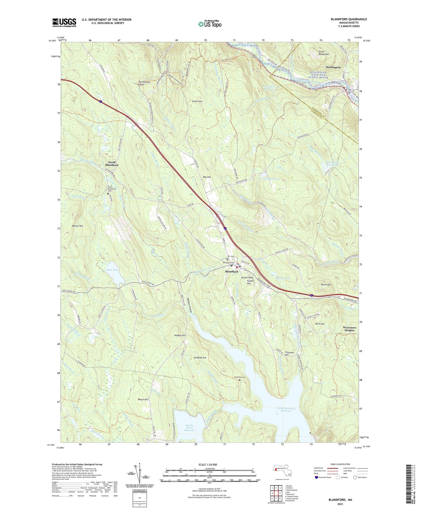
2024 topographic map quadrangle Blandford in the state of Massachusetts. Scale: 1:24000. Based on the newly updated USGS 7.5' US Topo map series, this map is in the following counties: Hampden, Hampshire. The map contains contour data, water features, and other items you are used to seeing on USGS maps, but also has updated roads and other features. This is the next generation of topographic maps. Printed on high-quality waterproof paper with UV fade-resistant inks.
Quads adjacent to this one:
West: Otis
Northwest: Becket
North: Chester
Northeast: Westhampton
East: Woronoco
Southeast: Southwick
South: West Granville
Southwest: Tolland Center
This map covers the same area as the classic USGS quad with code k42072b7.
Contains the following named places: Beaver Pond, Beaver Pond Dam, Bedlam Brook, Beech Hill, Birch Hill, Birch Meadow Brook, Black Brook Dam, Black Brook Reservoir, Blair Pond, Blandford, Blandford Cemetery, Blandford Census Designated Place, Blandford Fire Department, Blandford Police Department, Blandford Post Office, Blandford Ski Area, Blandford Town Hall, Blanford Elementary School, Borden Brook, Borden Brook Reservoir, Borden Brook Reservoir Dam, Case Brook, Chester-Blanford State Forest, Cobble Mountain Reservoir, Cobble Mountain Reservoir Dam, Cochran Pond, Cold Brook, Dug Hill, Dunlap Pond, Dunlap Pond Dam, Falls Brook, First Congregational Church of Blandford, Freeland Brook, Gibbs Brook, Goldmine Brook, Great Moose Hill, Green Hill, Griffin Brook, Hayden Pond, Henry Brook, Huntington, Huntington Census Designated Place, Huntington Evangelical Church, Huntington Fire Department Main Station, Huntington Police Department, Huntington Post Office, Huntington Reservoir, Huntington Town Hall, Lloyd Brook, Middle Brook, Murrayfield Elementary Schol, North Blandford, North Blandford Cemetery, Nye Brook, Pebble Hill, Peebles Brook, Peebles Hollow, Phelon Brook, Pioneer Valley Assembly Church, Pixley Brook, Pond Brook, Pudding Hill, Richards Brook, Roaring Brook, Sugar Creek, Sunset Hill, Sunset Rock, Tannery Brook, Tarrot Hill, The Volcanic Crater, Tiffany Brook, Tillotson Hill, Town of Blandford, Walnut Hill, Warfield Cemetery, Watson Brook, Watson Park, Wheeler Brook, Wigwam Brook, ZIP Code: 01008