MyTopo
Peru Massachusetts US Topo Map
Couldn't load pickup availability
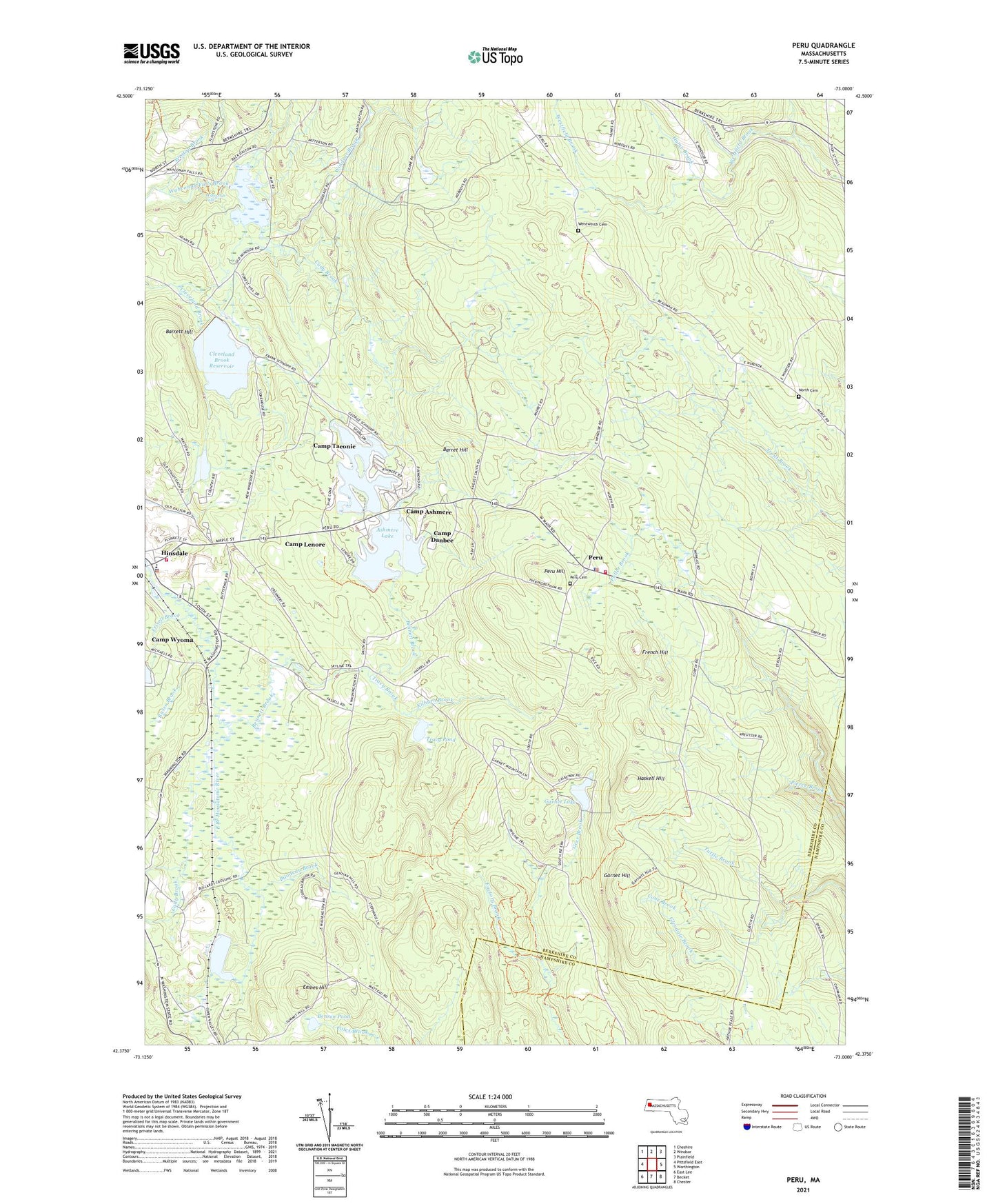
2024 topographic map quadrangle Peru in the state of Massachusetts. Scale: 1:24000. Based on the newly updated USGS 7.5' US Topo map series, this map is in the following counties: Berkshire, Hampshire. The map contains contour data, water features, and other items you are used to seeing on USGS maps, but also has updated roads and other features. This is the next generation of topographic maps. Printed on high-quality waterproof paper with UV fade-resistant inks.
Quads adjacent to this one:
West: Pittsfield East
Northwest: Cheshire
North: Windsor
Northeast: Plainfield
East: Worthington
Southeast: Chester
South: Becket
Southwest: East Lee
Contains the following named places: Ashmere Lake, Ashmere Lake Dam, Barret Hill, Barrett Hill, Bas-Ridge Country Club, Beechwood Estates, Bennett Brook, Benson Pond, Bilodeau Brook, Cady Brook, Camp Ashmere, Camp Danbee, Camp Lenore, Camp Taconic, Cleveland Brook Reservoir, Cleveland Brook Reservoir Dam, Cone Brook, Eames Hill, Frances Rice Wildlife Refuge, French Hill, Frisell Brook, Garnet Hill, Garnet Lake, Geer Brook, Haskell Hill, Hinsdale Fire Department, Hinsdale Flats Wildlife Management Area, Hinsdale Police Department, Hinsdale Town Hall, Hume Brook, Kilburn Brook, Kittredge School, Muddy Pond, North Cemetery, Peru, Peru Cemetery, Peru Fire Department, Peru Hill, Peru Police Department, Peru State Forest, Peru State Wildlife Management Area, Peru Wildlife Management Area, Pierce Brook, Russo Brook, Shaw Brook, Stritch Sculpture Garden, Town of Hinsdale, Town of Peru, Tracy Brook, Tracy Pond, Wahconah Falls, Wahconah Falls State Park, Weston Brook, Windsor Brook, Windsor Reservoir, Windsor Reservoir Dam, ZIP Code: 01235