MyTopo
Chatham Massachusetts US Topo Map
Couldn't load pickup availability
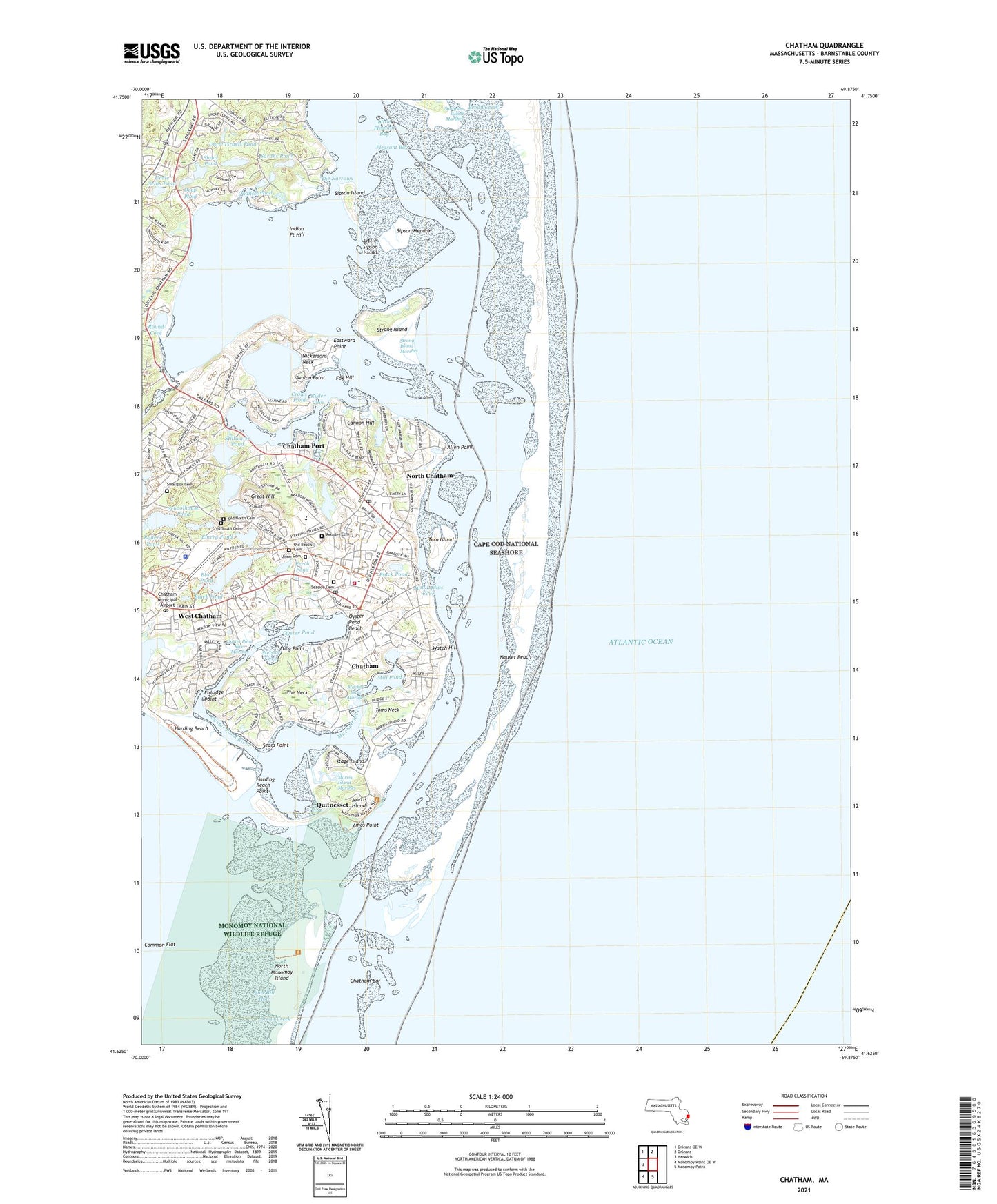
2021 topographic map quadrangle Chatham in the state of Massachusetts. Scale: 1:24000. Based on the newly updated USGS 7.5' US Topo map series, this map is in the following counties: Barnstable. The map contains contour data, water features, and other items you are used to seeing on USGS maps, but also has updated roads and other features. This is the next generation of topographic maps. Printed on high-quality waterproof paper with UV fade-resistant inks.
Quads adjacent to this one:
West: Harwich
Northwest: Orleans OE W
North: Orleans
South: Monomoy Point
Southwest: Monomoy Point OE W
Contains the following named places: Allen Point, Amos Point, Atwood House Museum, Aunt Lydias Cove, Avalon Point, Bassing Harbor, Bear Pond, Black Pond, Blue Bill Hole, Blue Pond, Broad Creek, Cannon Hill, Chatham, Chatham Aero Light, Chatham Bar, Chatham Census Designated Place, Chatham Fire and Rescue Department Station 1, Chatham Harbor, Chatham Lighthouse, Chatham Municipal Airport, Chatham Police Department, Chatham Port, Chatham Post Office, Chatham Railroad Museum, Chatham Roads, Chatham Station, Chatham United States Life Saving Station, Chatham Yacht Club, Common Flat, Crows Pond, Deep Pond, Eastward Ho Country Club, Eastward Point, Eldridge Point, Emery Pond, Fox Hill, Frost Fish Creek, Great Hill, Harding Beach, Harding Beach Point, Hog Island, Howes Wharf, Indian Fort Hill, Little Mill Pond, Little Pleasant Bay, Little Sipson Island, Long Point, Lovers Lake, Mill Pond, Mitchell River, Mitchell River Marshes, Monomoy Beach, Monomoy Regional Middle School, Morris Island, Morris Island Marshes, Muddy Creek, Nickersons Neck, North Chatham, North Chatham Heliport, North Chatham Post Office, North Monomoy Island, Old Baptist Cemetery, Old Burying Ground, Old Grist Mill, Old North Cemetery, Old South Cemetery, Oyster Pond, Oyster Pond Beach, Oyster Pond River, Oyster Pond River Marshes, Peoples Cemetery, Perch Pond, Pleasant Bay, Portanimicutt, Quanset Pond, Quitnesset, R C A Chatham Station, Round Cove, Ryder Cove, Sarahs Pond, Schoolhouse Pond, Sears Point, Seaside Cemetery, Shoal Pond, Sipson Island, Sipson Meadow, Smallpox Cemetery, Stage Harbor, Stage Harbor Light, Stage Island, Stetson Cove, Stillwater Pond, Strong Island, Strong Island Marshes, Tern Island, Tern Island Sanctuary, The Narrows, The Neck, Toms Neck, Town of Chatham, Uncle Israels Pond, Uncle Seths Pond, Union Cemetery, Watch Hill, West Chatham, West Chatham Census Designated Place, West Chatham Post Office, White Pond, ZIP Codes: 02633, 02650, 02669