MyTopo
Orleans OE W Massachusetts US Topo Map
Couldn't load pickup availability
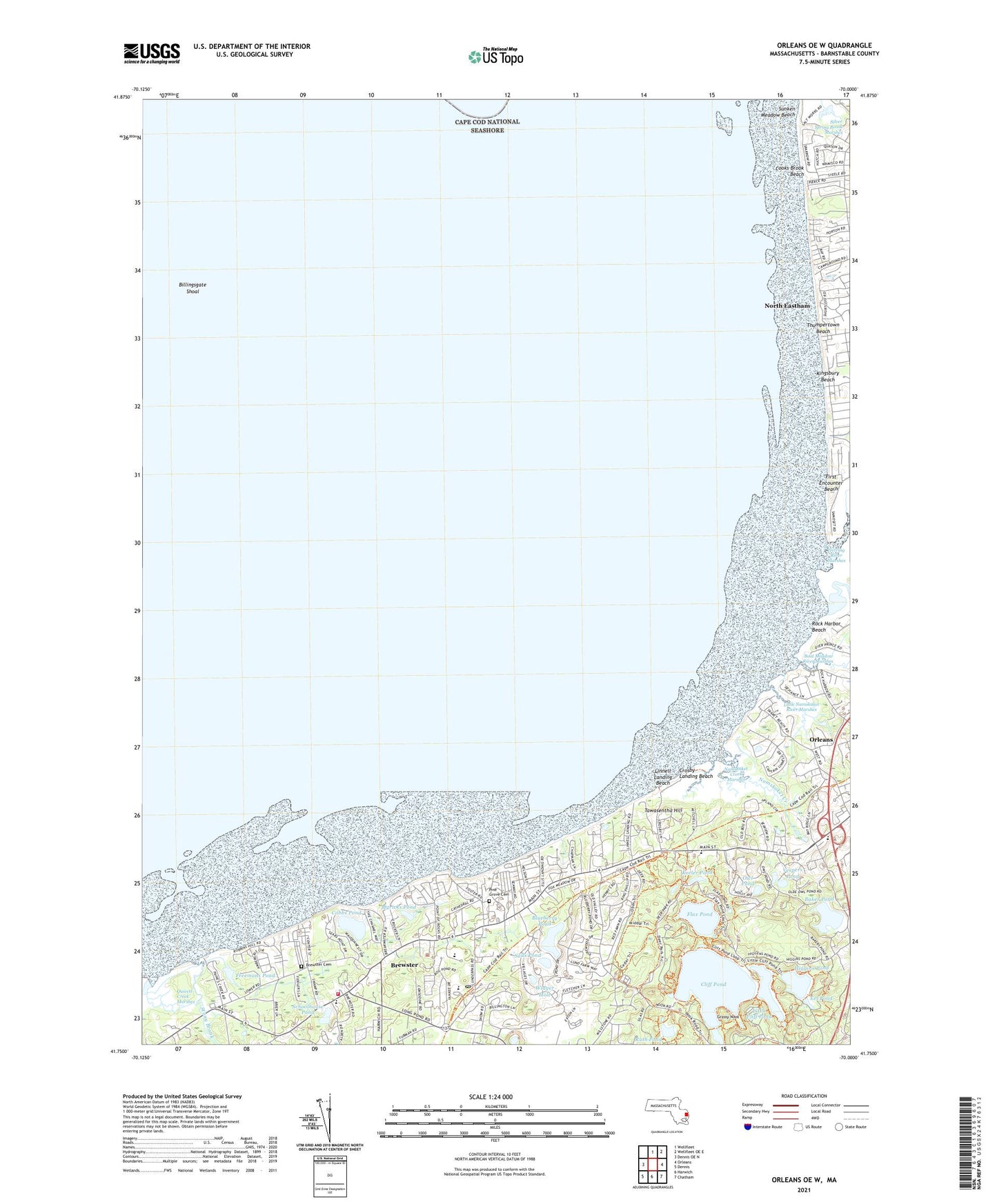
2024 topographic map quadrangle Orleans OE W in the state of Massachusetts. Scale: 1:24000. Based on the newly updated USGS 7.5' US Topo map series, this map is in the following counties: Barnstable. The map contains contour data, water features, and other items you are used to seeing on USGS maps, but also has updated roads and other features. This is the next generation of topographic maps. Printed on high-quality waterproof paper with UV fade-resistant inks.
Quads adjacent to this one:
West: Dennis OE N
North: Wellfleet
Northeast: Wellfleet OE E
East: Orleans
Southeast: Chatham
South: Harwich
Southwest: Dennis
Contains the following named places: Baker Pond, Bellingsgate Island, Billingsgate Shoal, Blueberry Pond, Boat Meadow River, Breakwater Landing, Brewster, Brewster Cemetery, Brewster Census Designated Place, Brewster County Club, Brewster Fire Department Station 1, Brewster Post Office, Brewster Station, Campground Landing, Cape Cod Bible Alliance Church, Cape Cod Museum of Natural History, Cape Cod Rail Trail, Captains Church, Clarks Point, Cliff Pond, Cobbs Point, Cobbs Pond, Cooks Brook Beach, Crosby Landing Beach, Drummer Boy Museum, East Brewster, Eastham Dunes, Eel Pond, Ellis Landing, Ellis Landing Beach, First Encounter Beach, Flax Pond, Freemans Pond, Friendship School, Grassy Nook, Grassy Nook Pond, Hatch Beach, Herring Brook, Herring River, Higgins Pond, Keeler Pond, Kingsbury Beach, La Salette Seminary, Linnell Landing Beach, Little Cliff Pond, Little Namskaket Creek, Little Namskaket River Marshes, Myricks Pond, Namskaket, Namskaket Creek, Namskaket Creek Marshes, Nickerson State Forest Park, North Eastham Census Designated Place, Old Higgins Windmill, Orleans Census Designated Place, Owl Pond, Paine's Creek Beach, Pine Grove Cemetery, Point of Rocks Landing, Point of Rocks Landing Beach, Quivett Creek, Quivett Creek Marshes, Quivett Neck, Robbins Hill Beach, Rock Harbor, Rock Harbor Beach, Rock Harbor Creek, Rock Harbor Range Light, Ruth Pond, Saints Landing Beach, Salls Pond, Schoolhouse Pond, Sealand of Cape Cod, Silver Spring Brook Marshes, Skaket Beach, Stony Brook, Sunken Meadow Beach, Sunken Meadows Marshes, Tawasentha Hill, The Cove, The Family School, Thumpertown Beach, Town Beach, Vespers Pond, Widger Hole, WKPE-AM (Orleans), WKPE-FM (Orleans), Woods Beach Rock, WVLC, Youth Forestry Camp, ZIP Code: 02651


