MyTopo
Monomoy Point Massachusetts US Topo Map
Couldn't load pickup availability
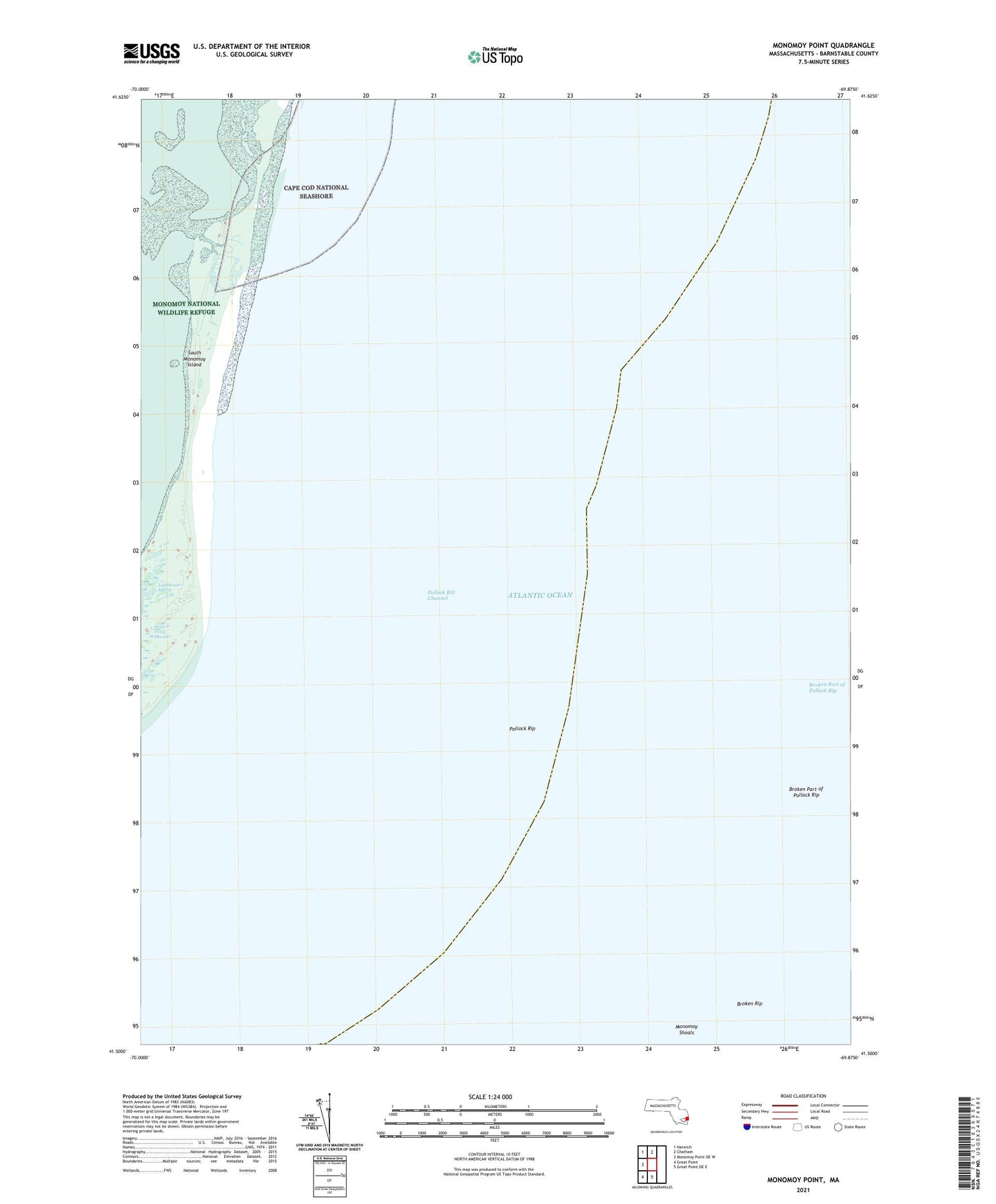
2024 topographic map quadrangle Monomoy Point in the state of Massachusetts. Scale: 1:24000. Based on the newly updated USGS 7.5' US Topo map series, this map is in the following counties: Barnstable. The map contains contour data, water features, and other items you are used to seeing on USGS maps, but also has updated roads and other features. This is the next generation of topographic maps. Printed on high-quality waterproof paper with UV fade-resistant inks.
Quads adjacent to this one:
West: Monomoy Point OE W
Northwest: Harwich
North: Chatham
South: Great Point OE E
Southwest: Great Point
This map covers the same area as the classic USGS quad with code o41069e8.
Contains the following named places: Barrier Dunes, Bearse Shoal, Blue Bill Hole, Broken Part of Pollock Rip, Broken Rip, Butler Hole, Hammonds Bend, Hospital Pond, Inward Point, Lighthouse Marsh, Monomoy Island, Monomoy Island Dunes, Monomoy National Wildlife Refuge, Monomoy Shoals, Monomoy Wilderness, Old Harbor, Pollock Rip, Pollock Rip Channel, Salls Drain, Schooner Bar, Shark Hole, Shooters Island, South Monomoy Island, Stone Horse Shoal, Trains Creek, Twelvefoot Shoal