MyTopo
East Lee Massachusetts US Topo Map
Couldn't load pickup availability
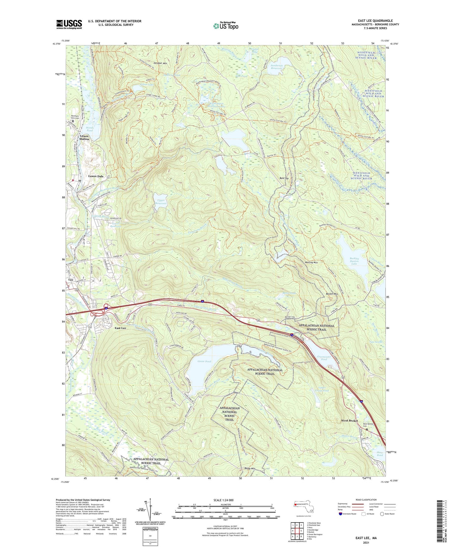
2021 topographic map quadrangle East Lee in the state of Massachusetts. Scale: 1:24000. Based on the newly updated USGS 7.5' US Topo map series, this map is in the following counties: Berkshire. The map contains contour data, water features, and other items you are used to seeing on USGS maps, but also has updated roads and other features. This is the next generation of topographic maps. Printed on high-quality waterproof paper with UV fade-resistant inks.
Quads adjacent to this one:
West: Stockbridge
Northwest: Pittsfield West
North: Pittsfield East
Northeast: Peru
East: Becket
Southeast: Otis
South: Monterey
Southwest: Great Barrington
Contains the following named places: Bald Top, Baldy Mountain, Basin Pond, Basin Pond Brook, Becket Mountain, Berkshire County, Berkshire Hills Baptist Church, Blueberry Hill Airport, Buckley Dunton Lake, Buckley Dunton Lake Dam, Bucksteep Cross-Country Ski Area, Clapp Pond, Codding Brook, Columbia Mill Dam, Commons Brook, Cooper Brook, East Lee, Felton Lake, Felton Lake Brook, Finerty Pond, Finerty Pond Dam, Gingerbread House, Golden Hill Nursery, Goose Pond, Goose Pond Brook, Goose Pond Dam, Greater Grace Church, Greenover Country Club, Greenwater Brook, Greenwater Pond, Greenwater Pond Dam, Halfway Pond, Higley Brook, Higley Brook Dam, Housatonic River Reservoir, Leahy Upper Reservoir Dam, Lee, Lee Elementary School, Lee High School, Lee Library Association, Lee Police Department, Lee Town Hall, Leisure Lee, Lenox Dale, Lenox Dale Census Designated Place, Lenox Dale Post Office, Lenox Fire Department Lenox Dale Station, Lenox Station, Lower Reservoir, Mad River, Mountain View Cemetery, Mud Pond, October Mountain, October Mountain State Forest, Riverside, Saint Andrews Chapel, Saint Georges Episcopal Church, Saint Marys School, Sandwash Reservoir, Sawmill Brook, Shales Brook, Town of Lee, Town of Washington, Tyne Swamp, Upper Goose Pond, Upper Reservoir, Walling Mountain, Washington Mountain Brook, Washington Mountain Lake, West Becket, Willow Brook, Woods Crossing Brook, Woods Pond, ZIP Codes: 01238, 01242