MyTopo
Hyannis OE S Massachusetts US Topo Map
Couldn't load pickup availability
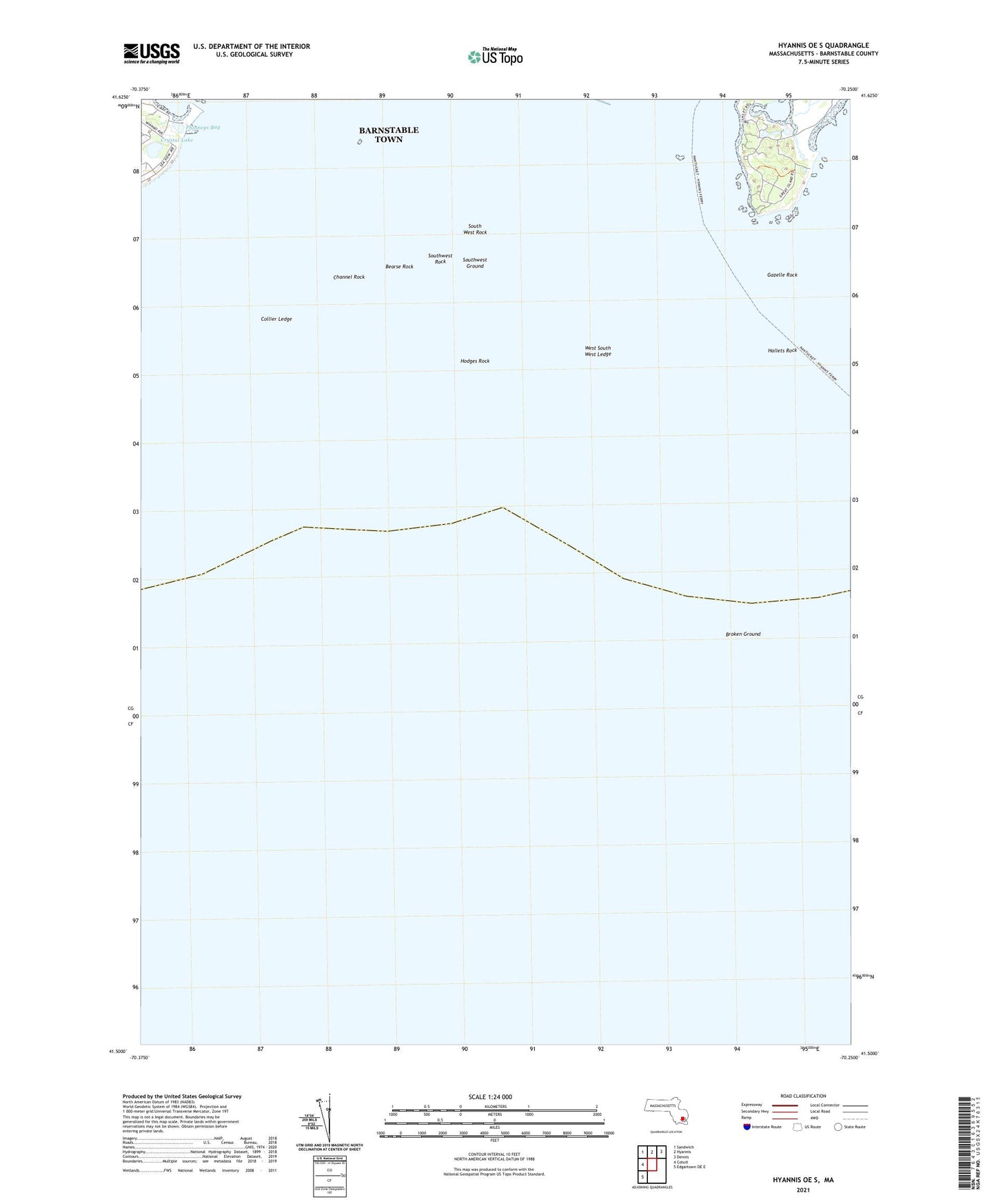
2024 topographic map quadrangle Hyannis OE S in the state of Massachusetts. Scale: 1:24000. Based on the newly updated USGS 7.5' US Topo map series, this map is in the following counties: Barnstable. The map contains contour data, water features, and other items you are used to seeing on USGS maps, but also has updated roads and other features. This is the next generation of topographic maps. Printed on high-quality waterproof paper with UV fade-resistant inks.
Quads adjacent to this one:
West: Cotuit
Northwest: Sandwich
North: Hyannis
Northeast: Dennis
Southwest: Edgartown OE E
Contains the following named places: Bearse Rock, Bishop and Clerks, Broken Ground, Channel Rock, Collier Ledge, Crystal Lake, Dead Neck Rock, Dowses Beach, Eddie Woods Rock, Gannet Ledge, Gannet Rocks, Gardiners Rock, Gazelle Rock, Great Island, Great Rock, Halftide Rock, Hallets Rock, Hodges Rock, Hyannis Breakwater Light, Middle Ledge, Osterville Point, Phinneys Bay, Point Gammon, South West Rock, Southwest Ground, Southwest Rock, The Spindle, Weequakut, West South West Ledge, Wianno Beach