MyTopo
Quabbin Reservoir Massachusetts US Topo Map
Couldn't load pickup availability
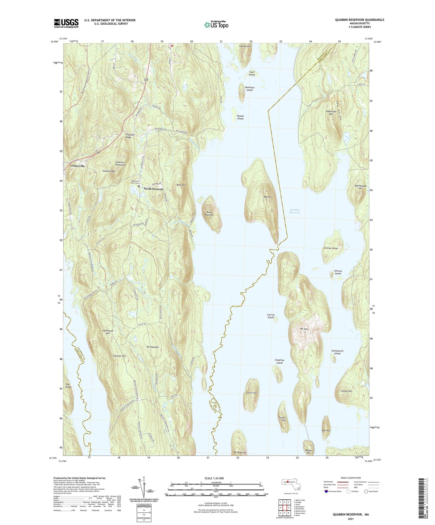
2021 topographic map quadrangle Quabbin Reservoir in the state of Massachusetts. Scale: 1:24000. Based on the newly updated USGS 7.5' US Topo map series, this map is in the following counties: Franklin, Worcester, Hampshire. The map contains contour data, water features, and other items you are used to seeing on USGS maps, but also has updated roads and other features. This is the next generation of topographic maps. Printed on high-quality waterproof paper with UV fade-resistant inks.
Quads adjacent to this one:
West: Shutesbury
Northwest: Millers Falls
North: Orange
Northeast: Athol
East: Petersham
Southeast: Ware
South: Winsor Dam
Southwest: Belchertown
Contains the following named places: Ash Pond, Baffle Dam, Bials Hill, Carrick Island, Chapman Island, Cooleyville, Curtis Hill, Curtis Pond, Dana, Dead Pond, Den Hill, East Branch Fever Brook, Egypt Brook, Fever Brook, Gibbs Pond, Greenwich Village, Hackmetack Pond, Hamilton Island, Hamilton Orchards, Hop Brook, Hop Brook Pond, Leveau Island, Lighthouse Hill, Millington, Mount L, Mount Pleasant, Mount Pomeroy, Mount Zion, Mountain View Cemetery, Nance Lake, Neeseponsett Pond, Nelson Island, New Salem Fire Department, North Dana, North Prescott, Packard Mountain, Parker Hill, Pitman Hill, Prescott, Prescott Center, Prescott Hill, Prescott Peninsula, Prescott Ridge, Purgee Brook, Quabbin Reservoir, Rattlesnake Hill, Russ Mountain, Russ Pond, School Hill, Shutesbury State Forest, Snell Island, Soapstone Hill, Southworth Island, Stevens Island, Sunk Pond, The Gorge, Thompson Pond, Town of New Salem, Turtle Pond, Underhill Brook, Walker Hill, West Branch Fever Brook, ZIP Code: 01355