MyTopo
Millers Falls Massachusetts US Topo Map
Couldn't load pickup availability
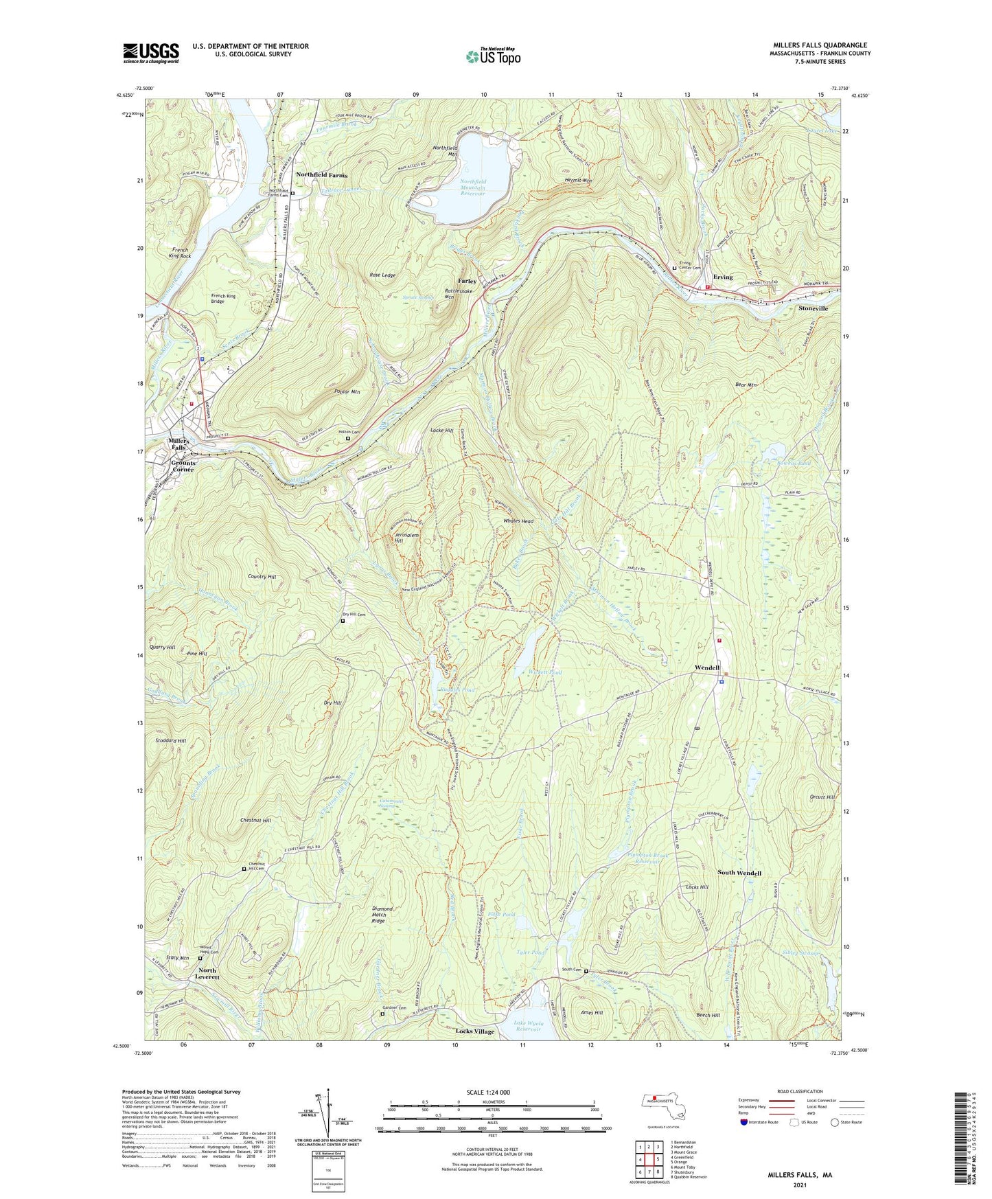
2024 topographic map quadrangle Millers Falls in the state of Massachusetts. Scale: 1:24000. Based on the newly updated USGS 7.5' US Topo map series, this map is in the following counties: Franklin. The map contains contour data, water features, and other items you are used to seeing on USGS maps, but also has updated roads and other features. This is the next generation of topographic maps. Printed on high-quality waterproof paper with UV fade-resistant inks.
Quads adjacent to this one:
West: Greenfield
Northwest: Bernardston
North: Northfield
Northeast: Mount Grace
East: Orange
Southeast: Quabbin Reservoir
South: Shutesbury
Southwest: Mount Toby
Contains the following named places: Ames Hill, Baker Brook, Bear Mountain, Beech Hill, Bowens Pond, Briggs Brook, Catamount Swamp, Chestnut Hill, Chestnut Hill Brook, Chestnut Hill Cemetery, Country Hill, Diamond Match Ridge, Dry Hill, Dry Hill Cemetery, Erving, Erving Elementary School, Erving Elementary School Library, Erving Fire Department Station 1, Erving Fire Department Station 2, Erving Police Department, Erving Post Office, Erving School, Erving Town Hall, Farley, Farley Post Office, Fiske Brook, Fiske Pond, Fiske Pond Dam, Fiske Pond Dike, Fourmile Brook, French King Bridge, French King Rock, Gardner Brook, Gardner Cemetery, Gate Hill Brook, Graham Pond Dam, Greenwood Farm, Grounts Corner, Hermit Mountain, Holton Cemetery, Jacks Brook, Jerusalem Hill, Lake Grove-Maple Valley School, Lake Myola Dam, Lake Wyola, Lake Wyola Reservoir, Leverett State Forest, Locke Hill, Locks Hill, Locks Village, Lyons Brook, McAvoy Dam, Millers Falls, Millers Falls Census Designated Place, Millers River, Montague State Forest, Mormon Hollow Brook, Mount Hope Cemetery, North Leverett, North Leverett Baptist Church, Northfield Farms, Northfield Farms Cemetery, Northfield Mountain, Northfield Mountain Reservoir, Northfield Mountain Reservoir Dam, Orcutt Hill, Packard Brook, Pine Hill, Pine Meadow Brook, Plympton Brook, Plympton Brook Reservoir, Poplar Mountain, Quarry Hill, Rattlesnake Mountain, Red Brook, Rose Ledge, Ruggles Pond, Ruggles Pond Dam, Schoolhouse Brook, Scots Brook, Sibley Swamp, South Cemetery, South Wendell, Spruce Swamp, Stacy Mountain, Stoddard Hill, Stoneville, Tailrace Tunnel, Town of Erving, Town of Wendell, Tyler Brook, Tyler Pond, Wendell, Wendell Fire Department, Wendell Police Department, Wendell Post Office, Wendell State Forest, Wendell Town Hall, Whales Head, Wickett Brook, Wickett Pond, Williams Brook, ZIP Codes: 01344, 01349, 01379