MyTopo
Winsor Dam Massachusetts US Topo Map
Couldn't load pickup availability
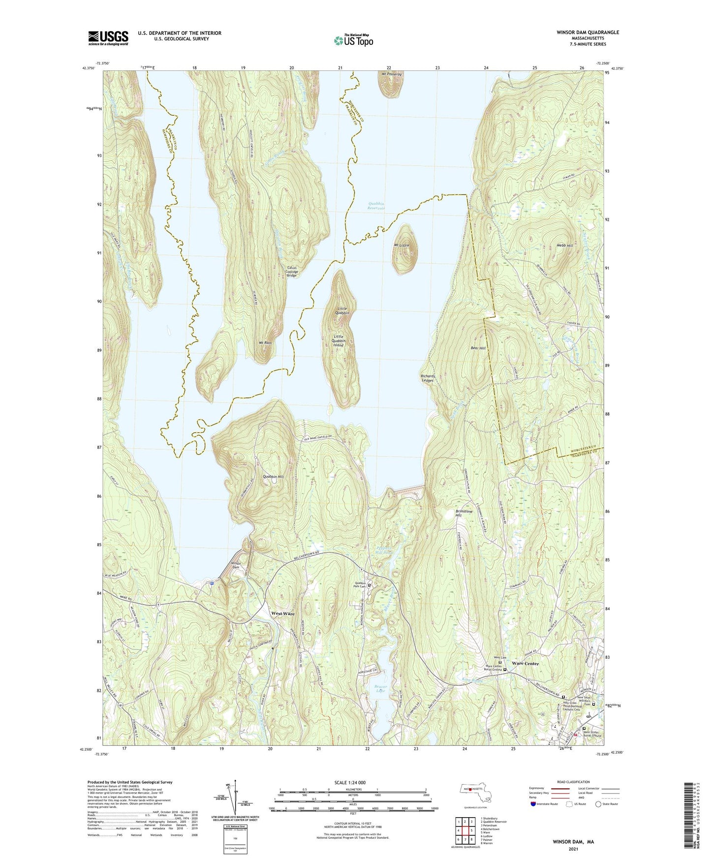
2024 topographic map quadrangle Winsor Dam in the state of Massachusetts. Scale: 1:24000. Based on the newly updated USGS 7.5' US Topo map series, this map is in the following counties: Hampshire, Worcester, Franklin. The map contains contour data, water features, and other items you are used to seeing on USGS maps, but also has updated roads and other features. This is the next generation of topographic maps. Printed on high-quality waterproof paper with UV fade-resistant inks.
Quads adjacent to this one:
West: Belchertown
Northwest: Shutesbury
North: Quabbin Reservoir
Northeast: Petersham
East: Ware
Southeast: Warren
South: Palmer
Southwest: Ludlow
This map covers the same area as the classic USGS quad with code o42072c3.
Contains the following named places: Bear Hill, Beaver Lake, Beaver Lake Dam, Beaver Lake Seaplane Base, Brimstone Hill, Cadwell Creek, Calvin Coolidge Bridge, Canterbury Brook, Chaffee Brook, Cold Spring Orchard, Davis Pond, East Branch Swift River, East Pond, Enfield, Flask Pond, Gibbs Brook, Goodnough Dike, Greenwich, Gulf Brook, Hooker School, Juda Dam, King Brook, Little Quabbin, Little Quabbin Island, Massachusetts State Police Station C7 Belchertown Barracks, Middle Branch Swift River, Morton Pond, Mount Lizzie, Mount Ram, Peppers Mill Pond, Peppers Mill Pond Dam, Phillips Plaza Shopping Center, Pilchs Number Three Dam, Prescott Brook, Quabbin Hill, Quabbin Park Cemetery, Quabbin Quabbin Park, Quabbin Spillway, Richards Ledges, Smiths, South Baffle Dam, Stanley M Koziol Elementary School, Sunk Brook, Sunk Pond, Swift River, Swift River Wildlife Management Area, Thurston Brook, Town of Ware, Ware Center, Ware Center Historic District, Ware Fire Department, Ware High School, Ware Post Office, Webb Hill, West Ware, Winsor Dam, ZIP Code: 01082