
MyTopo
Webster Massachusetts US Topo Map
Couldn't load pickup availability
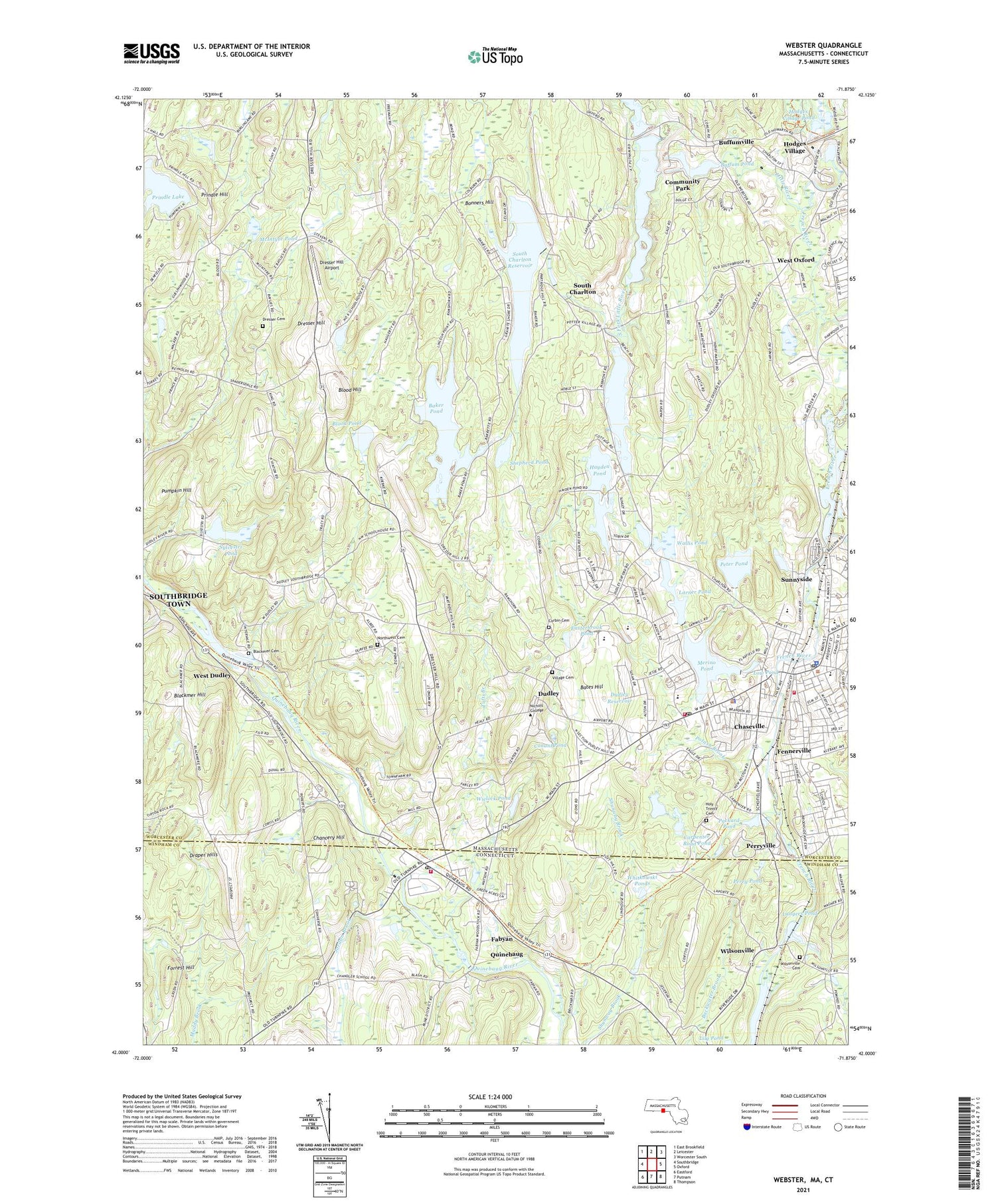
2021 topographic map quadrangle Webster in the states of Massachusetts, Connecticut. Scale: 1:24000. Based on the newly updated USGS 7.5' US Topo map series, this map is in the following counties: Worcester, Windham. The map contains contour data, water features, and other items you are used to seeing on USGS maps, but also has updated roads and other features. This is the next generation of topographic maps. Printed on high-quality waterproof paper with UV fade-resistant inks.
Quads adjacent to this one:
West: Southbridge
Northwest: East Brookfield
North: Leicester
Northeast: Worcester South
East: Oxford
Southeast: Thompson
South: Putnam
Southwest: Eastford
Contains the following named places: Abundant Life United Church, Anthony J Sitkowski School, Augutleback Pond, Baker Pond, Bartlett Junior-Senior High School, Bates Hill, Bible Fellowship Church, Blackmer Cemetery, Blackmer Hill, Blood Hill, Blood Pond, Bonners Hill, Buffum Pond, Buffumville, Buffumville Dam, Buffumville Lake, Cardinal Heights, Carpenter Road Dam, Carpenter Road Pond, Central Massachusetts SPED Collaborative School, Chancery Hill, Chaseville, Chester C Corbin Public Library, Christ Federated United Church, Church of Reconciliation, Community Park, Conant Library, Conant Pond, Corbin Cemetery, District Five Schoolhouse, Draper Hills, Dresser Cemetery, Dresser Hill, Dresser Hill Airport, Dudley, Dudley Charlton Regional School, Dudley Elementary School, Dudley Fire Department, Dudley Junior High School, Dudley Park N Shop, Dudley Plaza, Dudley Plaza Shopping Center, Dudley Police Department, Dudley Post Office, Dudley Reservoir, Dudley Town Hall, Easterbrook Pond, Emanuel Lutheran Church, Fabyan, Fabyan Post Office, Fennerville, First Baptist Church, First Congregational Church, Forrest Hill, French River Reservoir, Gordon Dam, Gore Pond Dam, Grand View Estates, Granite Reservoir Dam, Hayden Pond, Hodges Village, Hodges Village Dam, Hodges Village Pond, Holy Trinity Cemetery, Jordan Brook, Langers Pond, Langers Pond Dam, Larner Pond, Larner Pond Dam, Little River, Long Branch Brook, Low Pond, Lower Merino Pond Dam, Main Street Historic District, Mason Road School, McIntyre Pond, Meadowside Campground, Merino Pond, Merino Pond Dam, Merino Village, Mill Brook, New Pond, New Pond Dam, Nichols College, Nichols Golf Course, North Village, North Webster Village Pond Dam, Northwest Cemetery, Old Shepherd Pond, Old Shepherd Pond Dam, Packard Pond, Perry Pond, Perryville, Perryville Pond Dam, Peter Pond, Peter Pond Dam, Pierpoint Meadow Pond, Potash Brook, Prindle Hill, Prindle Lake, Pumpkin Hill, Quinebaug, Quinebaug Census Designated Place, Quinebaug Post Office, Quinebaug River Pond Dam, Quinebaug Volunteer Fire Department, Saint Anne Church, Saint Louis Church, Saint Louis School, Saint Stephens Church, Shepherd Hill Regional High School, Shepherd Pond, South Charlton, South Charlton Reservoir, South Fork Little River, South Village Pond Dam, Southern Worcester County Educational Collaborative School, Stocking Mill Dam, Sunnyside, Sylvestri Pond, Town of Dudley, Tufts Branch, Tufts Village, Village Cemetery, Wallis Pond, Wallis Pond Dam, Webster, Webster Fire Department Station 2, Webster Plaza Shopping Center, Webster Post Office, Webster Shopping Plaza Shopping Center, WESO-AM (Southbridge), West Dudley, West Oxford, Whitkowski Ponds, Wielock Pond, Wielock Pond Dam, Wilsonville, Wilsonville Cemetery, Wilsonville Heliport, WNRC-FM (Dudley), WQVR-FM (Southbridge), ZIP Codes: 01571, 06262


