MyTopo
Adair Michigan US Topo Map
Couldn't load pickup availability
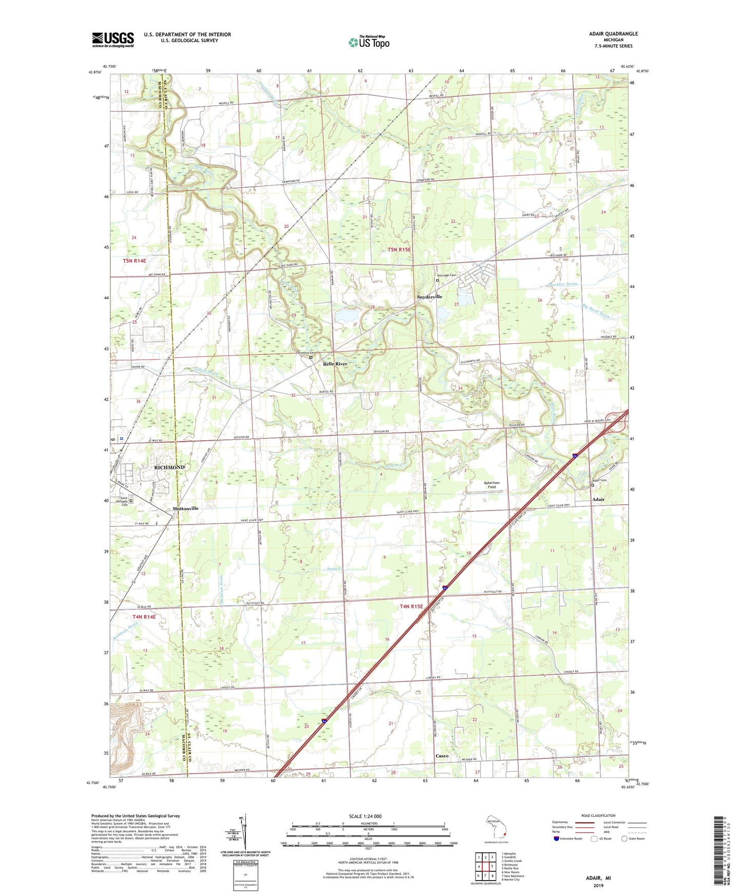
2019 topographic map quadrangle Adair in the state of Michigan. Scale: 1:24000. Based on the newly updated USGS 7.5' US Topo map series, this map is in the following counties: St. Clair, Macomb. The map contains contour data, water features, and other items you are used to seeing on USGS maps, but also has updated roads and other features. This is the next generation of topographic maps. Printed on high-quality waterproof paper with UV fade-resistant inks.
Quads adjacent to this one:
West: Richmond
Northwest: Memphis
North: Goodells
Northeast: Smiths Creek
East: Rattle Run
Southeast: Marine City
South: New Baltimore
Southwest: New Haven
Contains the following named places: Adair, Adair Airstrip, Adair Cemetery, Adair Post Office, Adair Rest Area, Adair Station, Belle River, Belle River Park, Big Hand Oil Field, Casco, Casco Post Office, Columbus Cemetery, Columbus Church, Columbus Gas Field, Dawson Drain, Gierk Park, Gillett Drain, Hessen Oil Field, Jerome Creek, Kittridge Cemetery, Michigan Meadows Golf Course, Muttonville, Muttonville Gas Field, Peters Oil Field, Puttygut Oil and Gas Field, Richmond Assembly of God Church, Richmond Police Department, Richmond Post Office, Robertson Field, Saint Augustine Church, Saint James' Cemetery, Saint James United Church of Christ, Saint Marys Camp, Saint Matthew United Church, Saint Michaels Cemetery, Saint Peter Lutheran Church, Saint Peter Lutheran School, Schriber Drain, Snyderville, Tinsman Drain, Township of Casco, Township of Columbus, West Columbus Gas Field, ZIP Codes: 48063, 48064